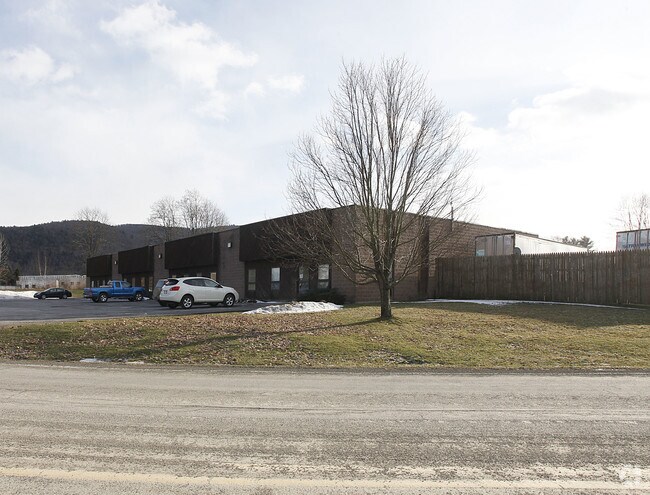
Property Record
139 Pony Farm Rd, Oneonta, NY 13820


NEARBY LISTINGS FOR SALE OR LEASE
Property Detail
139 Pony Farm Rd
364600-309-000-0001-001-001-0000
003INDUST PK FM 3025 0 4
Warehouse
Otsego
X
New York
36077C0653E
1.001
2025
1.82 AC
2024
Otsego County
590800
Albany/Schenectady/Troy
12,800 SF
Oneonta, NY
DEMOGRAPHICS near 139 Pony Farm Rd
1 Mile
3 Mile
5 Mile
2024 Total Population
915
13,497
22,699
2029 Population
904
13,449
22,637
Pop Growth 2024-2029
(1.20%)
(0.36%)
(0.27%)
Average Age
50
36
37
2024 Total Households
365
3,929
7,121
HH Growth 2024-2029
(1.92%)
(0.31%)
(0.49%)
Median Household Inc
$59,999
$53,705
$57,319
Avg Household Size
2.10
2.10
2.10
2024 Avg HH Vehicles
1.00
1.00
2.00
Median Home Value
$165,492
$170,150
$169,539
Median Year Built
1964
1949
1949
Nearby Places
Map Layers
Map Styles
 Street
 Aerial
- Restaurants
- Banks
- Shops
- Fitness
- Groceries
Nearby Properties
Address
Land Use
TOTAL SIZE
Lot Size
Zoning
Address
Land Use
TOTAL SIZE
Lot Size
Zoning
10,927 SF
142.34 AC
610
Address
Land Use
TOTAL SIZE
Lot Size
Zoning
126,759 SF
0.97 AC
610
Address
Land Use
TOTAL SIZE
Lot Size
Zoning
8,400 SF
65.53 AC
510
Address
Land Use
TOTAL SIZE
Lot Size
Zoning
42,000 SF
2.06 AC
230
Address
Land Use
TOTAL SIZE
Lot Size
Zoning
113.33 AC
520
Address
Land Use
TOTAL SIZE
Lot Size
Zoning
83,256 SF
1.30 AC
620
Address
Land Use
TOTAL SIZE
Lot Size
Zoning
7,980 SF
63.84 AC
01
Address
Land Use
TOTAL SIZE
Lot Size
Zoning
64,072 SF
1.53 AC
330
Address
Land Use
TOTAL SIZE
Lot Size
Zoning
55,648 SF
9.90 AC
Address
Land Use
TOTAL SIZE
Lot Size
Zoning
83,384 SF
10.45 AC
Address
Land Use
TOTAL SIZE
Lot Size
Zoning
73,580 SF
0.51 AC
310
Address
Land Use
TOTAL SIZE
Lot Size
Zoning
39,872 SF
4.10 AC
230
Address
Land Use
TOTAL SIZE
Lot Size
Zoning
49,047 SF
11.37 AC
01
Address
Land Use
TOTAL SIZE
Lot Size
Zoning
50,000 SF
16.41 AC
120
Address
Land Use
TOTAL SIZE
Lot Size
Zoning
37,536 SF
10.36 AC
620
Address
Land Use
TOTAL SIZE
Lot Size
Zoning
6,528 SF
8.64 AC
Address
Land Use
TOTAL SIZE
Lot Size
Zoning
33,454 SF
1.55 AC
340
Address
Land Use
TOTAL SIZE
Lot Size
Zoning
101,435 SF
18.72 AC
230
Address
Land Use
TOTAL SIZE
Lot Size
Zoning
44,500 SF
2.04 AC
352
Address
Land Use
TOTAL SIZE
Lot Size
Zoning
41,041 SF
16.44 AC
01
Address
Land Use
TOTAL SIZE
Lot Size
Zoning
61,316 SF
0.82 AC
310
Address
Land Use
TOTAL SIZE
Lot Size
Zoning
36,704 SF
1.74 AC
120
Address
Land Use
TOTAL SIZE
Lot Size
Zoning
11,716 SF
2.46 AC
420
Address
Land Use
TOTAL SIZE
Lot Size
Zoning
18,792 SF
0.63 AC
340
Address
Land Use
TOTAL SIZE
Lot Size
Zoning
12,000 SF
2.70 AC
420
Address
Land Use
TOTAL SIZE
Lot Size
Zoning
6,272 SF
14.45 AC
Address
Land Use
TOTAL SIZE
Lot Size
Zoning
33,360 SF
0.39 AC
130
Address
Land Use
TOTAL SIZE
Lot Size
Zoning
35,156 SF
0.72 AC
340
Address
Land Use
TOTAL SIZE
Lot Size
Zoning
960 SF
13.66 AC
Address
Land Use
TOTAL SIZE
Lot Size
Zoning
27,568 SF
1.88 AC
150
The World's #1 Commercial Real Estate Marketplace
Connect with us
© 2026 CoStar Group
The information above has been obtained from sources believed reliable. While we do not doubt its accuracy we have not verified it and make no guarantee, warranty or representation about it. It is your responsibility to independently confirm its accuracy and completeness. Any projections, opinions, assumptions, or estimates used are for example only and do not represent the current or future performance of the property. The value of this transaction to you depends on tax and other factors which should be evaluated by your tax, financial, and legal advisors. You and your advisors should conduct a careful, independent investigation of the property to determine to your satisfaction the suitability of the property for your needs.