Property Record
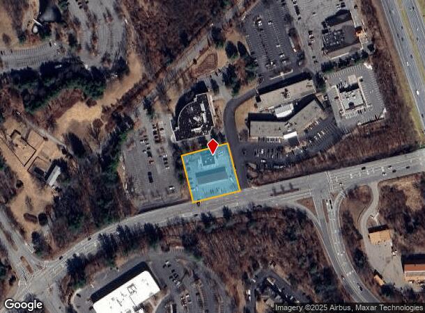
139 River Rd, Andover, MA 01810


NEARBY LISTINGS FOR SALE OR LEASE
Property Detail
139 River Rd
ANDO-000165-000001-C000000
Plan Land
Servicestation
Essex
X
Massachusetts
25009C0204G
c
2024
0.92 AC
2024
Lawrence/Andover
254402
Boston
2,430 SF
Boston-Cambridge-Newton, MA-NH
DEMOGRAPHICS near 139 River Rd
1 Mile
3 Mile
5 Mile
2024 Total Population
3,527
89,032
198,478
2029 Population
3,523
87,141
195,863
Pop Growth 2024-2029
(0.11%)
(2.12%)
(1.32%)
Average Age
41
38
39
2024 Total Households
1,389
30,663
69,689
HH Growth 2024-2029
(0.29%)
(2.04%)
(1.26%)
Median Household Inc
$96,874
$61,940
$78,869
Avg Household Size
2.50
2.80
2.70
2024 Avg HH Vehicles
2.00
2.00
2.00
Median Home Value
$614,463
$440,373
$460,489
Median Year Built
1984
1957
1963
Nearby Places
Map Layers
Map Styles
 Street
 Aerial
- Restaurants
- Banks
- Shops
- Fitness
- Groceries
PUBLIC TRANSPORTATION
COMMUTER RAIL
Lawrence (Haverhill Line - Massachusetts Bay Transportation Authority Commuter Rail (Purple Line))
DRIVE
WALK
Distance
Lawrence (Haverhill Line - Massachusetts Bay Transportation Authority Commuter Rail (Purple Line))
8 min
3.7 mi
Andover (Haverhill Line - Massachusetts Bay Transportation Authority Commuter Rail (Purple Line))
DRIVE
WALK
Distance
Andover (Haverhill Line - Massachusetts Bay Transportation Authority Commuter Rail (Purple Line))
10 min
5.1 mi
AIRPORT
Manchester Boston Regional
DRIVE
WALK
Distance
Manchester Boston Regional
40 min
26.1 mi
General Edward Lawrence Logan International
DRIVE
WALK
Distance
General Edward Lawrence Logan International
37 min
27.7 mi
Portsmouth International at Pease
DRIVE
WALK
Distance
Portsmouth International at Pease
55 min
41.2 mi
Nearby Properties
Address
Land Use
TOTAL SIZE
Lot Size
Zoning
Address
Land Use
TOTAL SIZE
Lot Size
Zoning
52.02 AC
ID
Address
Land Use
TOTAL SIZE
Lot Size
Zoning
309.16 AC
ID2
Address
Land Use
TOTAL SIZE
Lot Size
Zoning
335,482 SF
7.61 AC
Address
Land Use
TOTAL SIZE
Lot Size
Zoning
240,639 SF
2.65 AC
Address
Land Use
TOTAL SIZE
Lot Size
Zoning
144.01 AC
ID
Address
Land Use
TOTAL SIZE
Lot Size
Zoning
382,753 SF
25.86 AC
ID2
Address
Land Use
TOTAL SIZE
Lot Size
Zoning
90.21 AC
IA
Address
Land Use
TOTAL SIZE
Lot Size
Zoning
237,705 SF
33.49 AC
ID
Address
Land Use
TOTAL SIZE
Lot Size
Zoning
96.66 AC
ID
Address
Land Use
TOTAL SIZE
Lot Size
Zoning
210,192 SF
15.06 AC
CN
Address
Land Use
TOTAL SIZE
Lot Size
Zoning
152,040 SF
9.10 AC
SRC
Address
Land Use
TOTAL SIZE
Lot Size
Zoning
196,152 SF
20.20 AC
ID2
Address
Land Use
TOTAL SIZE
Lot Size
Zoning
Address
Land Use
TOTAL SIZE
Lot Size
Zoning
6.84 AC
Address
Land Use
TOTAL SIZE
Lot Size
Zoning
185,046 SF
3.06 AC
Address
Land Use
TOTAL SIZE
Lot Size
Zoning
2,552 SF
14.23 AC
Address
Land Use
TOTAL SIZE
Lot Size
Zoning
205,305 SF
1.94 AC
Address
Land Use
TOTAL SIZE
Lot Size
Zoning
124,750 SF
1.53 AC
Address
Land Use
TOTAL SIZE
Lot Size
Zoning
3,462 SF
8.14 AC
Address
Land Use
TOTAL SIZE
Lot Size
Zoning
130.08 AC
ID2
Address
Land Use
TOTAL SIZE
Lot Size
Zoning
2.52 AC
Address
Land Use
TOTAL SIZE
Lot Size
Zoning
105,949 SF
28.24 AC
ID2
Address
Land Use
TOTAL SIZE
Lot Size
Zoning
162,978 SF
13.73 AC
ID2
Address
Land Use
TOTAL SIZE
Lot Size
Zoning
150,292 SF
22.77 AC
ID2
Address
Land Use
TOTAL SIZE
Lot Size
Zoning
234,000 SF
17.55 AC
IL
Address
Land Use
TOTAL SIZE
Lot Size
Zoning
27.15 AC
ID
Address
Land Use
TOTAL SIZE
Lot Size
Zoning
26.60 AC
Address
Land Use
TOTAL SIZE
Lot Size
Zoning
322,858 SF
15.97 AC
ID
Address
Land Use
TOTAL SIZE
Lot Size
Zoning
10,614 SF
6.67 AC
Address
Land Use
TOTAL SIZE
Lot Size
Zoning
3.44 AC
The World's #1 Commercial Real Estate Marketplace
Connect with us
© 2026 CoStar Group
The information above has been obtained from sources believed reliable. While we do not doubt its accuracy we have not verified it and make no guarantee, warranty or representation about it. It is your responsibility to independently confirm its accuracy and completeness. Any projections, opinions, assumptions, or estimates used are for example only and do not represent the current or future performance of the property. The value of this transaction to you depends on tax and other factors which should be evaluated by your tax, financial, and legal advisors. You and your advisors should conduct a careful, independent investigation of the property to determine to your satisfaction the suitability of the property for your needs.