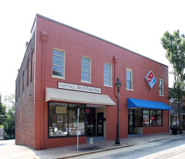
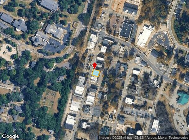
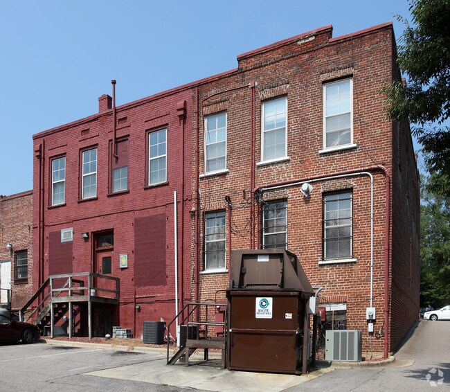
Property Record
139 S White St, Wake Forest, NC 27587
NEARBY LISTINGS FOR SALE OR LEASE
Property Detail
139 S White St
Raleigh, NC
Larry Robbins
1841.19-51-1323-000
LO1 & STORE WHITE ST & JONES BLDON
Storesoffices
Wake
X
North Carolina
3720184100K
1
2025
0.09 AC
2025
Route 1
054224
Raleigh/Durham
7,080 SF
DEMOGRAPHICS near 139 S White St
1 Mile
3 Mile
5 Mile
2024 Total Population
8,103
55,254
99,529
2029 Population
8,874
60,968
110,319
Pop Growth 2024-2029
+ 9.51%
+ 10.34%
+ 10.84%
Average Age
39
39
39
2024 Total Households
3,081
20,314
36,054
HH Growth 2024-2029
+ 9.61%
+ 10.32%
+ 10.84%
Median Household Inc
$70,339
$106,116
$111,952
Avg Household Size
2.50
2.70
2.70
2024 Avg HH Vehicles
2.00
2.00
2.00
Median Home Value
$323,874
$379,368
$390,960
Median Year Built
1997
2006
2005
Nearby Places
Map Layers
Map Styles
 Street
 Aerial
- Restaurants
- Banks
- Shops
- Fitness
- Groceries
PUBLIC TRANSPORTATION
AIRPORT
Raleigh-Durham International
DRIVE
WALK
Distance
Raleigh-Durham International
33 min
22.1 mi
Freight Ports
Virginia Port Authority - Richmond
DRIVE
WALK
Distance
Virginia Port Authority - Richmond
160 min
133.7 mi
Nearby Properties
Address
Land Use
TOTAL SIZE
Lot Size
Zoning
Address
Land Use
TOTAL SIZE
Lot Size
Zoning
378,421 SF
19.06 AC
RMX
Address
Land Use
TOTAL SIZE
Lot Size
Zoning
283,870 SF
11.39 AC
RMX
Address
Land Use
TOTAL SIZE
Lot Size
Zoning
362,583 SF
26.53 AC
RX-3
Address
Land Use
TOTAL SIZE
Lot Size
Zoning
356,168 SF
26.68 AC
RMX
Address
Land Use
TOTAL SIZE
Lot Size
Zoning
442,480 SF
52.02 AC
GR3
Address
Land Use
TOTAL SIZE
Lot Size
Zoning
306,712 SF
14.03 AC
PUD
Address
Land Use
TOTAL SIZE
Lot Size
Zoning
263,777 SF
93.84 AC
GR3
Address
Land Use
TOTAL SIZE
Lot Size
Zoning
286,520 SF
22.55 AC
R-6
Address
Land Use
TOTAL SIZE
Lot Size
Zoning
232,734 SF
57.28 AC
GR3
Address
Land Use
TOTAL SIZE
Lot Size
Zoning
306,050 SF
30.45 AC
GR10
Address
Land Use
TOTAL SIZE
Lot Size
Zoning
194,593 SF
13.09 AC
CX-3
Address
Land Use
TOTAL SIZE
Lot Size
Zoning
188,828 SF
19.91 AC
OX-3
Address
Land Use
TOTAL SIZE
Lot Size
Zoning
243,797 SF
22.57 AC
GR10
Address
Land Use
TOTAL SIZE
Lot Size
Zoning
248,945 SF
16.41 AC
GR10
Address
Land Use
TOTAL SIZE
Lot Size
Zoning
225,390 SF
14.95 AC
GR10
Address
Land Use
TOTAL SIZE
Lot Size
Zoning
283,795 SF
31.33 AC
ICD
Address
Land Use
TOTAL SIZE
Lot Size
Zoning
159,584 SF
67.12 AC
FCO GB
Address
Land Use
TOTAL SIZE
Lot Size
Zoning
162,909 SF
9.84 AC
RMX
Address
Land Use
TOTAL SIZE
Lot Size
Zoning
136,644 SF
4.38 AC
RMX
Address
Land Use
TOTAL SIZE
Lot Size
Zoning
186,546 SF
6.84 AC
RMX
Address
Land Use
TOTAL SIZE
Lot Size
Zoning
166,192 SF
13.59 AC
GR10
Address
Land Use
TOTAL SIZE
Lot Size
Zoning
143,060 SF
7.19 AC
RMX
Address
Land Use
TOTAL SIZE
Lot Size
Zoning
109,190 SF
1.46 AC
CX-5
Address
Land Use
TOTAL SIZE
Lot Size
Zoning
170,334 SF
23.99 AC
GR10
Address
Land Use
TOTAL SIZE
Lot Size
Zoning
154,602 SF
40 AC
ICD
Address
Land Use
TOTAL SIZE
Lot Size
Zoning
137,650 SF
36.63 AC
GR5
Address
Land Use
TOTAL SIZE
Lot Size
Zoning
84,528 SF
14.44 AC
NB
Address
Land Use
TOTAL SIZE
Lot Size
Zoning
97,878 SF
26.85 AC
GR5
Address
Land Use
TOTAL SIZE
Lot Size
Zoning
135,289 SF
12.09 AC
GR10
Address
Land Use
TOTAL SIZE
Lot Size
Zoning
111,616 SF
4.69 AC
NMX
The World's #1 Commercial Real Estate Marketplace
Connect with us
© 2025 CoStar Group
The information above has been obtained from sources believed reliable. While we do not doubt its accuracy we have not verified it and make no guarantee, warranty or representation about it. It is your responsibility to independently confirm its accuracy and completeness. Any projections, opinions, assumptions, or estimates used are for example only and do not represent the current or future performance of the property. The value of this transaction to you depends on tax and other factors which should be evaluated by your tax, financial, and legal advisors. You and your advisors should conduct a careful, independent investigation of the property to determine to your satisfaction the suitability of the property for your needs.