Property Record
13905 Crayton Blvd, Hagerstown, MD 21742


NEARBY LISTINGS FOR SALE OR LEASE
Property Detail
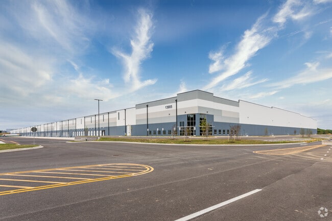
13905 Crayton Blvd
Hagerstown-Martinsburg, MD-WV
Perini Industrial Land Llc
27-014488
LOT 2 83.26 ACRES 13905 CRAYTON BLVD W/S PENNSYLVANIA AVE
Warehouse
Washington
X
Maryland
24043C0128D
2
2024
83.26 AC
2025
Washington County
010300
Washington, DC
1,190,700 SF
DEMOGRAPHICS near 13905 Crayton Blvd
1 Mile
3 Mile
5 Mile
2024 Total Population
3,771
26,083
69,855
2029 Population
3,769
26,284
70,710
Pop Growth 2024-2029
(0.05%)
+ 0.77%
+ 1.22%
Average Age
39
41
40
2024 Total Households
1,430
10,175
27,638
HH Growth 2024-2029
(0.07%)
+ 0.86%
+ 1.27%
Median Household Inc
$68,396
$73,848
$54,689
Avg Household Size
2.60
2.50
2.40
2024 Avg HH Vehicles
2.00
2.00
2.00
Median Home Value
$235,821
$262,708
$214,395
Median Year Built
1981
1979
1967
Nearby Places
Map Layers
Map Styles
 Street
 Aerial
- Restaurants
- Banks
- Shops
- Fitness
- Groceries
PUBLIC TRANSPORTATION
AIRPORT
Hagerstown Regional/Richard A Henson Field
DRIVE
WALK
Distance
Hagerstown Regional/Richard A Henson Field
4 min
0.6 mi
Freight Ports
Port of Baltimore
DRIVE
WALK
Distance
Port of Baltimore
102 min
81.8 mi
SALE & LEASE HISTORY
LISTING DATE
SALE/LEASE

Oct 18, 2018
For Lease
Feb 09, 2017
For Lease
Feb 06, 2017
For Lease
Feb 06, 2017
For Sale
Nearby Properties
Address
Land Use
TOTAL SIZE
Lot Size
Zoning
Address
Land Use
TOTAL SIZE
Lot Size
Zoning
23,941 SF
401.89 AC
U
Address
Land Use
TOTAL SIZE
Lot Size
Zoning
801,000 SF
86.86 AC
HI
Address
Land Use
TOTAL SIZE
Lot Size
Zoning
36,685 SF
281.72 AC
IG
Address
Land Use
TOTAL SIZE
Lot Size
Zoning
216 SF
52.93 AC
RH
Address
Land Use
TOTAL SIZE
Lot Size
Zoning
151,660 SF
56.24 AC
RMOD
Address
Land Use
TOTAL SIZE
Lot Size
Zoning
127,315 SF
26.65 AC
RMOD
Address
Land Use
TOTAL SIZE
Lot Size
Zoning
76,740 SF
16.01 AC
CG
Address
Land Use
TOTAL SIZE
Lot Size
Zoning
6,778 SF
8.24 AC
RH
Address
Land Use
TOTAL SIZE
Lot Size
Zoning
91,586 SF
28.49 AC
U
Address
Land Use
TOTAL SIZE
Lot Size
Zoning
5,090 SF
25.27 AC
RMOD
Address
Land Use
TOTAL SIZE
Lot Size
Zoning
23,086 SF
19.36 AC
CR
Address
Land Use
TOTAL SIZE
Lot Size
Zoning
150,000 SF
22.73 AC
HI
Address
Land Use
TOTAL SIZE
Lot Size
Zoning
3,159 SF
14.99 AC
CR
Address
Land Use
TOTAL SIZE
Lot Size
Zoning
764,619 SF
31.10 AC
IG
Address
Land Use
TOTAL SIZE
Lot Size
Zoning
35,402 SF
10.18 AC
BG
Address
Land Use
TOTAL SIZE
Lot Size
Zoning
79,084 SF
12.50 AC
RMOD
Address
Land Use
TOTAL SIZE
Lot Size
Zoning
84,796 SF
8.81 AC
PB
Address
Land Use
TOTAL SIZE
Lot Size
Zoning
78,042 SF
11 AC
RB-E
Address
Land Use
TOTAL SIZE
Lot Size
Zoning
51,773 SF
11.96 AC
HI
Address
Land Use
TOTAL SIZE
Lot Size
Zoning
36,000 SF
12.07 AC
RM
Address
Land Use
TOTAL SIZE
Lot Size
Zoning
188,784 SF
79.06 AC
AP
Address
Land Use
TOTAL SIZE
Lot Size
Zoning
351,104 SF
55.68 AC
AP
Address
Land Use
TOTAL SIZE
Lot Size
Zoning
6,300 SF
35.92 AC
RT
Address
Land Use
TOTAL SIZE
Lot Size
Zoning
139,403 SF
15.06 AC
CR
Address
Land Use
TOTAL SIZE
Lot Size
Zoning
102,782 SF
12.92 AC
RMOD
Address
Land Use
TOTAL SIZE
Lot Size
Zoning
12,908 SF
12.94 AC
HI
Address
Land Use
TOTAL SIZE
Lot Size
Zoning
287,625 SF
19.69 AC
IG
Address
Land Use
TOTAL SIZE
Lot Size
Zoning
20,312 SF
17.59 AC
U
Address
Land Use
TOTAL SIZE
Lot Size
Zoning
21,483 SF
3.51 AC
HI
The World's #1 Commercial Real Estate Marketplace
Connect with us
© 2025 CoStar Group
The information above has been obtained from sources believed reliable. While we do not doubt its accuracy we have not verified it and make no guarantee, warranty or representation about it. It is your responsibility to independently confirm its accuracy and completeness. Any projections, opinions, assumptions, or estimates used are for example only and do not represent the current or future performance of the property. The value of this transaction to you depends on tax and other factors which should be evaluated by your tax, financial, and legal advisors. You and your advisors should conduct a careful, independent investigation of the property to determine to your satisfaction the suitability of the property for your needs.