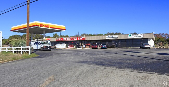
Property Record
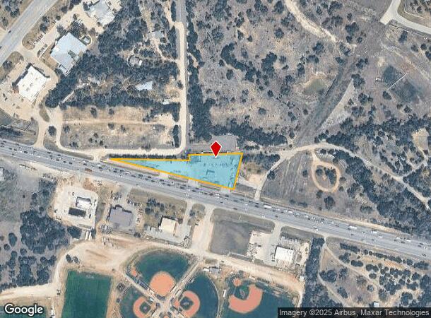
13908 W Highway 71, Austin, TX 78738
NEARBY LISTINGS FOR SALE OR LEASE
Property Detail
13908 W Highway 71
Austin-Round Rock, TX
H S T Subd
119029
LOT 1 H S T SUBD RESUB OF LOT 1
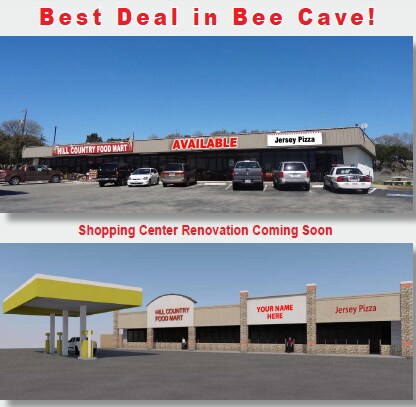
Stripcommercialcenter
Travis
X
Texas
48453C0415J
1
2024
1.14 AC
2025
Southwest
037000
Austin
5,000 SF
DEMOGRAPHICS near 13908 W Highway 71
1 Mile
3 Mile
5 Mile
2024 Total Population
2,923
22,449
58,579
2029 Population
3,114
24,222
63,681
Pop Growth 2024-2029
+ 6.53%
+ 7.90%
+ 8.71%
Average Age
41
42
42
2024 Total Households
1,191
8,461
21,385
HH Growth 2024-2029
+ 7.14%
+ 8.53%
+ 9.29%
Median Household Inc
$132,255
$141,971
$161,951
Avg Household Size
2.40
2.60
2.70
2024 Avg HH Vehicles
2.00
2.00
2.00
Median Home Value
$747,167
$755,172
$736,159
Median Year Built
2010
2010
2007
Nearby Places
Map Layers
Map Styles
 Street
 Aerial
- Restaurants
- Banks
- Shops
- Fitness
- Groceries
PUBLIC TRANSPORTATION
AIRPORT
Austin-Bergstrom International
DRIVE
WALK
Distance
Austin-Bergstrom International
39 min
23.6 mi
SALE & LEASE HISTORY
LISTING DATE
SALE/LEASE

Jan 20, 2017
For Lease
Nearby Properties
Address
Land Use
TOTAL SIZE
Lot Size
Zoning
Address
Land Use
TOTAL SIZE
Lot Size
Zoning
826,410 SF
154.43 AC
Address
Land Use
TOTAL SIZE
Lot Size
Zoning
904,909 SF
39.39 AC
Address
Land Use
TOTAL SIZE
Lot Size
Zoning
554,062 SF
77.58 AC
Address
Land Use
TOTAL SIZE
Lot Size
Zoning
270,509 SF
8.84 AC
Address
Land Use
TOTAL SIZE
Lot Size
Zoning
329,638 SF
40.10 AC
Address
Land Use
TOTAL SIZE
Lot Size
Zoning
375,383 SF
34.13 AC
Address
Land Use
TOTAL SIZE
Lot Size
Zoning
390.72 AC
Address
Land Use
TOTAL SIZE
Lot Size
Zoning
293,295 SF
9.54 AC
Address
Land Use
TOTAL SIZE
Lot Size
Zoning
267,540 SF
17.53 AC
Address
Land Use
TOTAL SIZE
Lot Size
Zoning
4,580 SF
213 AC
Address
Land Use
TOTAL SIZE
Lot Size
Zoning
278,823 SF
19.52 AC
Address
Land Use
TOTAL SIZE
Lot Size
Zoning
115,358 SF
21.04 AC
Address
Land Use
TOTAL SIZE
Lot Size
Zoning
8,711 SF
16.94 AC
Address
Land Use
TOTAL SIZE
Lot Size
Zoning
209,936 SF
5.79 AC
Address
Land Use
TOTAL SIZE
Lot Size
Zoning
267,877 SF
16.14 AC
Address
Land Use
TOTAL SIZE
Lot Size
Zoning
59,882 SF
12.04 AC
Address
Land Use
TOTAL SIZE
Lot Size
Zoning
91,140 SF
16.47 AC
Address
Land Use
TOTAL SIZE
Lot Size
Zoning
157,030 SF
8.91 AC
Address
Land Use
TOTAL SIZE
Lot Size
Zoning
119,164 SF
23.21 AC
Address
Land Use
TOTAL SIZE
Lot Size
Zoning
131,175 SF
36.46 AC
Address
Land Use
TOTAL SIZE
Lot Size
Zoning
150,000 SF
13.52 AC
Address
Land Use
TOTAL SIZE
Lot Size
Zoning
265,650 SF
12.15 AC
Address
Land Use
TOTAL SIZE
Lot Size
Zoning
Address
Land Use
TOTAL SIZE
Lot Size
Zoning
121.82 AC
Address
Land Use
TOTAL SIZE
Lot Size
Zoning
110,000 SF
8.37 AC
Address
Land Use
TOTAL SIZE
Lot Size
Zoning
132,793 SF
2.76 AC
Address
Land Use
TOTAL SIZE
Lot Size
Zoning
4,580 SF
171.59 AC
Address
Land Use
TOTAL SIZE
Lot Size
Zoning
55,468 SF
Address
Land Use
TOTAL SIZE
Lot Size
Zoning
104,303 SF
15.45 AC
Address
Land Use
TOTAL SIZE
Lot Size
Zoning
131,175 SF
32.21 AC
The World's #1 Commercial Real Estate Marketplace
Connect with us
© 2025 CoStar Group
The information above has been obtained from sources believed reliable. While we do not doubt its accuracy we have not verified it and make no guarantee, warranty or representation about it. It is your responsibility to independently confirm its accuracy and completeness. Any projections, opinions, assumptions, or estimates used are for example only and do not represent the current or future performance of the property. The value of this transaction to you depends on tax and other factors which should be evaluated by your tax, financial, and legal advisors. You and your advisors should conduct a careful, independent investigation of the property to determine to your satisfaction the suitability of the property for your needs.