Property Record
13915 N Dysart Rd, El Mirage, AZ 85335

NEARBY LISTINGS FOR SALE OR LEASE
Property Detail
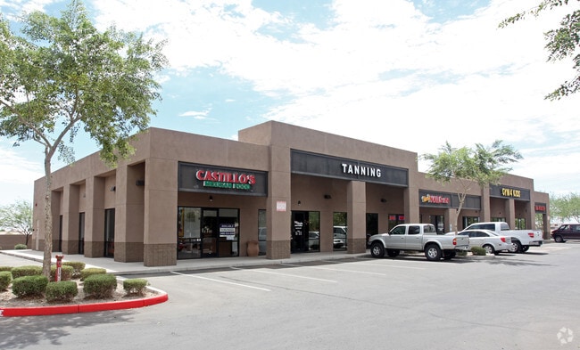
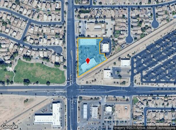
13915 N Dysart Rd
Phoenix-Mesa-Scottsdale, AZ
Rancho El Mirage Plaza
501-33-979
RANCHO EL MIRAGE PLAZA MCR 837-01
Storebuilding
Maricopa
X
Arizona
04013C1680L
1
2025
2.26 AC
2025
Sun City
060901
Phoenix
20,640 SF
DEMOGRAPHICS near 13915 N Dysart Rd
1 Mile
3 Mile
5 Mile
2024 Total Population
19,185
102,818
216,851
2029 Population
20,625
111,388
235,453
Pop Growth 2024-2029
+ 7.51%
+ 8.34%
+ 8.58%
Average Age
35
40
48
2024 Total Households
5,786
36,240
91,332
HH Growth 2024-2029
+ 7.54%
+ 8.53%
+ 8.83%
Median Household Inc
$73,276
$67,772
$63,779
Avg Household Size
3.30
2.80
2.30
2024 Avg HH Vehicles
2.00
2.00
2.00
Median Home Value
$285,157
$289,126
$293,848
Median Year Built
2004
2001
1993
Nearby Places
Map Layers
Map Styles
 Street
 Aerial
- Restaurants
- Banks
- Shops
- Fitness
- Groceries
PUBLIC TRANSPORTATION
AIRPORT
Phoenix Sky Harbor International
DRIVE
WALK
Distance
Phoenix Sky Harbor International
44 min
32.1 mi
Freight Ports
Port of San Diego
DRIVE
WALK
Distance
Port of San Diego
391 min
348.8 mi
SALE & LEASE HISTORY
LISTING DATE
SALE/LEASE

Jun 04, 2018
For Lease
Dec 22, 2023
For Lease
Aug 08, 2019
For Lease
Nearby Properties
Address
Land Use
TOTAL SIZE
Lot Size
Zoning
Address
Land Use
TOTAL SIZE
Lot Size
Zoning
290,294 SF
61.52 AC
PAD
Address
Land Use
TOTAL SIZE
Lot Size
Zoning
35.74 AC
Address
Land Use
TOTAL SIZE
Lot Size
Zoning
53.02 AC
Address
Land Use
TOTAL SIZE
Lot Size
Zoning
16,341 SF
174.45 AC
R-43
Address
Land Use
TOTAL SIZE
Lot Size
Zoning
575,121 SF
73.01 AC
PAD
Address
Land Use
TOTAL SIZE
Lot Size
Zoning
197,699 SF
40.78 AC
PAD
Address
Land Use
TOTAL SIZE
Lot Size
Zoning
294,360 SF
21.69 AC
EI
Address
Land Use
TOTAL SIZE
Lot Size
Zoning
225,457 SF
70.07 AC
PAD
Address
Land Use
TOTAL SIZE
Lot Size
Zoning
20,948 SF
2.39 AC
R-6
Address
Land Use
TOTAL SIZE
Lot Size
Zoning
67,417 SF
12.16 AC
PAD
Address
Land Use
TOTAL SIZE
Lot Size
Zoning
418,305 SF
24.06 AC
PAD
Address
Land Use
TOTAL SIZE
Lot Size
Zoning
333,066 SF
16.33 AC
PAD
Address
Land Use
TOTAL SIZE
Lot Size
Zoning
38,400 SF
4.97 AC
I-2
Address
Land Use
TOTAL SIZE
Lot Size
Zoning
247,178 SF
33.92 AC
PAD
Address
Land Use
TOTAL SIZE
Lot Size
Zoning
106,356 SF
14.16 AC
PAD
Address
Land Use
TOTAL SIZE
Lot Size
Zoning
90,636 SF
13.27 AC
PAD
Address
Land Use
TOTAL SIZE
Lot Size
Zoning
106,244 SF
13.55 AC
PAD
Address
Land Use
TOTAL SIZE
Lot Size
Zoning
236,026 SF
6.66 AC
PAD
Address
Land Use
TOTAL SIZE
Lot Size
Zoning
77,400 SF
20.34 AC
PAD
Address
Land Use
TOTAL SIZE
Lot Size
Zoning
145,491 SF
37.61 AC
PAD
Address
Land Use
TOTAL SIZE
Lot Size
Zoning
104,619 SF
11.45 AC
PAD
Address
Land Use
TOTAL SIZE
Lot Size
Zoning
707,380 SF
46.26 AC
I-2
Address
Land Use
TOTAL SIZE
Lot Size
Zoning
67,932 SF
14.90 AC
PAD
Address
Land Use
TOTAL SIZE
Lot Size
Zoning
199,390 SF
24.59 AC
C-C
Address
Land Use
TOTAL SIZE
Lot Size
Zoning
89,601 SF
19.92 AC
PAD
Address
Land Use
TOTAL SIZE
Lot Size
Zoning
65,749 SF
14.58 AC
PAD
Address
Land Use
TOTAL SIZE
Lot Size
Zoning
270,000 SF
16.26 AC
PAD
Address
Land Use
TOTAL SIZE
Lot Size
Zoning
65,711 SF
8.62 AC
PAD
Address
Land Use
TOTAL SIZE
Lot Size
Zoning
153,525 SF
14.48 AC
PAD
Address
Land Use
TOTAL SIZE
Lot Size
Zoning
112,957 SF
17.40 AC
PAD
The World's #1 Commercial Real Estate Marketplace
Connect with us
© 2025 CoStar Group
The information above has been obtained from sources believed reliable. While we do not doubt its accuracy we have not verified it and make no guarantee, warranty or representation about it. It is your responsibility to independently confirm its accuracy and completeness. Any projections, opinions, assumptions, or estimates used are for example only and do not represent the current or future performance of the property. The value of this transaction to you depends on tax and other factors which should be evaluated by your tax, financial, and legal advisors. You and your advisors should conduct a careful, independent investigation of the property to determine to your satisfaction the suitability of the property for your needs.