Property Record
1395 Collier Rd, Akron, OH 44320
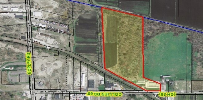

Property Detail
1395 Collier Rd
Akron, OH
WPP LOT 16 E OF COLLIER RD 1.20AC FARM DIST
67-57861
Summit
Farms
Ohio
2023
16
2025
1.20 AC
508800
Akron
783 SF
Cleveland
NEARBY LISTINGS FOR SALE OR LEASE
DEMOGRAPHICS near 1395 Collier Rd
1 mile
3 mile
5 mile
2025 Total Population
4,490
65,481
174,023
2030 Population
4,523
65,651
174,612
Pop Growth 2025-2030
+ 0.73%
+ 0.26%
+ 0.34%
Average Age
42
41
40
2025 Total Households
2,023
29,823
75,154
HH Growth 2025-2030
+ 0.69%
+ 0.20%
+ 0.32%
Median Household Inc
$43,651
$48,484
$53,857
Avg Household Size
2.10
2.10
2.20
2025 Avg HH Vehicles
1.00
1.00
2.00
Median Home Value
$123,501
$145,148
$159,182
Median Year Built
1956
1953
1955
Nearby Places
Map Layers
Map Styles
 Street
 Aerial
Transit
 Traffic
 Biking
Places
Listings with unknown addresses are not visible on the map
- Restaurants
- Banks
- Shops
- Fitness
- Groceries
PUBLIC TRANSPORTATION
COMMUTER RAIL
Drive
Walk
Distance
11 min
4.7 mi
Drive
Walk
Distance
15 min
6.2 mi
AIRPORT
Akron-Canton Regional
Drive
Walk
Distance
Akron-Canton Regional
25 min
17.8 mi
Cleveland-Hopkins International
Drive
Walk
Distance
Cleveland-Hopkins International
52 min
37.3 mi
Nearby Properties
Address
Land Use
TOTAL SIZE
Lot Size
Zoning
Address
Land Use
TOTAL SIZE
Lot Size
Zoning
1,397,532 SF
92.95 AC
Address
Land Use
TOTAL SIZE
Lot Size
Zoning
282,490 SF
20.76 AC
Address
Land Use
TOTAL SIZE
Lot Size
Zoning
472,380 SF
4.55 AC
Address
Land Use
TOTAL SIZE
Lot Size
Zoning
194,508 SF
30.87 AC
Address
Land Use
TOTAL SIZE
Lot Size
Zoning
92,152 SF
1.69 AC
Address
Land Use
TOTAL SIZE
Lot Size
Zoning
246,312 SF
17.50 AC
Address
Land Use
TOTAL SIZE
Lot Size
Zoning
231,968 SF
29.14 AC
Address
Land Use
TOTAL SIZE
Lot Size
Zoning
10 AC
Address
Land Use
TOTAL SIZE
Lot Size
Zoning
10.78 AC
Address
Land Use
TOTAL SIZE
Lot Size
Zoning
12.46 AC
Address
Land Use
TOTAL SIZE
Lot Size
Zoning
76,560 SF
6.07 AC
Address
Land Use
TOTAL SIZE
Lot Size
Zoning
184,791 SF
3.25 AC
Address
Land Use
TOTAL SIZE
Lot Size
Zoning
10.26 AC
Address
Land Use
TOTAL SIZE
Lot Size
Zoning
327,798 SF
116.80 AC
Address
Land Use
TOTAL SIZE
Lot Size
Zoning
123,800 SF
76.50 AC
Address
Land Use
TOTAL SIZE
Lot Size
Zoning
54,398 SF
8.10 AC
Address
Land Use
TOTAL SIZE
Lot Size
Zoning
58,639 SF
2.29 AC
Address
Land Use
TOTAL SIZE
Lot Size
Zoning
148.10 AC
Address
Land Use
TOTAL SIZE
Lot Size
Zoning
Address
Land Use
TOTAL SIZE
Lot Size
Zoning
209,183 SF
36.34 AC
Address
Land Use
TOTAL SIZE
Lot Size
Zoning
105,770 SF
16.40 AC
Address
Land Use
TOTAL SIZE
Lot Size
Zoning
104,861 SF
2.07 AC
Address
Land Use
TOTAL SIZE
Lot Size
Zoning
63,918 SF
4.95 AC
Address
Land Use
TOTAL SIZE
Lot Size
Zoning
28,920 SF
2.40 AC
Address
Land Use
TOTAL SIZE
Lot Size
Zoning
61,897 SF
2.75 AC
Address
Land Use
TOTAL SIZE
Lot Size
Zoning
51,977 SF
17.55 AC
Address
Land Use
TOTAL SIZE
Lot Size
Zoning
86,366 SF
5.37 AC
Address
Land Use
TOTAL SIZE
Lot Size
Zoning
156,574 SF
9.31 AC
Address
Land Use
TOTAL SIZE
Lot Size
Zoning
41,692 SF
3.15 AC
Address
Land Use
TOTAL SIZE
Lot Size
Zoning
113,321 SF
13.32 AC
The World's #1 Commercial Real Estate Marketplace
Connect with us
© 2026 CoStar Group
The information above has been obtained from sources believed reliable. While we do not doubt its accuracy we have not verified it and make no guarantee, warranty or representation about it. It is your responsibility to independently confirm its accuracy and completeness. Any projections, opinions, assumptions, or estimates used are for example only and do not represent the current or future performance of the property. The value of this transaction to you depends on tax and other factors which should be evaluated by your tax, financial, and legal advisors. You and your advisors should conduct a careful, independent investigation of the property to determine to your satisfaction the suitability of the property for your needs.