Property Record
1395 Two Mile Rd, Winchester, KY 40391


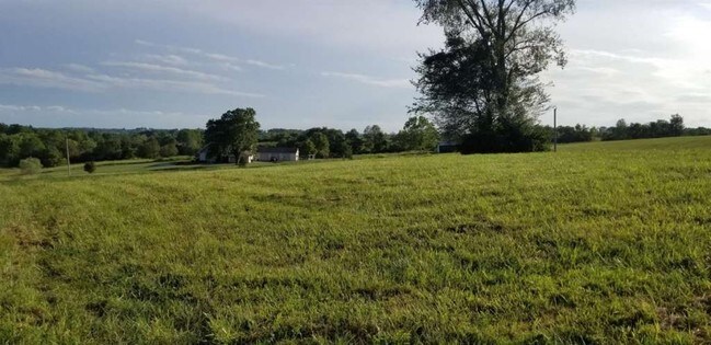
Property Detail
1395 Two Mile Rd
Lexington-Fayette, KY
PARCEL 10 PLAT 2106 AND PARCEL 8B PLAT 2084 AND LOT 61A PLAT 2183 AND PARCEL 1B IN DB 542-826
055-0000-00100
Clark
Farms
Kentucky
PD
61a
B and X Area of moderate flood hazard, usually the area between the limits of the 100-year and 500-year floods.
144.93 AC
2025
Clark County
2025
Lexington/Fayette
020105
NEARBY LISTINGS FOR SALE OR LEASE
DEMOGRAPHICS near 1395 Two Mile Rd
1 mile
3 mile
5 mile
2025 Total Population
2,411
26,752
29,996
2030 Population
2,479
27,396
30,749
Pop Growth 2025-2030
+ 2.82%
+ 2.41%
+ 2.51%
Average Age
40
40
41
2025 Total Households
970
11,010
12,251
HH Growth 2025-2030
+ 2.78%
+ 2.43%
+ 2.54%
Median Household Inc
$87,643
$65,202
$65,865
Avg Household Size
2.40
2.40
2.40
2025 Avg HH Vehicles
2.00
2.00
2.00
Median Home Value
$270,740
$199,241
$209,026
Median Year Built
1970
1979
1980
Nearby Places
Map Layers
Map Styles
 Street
 Aerial
Layers
 Traffic
 Biking
Places
Listings with unknown addresses are not visible on the map
- Restaurants
- Banks
- Shops
- Fitness
- Groceries
PUBLIC TRANSPORTATION
AIRPORT
Blue Grass
Drive
Walk
Distance
Blue Grass
43 min
30.7 mi
Freight Ports
Port of Toledo
Drive
Walk
Distance
Port of Toledo
352 min
303.9 mi
SALE & LEASE HISTORY
LISTING DATE
SALE/LEASE

Sep 17, 2019
For Sale
Nearby Properties
Address
Land Use
TOTAL SIZE
Lot Size
Zoning
Address
Land Use
TOTAL SIZE
Lot Size
Zoning
792 SF
5.71 AC
SINGLE FAM
Address
Land Use
TOTAL SIZE
Lot Size
Zoning
Address
Land Use
TOTAL SIZE
Lot Size
Zoning
Address
Land Use
TOTAL SIZE
Lot Size
Zoning
179,856 SF
20.42 AC
PLANNED DE
Address
Land Use
TOTAL SIZE
Lot Size
Zoning
6.65 AC
I1
Address
Land Use
TOTAL SIZE
Lot Size
Zoning
6.50 AC
PD
Address
Land Use
TOTAL SIZE
Lot Size
Zoning
0.98 AC
DOWNTOWN B
Address
Land Use
TOTAL SIZE
Lot Size
Zoning
24.23 AC
I1
Address
Land Use
TOTAL SIZE
Lot Size
Zoning
121,809 SF
19.44 AC
LIGHT INDU
Address
Land Use
TOTAL SIZE
Lot Size
Zoning
Address
Land Use
TOTAL SIZE
Lot Size
Zoning
76,440 SF
15.67 AC
PLANNED DE
Address
Land Use
TOTAL SIZE
Lot Size
Zoning
4.53 AC
Address
Land Use
TOTAL SIZE
Lot Size
Zoning
64,000 SF
8.45 AC
HIGHWAY BU
Address
Land Use
TOTAL SIZE
Lot Size
Zoning
3.15 AC
Address
Land Use
TOTAL SIZE
Lot Size
Zoning
60,060 SF
6.04 AC
HIGHWAY BU
Address
Land Use
TOTAL SIZE
Lot Size
Zoning
5.88 AC
PLANNED DE
Address
Land Use
TOTAL SIZE
Lot Size
Zoning
Address
Land Use
TOTAL SIZE
Lot Size
Zoning
69,834 SF
8.82 AC
PLANNED DE
Address
Land Use
TOTAL SIZE
Lot Size
Zoning
1.07 AC
PD
Address
Land Use
TOTAL SIZE
Lot Size
Zoning
1.21 AC
B3
Address
Land Use
TOTAL SIZE
Lot Size
Zoning
45,220 SF
5.03 AC
HIGHWAY BU
Address
Land Use
TOTAL SIZE
Lot Size
Zoning
1.90 AC
B3
Address
Land Use
TOTAL SIZE
Lot Size
Zoning
7.80 AC
R4
Address
Land Use
TOTAL SIZE
Lot Size
Zoning
150,042 SF
11.70 AC
HIGHWAY BU
Address
Land Use
TOTAL SIZE
Lot Size
Zoning
20 AC
MH
Address
Land Use
TOTAL SIZE
Lot Size
Zoning
5.20 AC
B3
Address
Land Use
TOTAL SIZE
Lot Size
Zoning
14,878 SF
1.86 AC
NEIGHBORHO
Address
Land Use
TOTAL SIZE
Lot Size
Zoning
19.91 AC
LIGHT INDU
Address
Land Use
TOTAL SIZE
Lot Size
Zoning
14.84 AC
I1
Address
Land Use
TOTAL SIZE
Lot Size
Zoning
14,440 SF
1.59 AC
PLANNED DE
The World's #1 Commercial Real Estate Marketplace
Connect with us
© 2026 CoStar Group
The information above has been obtained from sources believed reliable. While we do not doubt its accuracy we have not verified it and make no guarantee, warranty or representation about it. It is your responsibility to independently confirm its accuracy and completeness. Any projections, opinions, assumptions, or estimates used are for example only and do not represent the current or future performance of the property. The value of this transaction to you depends on tax and other factors which should be evaluated by your tax, financial, and legal advisors. You and your advisors should conduct a careful, independent investigation of the property to determine to your satisfaction the suitability of the property for your needs.