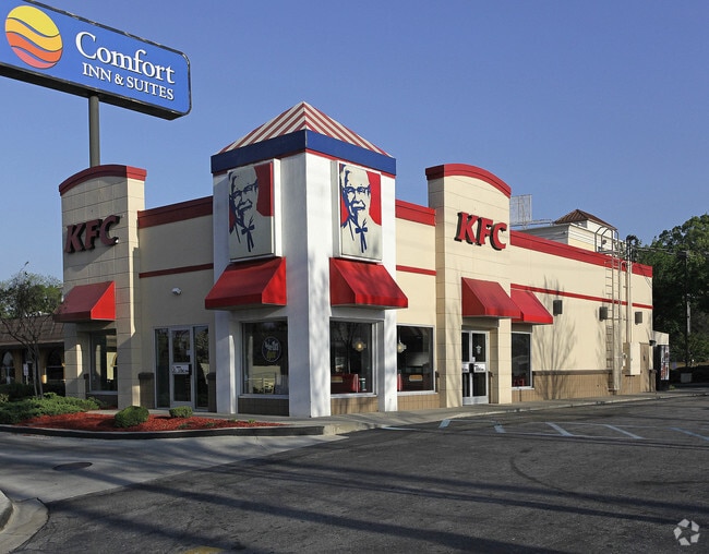
Property Record
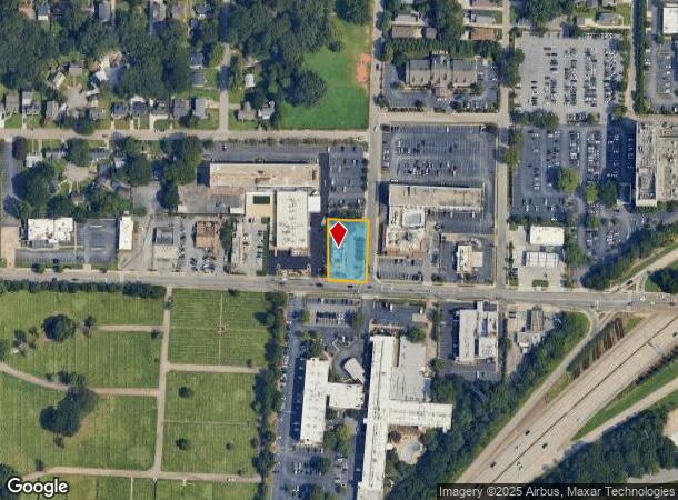
1395 Virginia Ave, Atlanta, GA 30344

NEARBY LISTINGS FOR SALE OR LEASE
Property Detail
1395 Virginia Ave
14-0130-LL-018-7
Fulton
Restaurantdrivein
Georgia
X
130
13121C0366F
0.45 AC
2024
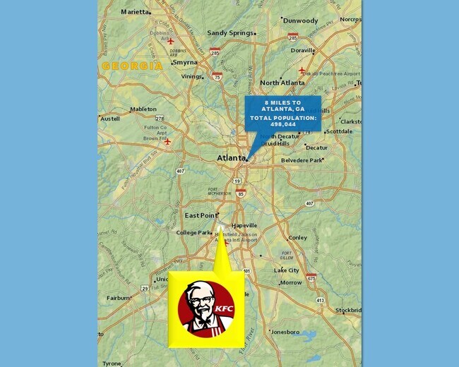
College Park/SW Atl
2025
Atlanta
012300
Atlanta-Sandy Springs-Roswell, GA
2,376 SF
DEMOGRAPHICS near 1395 Virginia Ave
1 Mile
3 Mile
5 Mile
2024 Total Population
4,758
53,515
184,622
2029 Population
4,952
55,649
190,595
Pop Growth 2024-2029
+ 4.08%
+ 3.99%
+ 3.24%
Average Age
41
39
37
2024 Total Households
2,220
22,168
75,912
HH Growth 2024-2029
+ 4.23%
+ 4.04%
+ 3.24%
Median Household Inc
$58,659
$50,748
$44,284
Avg Household Size
2.10
2.30
2.40
2024 Avg HH Vehicles
1.00
1.00
1.00
Median Home Value
$332,486
$225,497
$203,393
Median Year Built
1962
1966
1973
Nearby Places
Map Layers
Map Styles
 Street
 Aerial
- Restaurants
- Banks
- Shops
- Fitness
- Groceries
PUBLIC TRANSPORTATION
AIRPORT
Hartsfield - Jackson Atlanta International
DRIVE
WALK
Distance
Hartsfield - Jackson Atlanta International
9 min
3.8 mi
SALE & LEASE HISTORY
LISTING DATE
SALE/LEASE

Nov 06, 2018
For Lease
Feb 03, 2020
For Sale
Aug 28, 2019
For Sale
Nearby Properties
Address
Land Use
TOTAL SIZE
Lot Size
Zoning
Address
Land Use
TOTAL SIZE
Lot Size
Zoning
116,750 SF
997.24 AC
HI
Address
Land Use
TOTAL SIZE
Lot Size
Zoning
880,465 SF
130.34 AC
C
Address
Land Use
TOTAL SIZE
Lot Size
Zoning
63,992 SF
174.80 AC
HI
Address
Land Use
TOTAL SIZE
Lot Size
Zoning
200,000 SF
34.20 AC
HI
Address
Land Use
TOTAL SIZE
Lot Size
Zoning
318.25 AC
HI
Address
Land Use
TOTAL SIZE
Lot Size
Zoning
274.75 AC
HI
Address
Land Use
TOTAL SIZE
Lot Size
Zoning
28,000 SF
246.83 AC
I
Address
Land Use
TOTAL SIZE
Lot Size
Zoning
104.17 AC
C
Address
Land Use
TOTAL SIZE
Lot Size
Zoning
965,840 SF
1.50 AC
C
Address
Land Use
TOTAL SIZE
Lot Size
Zoning
2,666 SF
46.88 AC
BP
Address
Land Use
TOTAL SIZE
Lot Size
Zoning
229.84 AC
HI
Address
Land Use
TOTAL SIZE
Lot Size
Zoning
198.66 AC
I
Address
Land Use
TOTAL SIZE
Lot Size
Zoning
2,666 SF
0.43 AC
Address
Land Use
TOTAL SIZE
Lot Size
Zoning
2,666 SF
0.43 AC
Address
Land Use
TOTAL SIZE
Lot Size
Zoning
2,666 SF
0.43 AC
Address
Land Use
TOTAL SIZE
Lot Size
Zoning
2,666 SF
0.43 AC
Address
Land Use
TOTAL SIZE
Lot Size
Zoning
2,666 SF
0.43 AC
Address
Land Use
TOTAL SIZE
Lot Size
Zoning
2,666 SF
0.43 AC
Address
Land Use
TOTAL SIZE
Lot Size
Zoning
2,666 SF
0.43 AC
Address
Land Use
TOTAL SIZE
Lot Size
Zoning
2,666 SF
0.43 AC
Address
Land Use
TOTAL SIZE
Lot Size
Zoning
2,666 SF
0.43 AC
Address
Land Use
TOTAL SIZE
Lot Size
Zoning
2,666 SF
0.43 AC
Address
Land Use
TOTAL SIZE
Lot Size
Zoning
293,211 SF
23.51 AC
C
Address
Land Use
TOTAL SIZE
Lot Size
Zoning
65,458 SF
174.39 AC
C1
Address
Land Use
TOTAL SIZE
Lot Size
Zoning
1,113,792 SF
3.68 AC
CR
Address
Land Use
TOTAL SIZE
Lot Size
Zoning
270,503 SF
4.56 AC
C
Address
Land Use
TOTAL SIZE
Lot Size
Zoning
2,059,074 SF
13.91 AC
R3
Address
Land Use
TOTAL SIZE
Lot Size
Zoning
368,274 SF
171.85 AC
I1
Address
Land Use
TOTAL SIZE
Lot Size
Zoning
386,354 SF
10.03 AC
CR
Address
Land Use
TOTAL SIZE
Lot Size
Zoning
196,294 SF
0.49 AC
R1
The World's #1 Commercial Real Estate Marketplace
Connect with us
© 2025 CoStar Group
The information above has been obtained from sources believed reliable. While we do not doubt its accuracy we have not verified it and make no guarantee, warranty or representation about it. It is your responsibility to independently confirm its accuracy and completeness. Any projections, opinions, assumptions, or estimates used are for example only and do not represent the current or future performance of the property. The value of this transaction to you depends on tax and other factors which should be evaluated by your tax, financial, and legal advisors. You and your advisors should conduct a careful, independent investigation of the property to determine to your satisfaction the suitability of the property for your needs.