Property Record
13993 Laplaisance Rd, Monroe, MI 48161


Property Detail
13993 Laplaisance Rd
12-010-027-01
MAP 64 PC 424, 417 & 424 6.082 AC MOL COM AT THE INT OF THE CL OF LIGHTHOUSE RD WITH THE W'LY LI OF LAPLAISANCE RD (55 FT
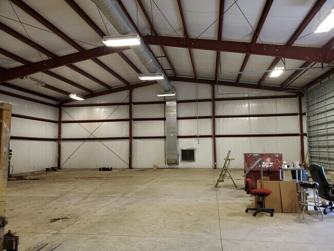
Restaurantbuilding
MONROE
AE The base floodplain where base flood elevations are provided. AE Zones are now used on new format FIRMs instead of A1-A30 Zones.
Michigan
2025
6.14 AC
2025
Monroe County
832500
Detroit
10,147 SF
Monroe, MI
NEARBY LISTINGS FOR SALE OR LEASE
DEMOGRAPHICS near 13993 Laplaisance Rd
1 mile
3 mile
5 mile
2025 Total Population
954
14,885
42,883
2030 Population
946
14,894
42,921
Pop Growth 2025-2030
(0.84%)
+ 0.06%
+ 0.09%
Average Age
42
42
42
2025 Total Households
387
6,008
17,697
HH Growth 2025-2030
(0.78%)
+ 0.02%
+ 0.06%
Median Household Inc
$67,734
$58,572
$59,653
Avg Household Size
2.40
2.30
2.30
2025 Avg HH Vehicles
2.00
2.00
2.00
Median Home Value
$212,222
$180,043
$182,434
Median Year Built
1980
1960
1964
Nearby Places
Map Layers
Map Styles
 Street
 Aerial
Layers
 Traffic
 Biking
Places
Listings with unknown addresses are not visible on the map
- Restaurants
- Banks
- Shops
- Fitness
- Groceries
PUBLIC TRANSPORTATION
AIRPORT
Detroit Metro Wayne County
Drive
Walk
Distance
Detroit Metro Wayne County
38 min
28.3 mi
Eugene F Kranz Toledo Express
Drive
Walk
Distance
Eugene F Kranz Toledo Express
57 min
37.8 mi
SALE & LEASE HISTORY
LISTING DATE
SALE/LEASE

Apr 09, 2021
For Sale
Nearby Properties
Address
Land Use
TOTAL SIZE
Lot Size
Zoning
Address
Land Use
TOTAL SIZE
Lot Size
Zoning
97.18 AC
Address
Land Use
TOTAL SIZE
Lot Size
Zoning
5,088 SF
123.61 AC
R-1A
Address
Land Use
TOTAL SIZE
Lot Size
Zoning
48,845 SF
163.20 AC
R-1A
Address
Land Use
TOTAL SIZE
Lot Size
Zoning
Address
Land Use
TOTAL SIZE
Lot Size
Zoning
109,073 SF
47.32 AC
Address
Land Use
TOTAL SIZE
Lot Size
Zoning
Address
Land Use
TOTAL SIZE
Lot Size
Zoning
183,508 SF
70 AC
Address
Land Use
TOTAL SIZE
Lot Size
Zoning
13.60 AC
Address
Land Use
TOTAL SIZE
Lot Size
Zoning
108,575 SF
38.21 AC
R-1A
Address
Land Use
TOTAL SIZE
Lot Size
Zoning
43,528 SF
16.06 AC
MHP
Address
Land Use
TOTAL SIZE
Lot Size
Zoning
507.34 AC
R-1A
Address
Land Use
TOTAL SIZE
Lot Size
Zoning
2,195 SF
86.71 AC
MHP
Address
Land Use
TOTAL SIZE
Lot Size
Zoning
PS PUBLIC
Address
Land Use
TOTAL SIZE
Lot Size
Zoning
Address
Land Use
TOTAL SIZE
Lot Size
Zoning
13.38 AC
Address
Land Use
TOTAL SIZE
Lot Size
Zoning
6.78 AC
Address
Land Use
TOTAL SIZE
Lot Size
Zoning
975 SF
34.50 AC
MHP
Address
Land Use
TOTAL SIZE
Lot Size
Zoning
106,200 SF
10.83 AC
R-1A
Address
Land Use
TOTAL SIZE
Lot Size
Zoning
104,117 SF
12.04 AC
Address
Land Use
TOTAL SIZE
Lot Size
Zoning
22,192 SF
51.15 AC
R-1A
Address
Land Use
TOTAL SIZE
Lot Size
Zoning
66,912 SF
4.90 AC
Address
Land Use
TOTAL SIZE
Lot Size
Zoning
40,476 SF
18.60 AC
Address
Land Use
TOTAL SIZE
Lot Size
Zoning
8,564 SF
33.87 AC
Address
Land Use
TOTAL SIZE
Lot Size
Zoning
73,356 SF
6.23 AC
Address
Land Use
TOTAL SIZE
Lot Size
Zoning
24,854 SF
10.30 AC
Address
Land Use
TOTAL SIZE
Lot Size
Zoning
57,560 SF
11.30 AC
Address
Land Use
TOTAL SIZE
Lot Size
Zoning
36,278 SF
2.78 AC
Address
Land Use
TOTAL SIZE
Lot Size
Zoning
126,141 SF
16.21 AC
Address
Land Use
TOTAL SIZE
Lot Size
Zoning
23,133 SF
4.57 AC
Address
Land Use
TOTAL SIZE
Lot Size
Zoning
9,420 SF
28.92 AC
The World's #1 Commercial Real Estate Marketplace
Connect with us
© 2026 CoStar Group
The information above has been obtained from sources believed reliable. While we do not doubt its accuracy we have not verified it and make no guarantee, warranty or representation about it. It is your responsibility to independently confirm its accuracy and completeness. Any projections, opinions, assumptions, or estimates used are for example only and do not represent the current or future performance of the property. The value of this transaction to you depends on tax and other factors which should be evaluated by your tax, financial, and legal advisors. You and your advisors should conduct a careful, independent investigation of the property to determine to your satisfaction the suitability of the property for your needs.