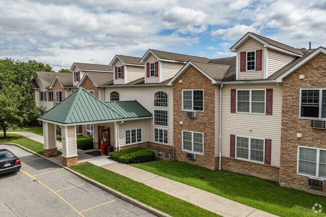
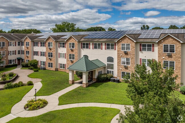
Property Record
14 Dogwood Ln, Beacon, NY 12508
NEARBY LISTINGS FOR SALE OR LEASE
Property Detail
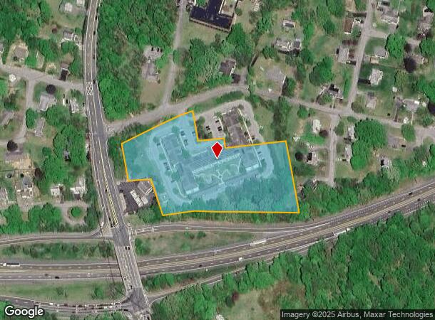
14 Dogwood Ln
Dutchess County-Putnam County, NY
4.4 AC (C) 1703 0235 1372 0349
133089-5955-04-869356-0000
Dutchess
Apartment
New York
X
869
36027C0463E
4.40 AC
2025
Beacon
2024
Westchester/So Connecticut
060100
DEMOGRAPHICS near 14 Dogwood Ln
1 Mile
3 Mile
5 Mile
2024 Total Population
8,925
51,621
92,589
2029 Population
9,001
52,023
93,503
Pop Growth 2024-2029
+ 0.85%
+ 0.78%
+ 0.99%
Average Age
42
39
40
2024 Total Households
3,624
19,515
35,558
HH Growth 2024-2029
+ 0.72%
+ 0.70%
+ 0.96%
Median Household Inc
$81,557
$76,492
$81,589
Avg Household Size
2.10
2.40
2.40
2024 Avg HH Vehicles
2.00
2.00
2.00
Median Home Value
$402,269
$360,256
$328,119
Median Year Built
1973
1957
1964
Nearby Places
- Restaurants
- Banks
- Shops
- Fitness
- Groceries
PUBLIC TRANSPORTATION
COMMUTER RAIL
Beacon Station (Hudson Line - Metro-North Commuter Railroad Company (Metro-North))
DRIVE
WALK
Distance
Beacon Station (Hudson Line - Metro-North Commuter Railroad Company (Metro-North))
4 min
1.4 mi
Breakneck Ridge Station (Hudson Line - Metro-North Commuter Railroad Company (Metro-North))
DRIVE
WALK
Distance
Breakneck Ridge Station (Hudson Line - Metro-North Commuter Railroad Company (Metro-North))
12 min
6.1 mi
AIRPORT
New York Stewart International
DRIVE
WALK
Distance
New York Stewart International
18 min
9.9 mi
Freight Ports
Port of New Haven
DRIVE
WALK
Distance
Port of New Haven
97 min
71.8 mi
Nearby Properties
Address
Land Use
TOTAL SIZE
Lot Size
Zoning
Address
Land Use
TOTAL SIZE
Lot Size
Zoning
211,240 SF
5.30 AC
WG
Address
Land Use
TOTAL SIZE
Lot Size
Zoning
325,026 SF
6.30 AC
RM
Address
Land Use
TOTAL SIZE
Lot Size
Zoning
251,689 SF
43.70 AC
RMF5
Address
Land Use
TOTAL SIZE
Lot Size
Zoning
48,135 SF
40.98 AC
RMF5
Address
Land Use
TOTAL SIZE
Lot Size
Zoning
101,170 SF
28.71 AC
RMF5
Address
Land Use
TOTAL SIZE
Lot Size
Zoning
17.59 AC
R1-40
Address
Land Use
TOTAL SIZE
Lot Size
Zoning
355,349 SF
28.50 AC
RM
Address
Land Use
TOTAL SIZE
Lot Size
Zoning
345,572 SF
43.80 AC
R-1
Address
Land Use
TOTAL SIZE
Lot Size
Zoning
94,340 SF
31.64 AC
RMF5
Address
Land Use
TOTAL SIZE
Lot Size
Zoning
7.96 AC
RD-1.8
Address
Land Use
TOTAL SIZE
Lot Size
Zoning
47,187 SF
33 AC
R40
Address
Land Use
TOTAL SIZE
Lot Size
Zoning
36.65 AC
R1-20
Address
Land Use
TOTAL SIZE
Lot Size
Zoning
272,943 SF
17 AC
RL
Address
Land Use
TOTAL SIZE
Lot Size
Zoning
21,996 SF
17.36 AC
RMF5
Address
Land Use
TOTAL SIZE
Lot Size
Zoning
110,384 SF
13.10 AC
RM
Address
Land Use
TOTAL SIZE
Lot Size
Zoning
112,136 SF
2.70 AC
RM
Address
Land Use
TOTAL SIZE
Lot Size
Zoning
45.48 AC
HI
Address
Land Use
TOTAL SIZE
Lot Size
Zoning
10,746 SF
11 AC
PWD
Address
Land Use
TOTAL SIZE
Lot Size
Zoning
7.65 AC
RMF-5
Address
Land Use
TOTAL SIZE
Lot Size
Zoning
182,318 SF
9.20 AC
RL
Address
Land Use
TOTAL SIZE
Lot Size
Zoning
200 SF
11.97 AC
RD-3
Address
Land Use
TOTAL SIZE
Lot Size
Zoning
38,962 SF
16.80 AC
RMF5
Address
Land Use
TOTAL SIZE
Lot Size
Zoning
38.66 AC
R1-40
Address
Land Use
TOTAL SIZE
Lot Size
Zoning
20.50 AC
Address
Land Use
TOTAL SIZE
Lot Size
Zoning
91,705 SF
1.90 AC
RM
Address
Land Use
TOTAL SIZE
Lot Size
Zoning
5.70 AC
RD-3
Address
Land Use
TOTAL SIZE
Lot Size
Zoning
11.86 AC
Address
Land Use
TOTAL SIZE
Lot Size
Zoning
466.77 AC
R40
Address
Land Use
TOTAL SIZE
Lot Size
Zoning
9.17 AC
RD-3
Address
Land Use
TOTAL SIZE
Lot Size
Zoning
1.20 AC
The World's #1 Commercial Real Estate Marketplace
Connect with us
© 2025 CoStar Group
The information above has been obtained from sources believed reliable. While we do not doubt its accuracy we have not verified it and make no guarantee, warranty or representation about it. It is your responsibility to independently confirm its accuracy and completeness. Any projections, opinions, assumptions, or estimates used are for example only and do not represent the current or future performance of the property. The value of this transaction to you depends on tax and other factors which should be evaluated by your tax, financial, and legal advisors. You and your advisors should conduct a careful, independent investigation of the property to determine to your satisfaction the suitability of the property for your needs.