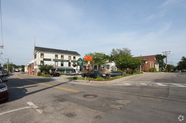
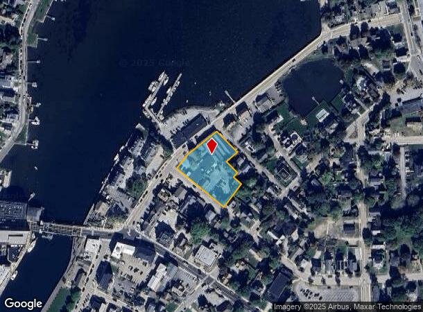
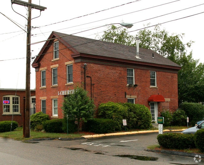
Property Record
14 Holmes St, Mystic, CT 06355
NEARBY LISTINGS FOR SALE OR LEASE
Property Detail
14 Holmes St
STON-000174-000003-000001
New London
Commercialbuilding
Connecticut
AE
1
09011C0527J
1.01 AC
2024
SE New London
2025
Hartford
705300
Norwich-New London, CT
22,753 SF
DEMOGRAPHICS near 14 Holmes St
1 Mile
3 Mile
5 Mile
2024 Total Population
4,634
17,464
33,434
2029 Population
4,645
17,653
33,762
Pop Growth 2024-2029
+ 0.24%
+ 1.08%
+ 0.98%
Average Age
51
49
47
2024 Total Households
2,075
7,580
14,874
HH Growth 2024-2029
(0.19%)
+ 0.94%
+ 0.96%
Median Household Inc
$116,623
$111,869
$94,160
Avg Household Size
1.90
2.20
2.10
2024 Avg HH Vehicles
2.00
2.00
2.00
Median Home Value
$438,696
$395,893
$366,648
Median Year Built
1948
1967
1973
Nearby Places
Map Layers
Map Styles
 Street
 Aerial
- Restaurants
- Banks
- Shops
- Fitness
- Groceries
PUBLIC TRANSPORTATION
COMMUTER RAIL
DRIVE
WALK
Distance
1 min
10 min
0.5 mi
DRIVE
WALK
Distance
14 min
8.9 mi
AIRPORT
Rhode Island Tf Green International
DRIVE
WALK
Distance
Rhode Island Tf Green International
59 min
44.0 mi
Freight Ports
Port of Davisville, RI
DRIVE
WALK
Distance
Port of Davisville, RI
60 min
44.3 mi
Nearby Properties
Address
Land Use
TOTAL SIZE
Lot Size
Zoning
Address
Land Use
TOTAL SIZE
Lot Size
Zoning
8,820 SF
66.22 AC
R-12
Address
Land Use
TOTAL SIZE
Lot Size
Zoning
268,573 SF
74.66 AC
RS-20
Address
Land Use
TOTAL SIZE
Lot Size
Zoning
18.02 AC
RM-15
Address
Land Use
TOTAL SIZE
Lot Size
Zoning
162,521 SF
44.19 AC
RS-20
Address
Land Use
TOTAL SIZE
Lot Size
Zoning
32.59 AC
RA-40
Address
Land Use
TOTAL SIZE
Lot Size
Zoning
18.17 AC
TC-80
Address
Land Use
TOTAL SIZE
Lot Size
Zoning
138,366 SF
11.20 AC
GDD
Address
Land Use
TOTAL SIZE
Lot Size
Zoning
74,433 SF
47.37 AC
RS-20
Address
Land Use
TOTAL SIZE
Lot Size
Zoning
139,952 SF
5.81 AC
GDD
Address
Land Use
TOTAL SIZE
Lot Size
Zoning
74,328 SF
19.50 AC
RR-80
Address
Land Use
TOTAL SIZE
Lot Size
Zoning
45,795 SF
5.60 AC
GDD
Address
Land Use
TOTAL SIZE
Lot Size
Zoning
120,243 SF
9.06 AC
TC-80
Address
Land Use
TOTAL SIZE
Lot Size
Zoning
40.80 AC
M-1
Address
Land Use
TOTAL SIZE
Lot Size
Zoning
7.35 AC
TC-80
Address
Land Use
TOTAL SIZE
Lot Size
Zoning
85,073 SF
17.60 AC
RA-20
Address
Land Use
TOTAL SIZE
Lot Size
Zoning
58,739 SF
21.85 AC
RU-40
Address
Land Use
TOTAL SIZE
Lot Size
Zoning
7.40 AC
M-1
Address
Land Use
TOTAL SIZE
Lot Size
Zoning
59,024 SF
3.24 AC
RS-12
Address
Land Use
TOTAL SIZE
Lot Size
Zoning
68,206 SF
6.40 AC
M-1
Address
Land Use
TOTAL SIZE
Lot Size
Zoning
19,274 SF
1.36 AC
GB-130
Address
Land Use
TOTAL SIZE
Lot Size
Zoning
39,386 SF
28.74 AC
RS-20
Address
Land Use
TOTAL SIZE
Lot Size
Zoning
1,880 SF
166.33 AC
IM
Address
Land Use
TOTAL SIZE
Lot Size
Zoning
55,089 SF
2.63 AC
GC-60
Address
Land Use
TOTAL SIZE
Lot Size
Zoning
14.50 AC
GC-60
Address
Land Use
TOTAL SIZE
Lot Size
Zoning
46,652 SF
12.23 AC
RC-120
Address
Land Use
TOTAL SIZE
Lot Size
Zoning
0.77 AC
DB-5
Address
Land Use
TOTAL SIZE
Lot Size
Zoning
74,984 SF
15.63 AC
M-1
Address
Land Use
TOTAL SIZE
Lot Size
Zoning
35,520 SF
1.61 AC
MDD
Address
Land Use
TOTAL SIZE
Lot Size
Zoning
39,667 SF
8.41 AC
RS-20
Address
Land Use
TOTAL SIZE
Lot Size
Zoning
62,549 SF
6.41 AC
IM
The World's #1 Commercial Real Estate Marketplace
Connect with us
© 2025 CoStar Group
The information above has been obtained from sources believed reliable. While we do not doubt its accuracy we have not verified it and make no guarantee, warranty or representation about it. It is your responsibility to independently confirm its accuracy and completeness. Any projections, opinions, assumptions, or estimates used are for example only and do not represent the current or future performance of the property. The value of this transaction to you depends on tax and other factors which should be evaluated by your tax, financial, and legal advisors. You and your advisors should conduct a careful, independent investigation of the property to determine to your satisfaction the suitability of the property for your needs.