Property Record
14 Kraft Ave, Albany, NY 12205


Current Lease Availabilities
NEARBY LISTINGS FOR SALE OR LEASE
Property Detail
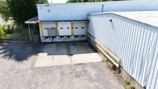
14 Kraft Ave
012689-053-010-0003-006-000-0000
N-1160 E-POWER CO S-54-45
Storesoffices
Albany
X
New York
36001C0183D
6.000
2025
2.20 AC
2024
Central Avenue Corridor
014001
Albany/Schenectady/Troy
29,672 SF
Albany-Schenectady-Troy, NY
DEMOGRAPHICS near 14 Kraft Ave
1 Mile
3 Mile
5 Mile
2024 Total Population
9,043
92,211
192,247
2029 Population
8,951
90,952
190,443
Pop Growth 2024-2029
(1.02%)
(1.37%)
(0.94%)
Average Age
41
39
39
2024 Total Households
3,905
37,187
80,560
HH Growth 2024-2029
(1.05%)
(1.44%)
(0.96%)
Median Household Inc
$68,423
$72,016
$68,595
Avg Household Size
2.20
2.10
2.10
2024 Avg HH Vehicles
1.00
1.00
1.00
Median Home Value
$220,586
$248,885
$248,547
Median Year Built
1958
1958
1961
Nearby Places
Map Layers
Map Styles
 Street
 Aerial
- Restaurants
- Banks
- Shops
- Fitness
- Groceries
PUBLIC TRANSPORTATION
COMMUTER RAIL
DRIVE
WALK
Distance
16 min
7.4 mi
AIRPORT
Albany International
DRIVE
WALK
Distance
Albany International
14 min
6.8 mi
Nearby Properties
Address
Land Use
TOTAL SIZE
Lot Size
Zoning
Address
Land Use
TOTAL SIZE
Lot Size
Zoning
111,628 SF
303.87 AC
CO
Address
Land Use
TOTAL SIZE
Lot Size
Zoning
72,000 SF
279.23 AC
CO
Address
Land Use
TOTAL SIZE
Lot Size
Zoning
5.04 AC
CM
Address
Land Use
TOTAL SIZE
Lot Size
Zoning
Address
Land Use
TOTAL SIZE
Lot Size
Zoning
674,048 SF
7.40 AC
CO
Address
Land Use
TOTAL SIZE
Lot Size
Zoning
442,188 SF
15.10 AC
CO
Address
Land Use
TOTAL SIZE
Lot Size
Zoning
502,950 SF
12.50 AC
CO
Address
Land Use
TOTAL SIZE
Lot Size
Zoning
152,951 SF
3.70 AC
CO
Address
Land Use
TOTAL SIZE
Lot Size
Zoning
812,458 SF
38.74 AC
F
Address
Land Use
TOTAL SIZE
Lot Size
Zoning
206.10 AC
C2
Address
Land Use
TOTAL SIZE
Lot Size
Zoning
561,128 SF
33.58 AC
GB
Address
Land Use
TOTAL SIZE
Lot Size
Zoning
9,208 SF
290.80 AC
LC
Address
Land Use
TOTAL SIZE
Lot Size
Zoning
10,216 SF
48.37 AC
16
Address
Land Use
TOTAL SIZE
Lot Size
Zoning
595,472 SF
6.06 AC
CO
Address
Land Use
TOTAL SIZE
Lot Size
Zoning
12,096 SF
73.12 AC
CM
Address
Land Use
TOTAL SIZE
Lot Size
Zoning
105.28 AC
C2
Address
Land Use
TOTAL SIZE
Lot Size
Zoning
99,300 SF
4.66 AC
R2B
Address
Land Use
TOTAL SIZE
Lot Size
Zoning
211,848 SF
27.20 AC
R2A
Address
Land Use
TOTAL SIZE
Lot Size
Zoning
373,296 SF
11.70 AC
46
Address
Land Use
TOTAL SIZE
Lot Size
Zoning
441,152 SF
3.32 AC
CO
Address
Land Use
TOTAL SIZE
Lot Size
Zoning
175,587 SF
20.14 AC
LB
Address
Land Use
TOTAL SIZE
Lot Size
Zoning
3,760 SF
28.30 AC
MR
Address
Land Use
TOTAL SIZE
Lot Size
Zoning
301,203 SF
1.43 AC
C3
Address
Land Use
TOTAL SIZE
Lot Size
Zoning
213,860 SF
28.20 AC
C2
Address
Land Use
TOTAL SIZE
Lot Size
Zoning
135,000 SF
14.64 AC
R1B
Address
Land Use
TOTAL SIZE
Lot Size
Zoning
301,834 SF
9 AC
26
Address
Land Use
TOTAL SIZE
Lot Size
Zoning
279,150 SF
21.10 AC
CO
Address
Land Use
TOTAL SIZE
Lot Size
Zoning
63,908 SF
2.18 AC
R2A
Address
Land Use
TOTAL SIZE
Lot Size
Zoning
78.70 AC
LC
Address
Land Use
TOTAL SIZE
Lot Size
Zoning
64,685 SF
6.79 AC
R2A
The World's #1 Commercial Real Estate Marketplace
Connect with us
© 2026 CoStar Group
The information above has been obtained from sources believed reliable. While we do not doubt its accuracy we have not verified it and make no guarantee, warranty or representation about it. It is your responsibility to independently confirm its accuracy and completeness. Any projections, opinions, assumptions, or estimates used are for example only and do not represent the current or future performance of the property. The value of this transaction to you depends on tax and other factors which should be evaluated by your tax, financial, and legal advisors. You and your advisors should conduct a careful, independent investigation of the property to determine to your satisfaction the suitability of the property for your needs.