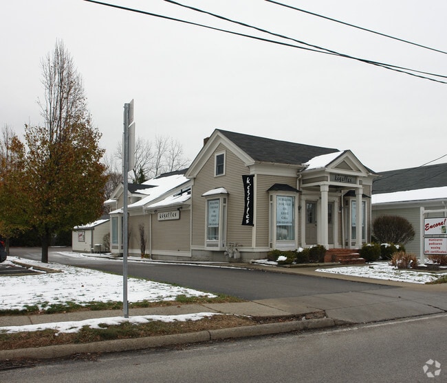
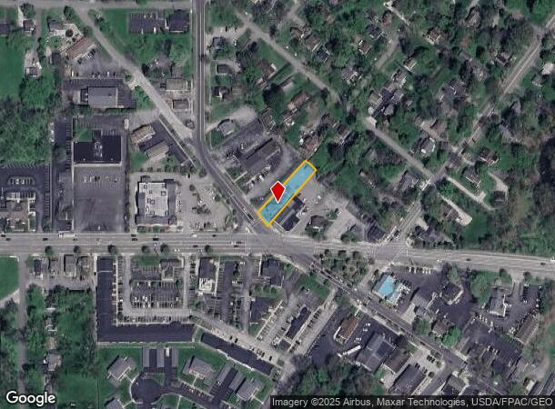
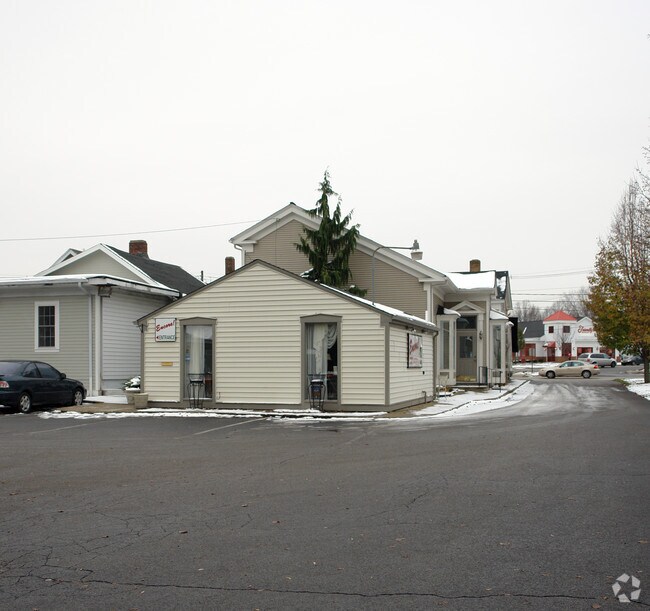
Property Record
14 N Main St, Poland, OH 44514
NEARBY LISTINGS FOR SALE OR LEASE
Property Detail
14 N Main St
Youngstown/Warren/Boardman
Main
Youngstown-Warren-Boardman, OH-PA
LOT 27 55 X 215 MAIN
36-004-0-016.00-0
Mahoning
Storebuilding
Ohio
2024
27
2024
0.27 AC
811200
Mahoning County
4,127 SF
DEMOGRAPHICS near 14 N Main St
1 Mile
3 Mile
5 Mile
2024 Total Population
5,824
47,869
102,338
2029 Population
5,646
46,810
100,829
Pop Growth 2024-2029
(3.06%)
(2.21%)
(1.47%)
Average Age
44
43
43
2024 Total Households
2,511
20,740
44,270
HH Growth 2024-2029
(3.11%)
(2.28%)
(1.59%)
Median Household Inc
$74,725
$58,687
$49,070
Avg Household Size
2.30
2.20
2.20
2024 Avg HH Vehicles
2.00
2.00
2.00
Median Home Value
$177,090
$141,868
$127,982
Median Year Built
1958
1958
1958
Nearby Places
Map Layers
Map Styles
 Street
 Aerial
- Restaurants
- Banks
- Shops
- Fitness
- Groceries
Nearby Properties
Address
Land Use
TOTAL SIZE
Lot Size
Zoning
Address
Land Use
TOTAL SIZE
Lot Size
Zoning
252,909 SF
22.37 AC
C
Address
Land Use
TOTAL SIZE
Lot Size
Zoning
436,605 SF
64.24 AC
C
Address
Land Use
TOTAL SIZE
Lot Size
Zoning
318,339 SF
14.66 AC
R1
Address
Land Use
TOTAL SIZE
Lot Size
Zoning
Address
Land Use
TOTAL SIZE
Lot Size
Zoning
88,996 SF
10.94 AC
C
Address
Land Use
TOTAL SIZE
Lot Size
Zoning
140,889 SF
14.71 AC
C
Address
Land Use
TOTAL SIZE
Lot Size
Zoning
105,326 SF
6.75 AC
Address
Land Use
TOTAL SIZE
Lot Size
Zoning
41,443 SF
0.93 AC
C
Address
Land Use
TOTAL SIZE
Lot Size
Zoning
134,650 SF
16.10 AC
C
Address
Land Use
TOTAL SIZE
Lot Size
Zoning
121,281 SF
11.79 AC
Address
Land Use
TOTAL SIZE
Lot Size
Zoning
57,178 SF
20.42 AC
R2
Address
Land Use
TOTAL SIZE
Lot Size
Zoning
49,014 SF
8.63 AC
C
Address
Land Use
TOTAL SIZE
Lot Size
Zoning
96,005 SF
3.89 AC
C
Address
Land Use
TOTAL SIZE
Lot Size
Zoning
108,150 SF
6.06 AC
C
Address
Land Use
TOTAL SIZE
Lot Size
Zoning
79,778 SF
5.85 AC
Address
Land Use
TOTAL SIZE
Lot Size
Zoning
41,835 SF
7.46 AC
I
Address
Land Use
TOTAL SIZE
Lot Size
Zoning
53,530 SF
5.85 AC
Address
Land Use
TOTAL SIZE
Lot Size
Zoning
39,370 SF
10.58 AC
C
Address
Land Use
TOTAL SIZE
Lot Size
Zoning
139,722 SF
19.72 AC
R1
Address
Land Use
TOTAL SIZE
Lot Size
Zoning
56,688 SF
10.33 AC
R1
Address
Land Use
TOTAL SIZE
Lot Size
Zoning
141,528 SF
16.11 AC
C
Address
Land Use
TOTAL SIZE
Lot Size
Zoning
23,583 SF
9.76 AC
C
Address
Land Use
TOTAL SIZE
Lot Size
Zoning
140,132 SF
8.91 AC
C
Address
Land Use
TOTAL SIZE
Lot Size
Zoning
123,138 SF
8.16 AC
C
Address
Land Use
TOTAL SIZE
Lot Size
Zoning
68,415 SF
11.60 AC
R1
Address
Land Use
TOTAL SIZE
Lot Size
Zoning
29,735 SF
8.65 AC
C
Address
Land Use
TOTAL SIZE
Lot Size
Zoning
69,600 SF
5.84 AC
C
Address
Land Use
TOTAL SIZE
Lot Size
Zoning
73,489 SF
14.40 AC
Address
Land Use
TOTAL SIZE
Lot Size
Zoning
134,320 SF
3.36 AC
Address
Land Use
TOTAL SIZE
Lot Size
Zoning
102,699 SF
39.18 AC
R1
The World's #1 Commercial Real Estate Marketplace
Connect with us
© 2025 CoStar Group
The information above has been obtained from sources believed reliable. While we do not doubt its accuracy we have not verified it and make no guarantee, warranty or representation about it. It is your responsibility to independently confirm its accuracy and completeness. Any projections, opinions, assumptions, or estimates used are for example only and do not represent the current or future performance of the property. The value of this transaction to you depends on tax and other factors which should be evaluated by your tax, financial, and legal advisors. You and your advisors should conduct a careful, independent investigation of the property to determine to your satisfaction the suitability of the property for your needs.