Property Record
14 Red Maple Dr, Weaverville, NC 28787
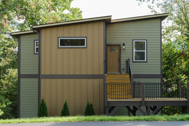
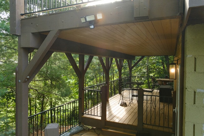
This Property Is For Sale
NEARBY LISTINGS FOR SALE OR LEASE
-
-
View all Weaverville listings for sale on LoopNet.com
Property Detail
14 Red Maple Dr
Asheville, NC
As Shown On That Plat
9743-46-9807-00000
Buncombe
Sfr
North Carolina
X
0.43 AC
3700974300J
North/West Buncombe County
1,764 SF
Asheville
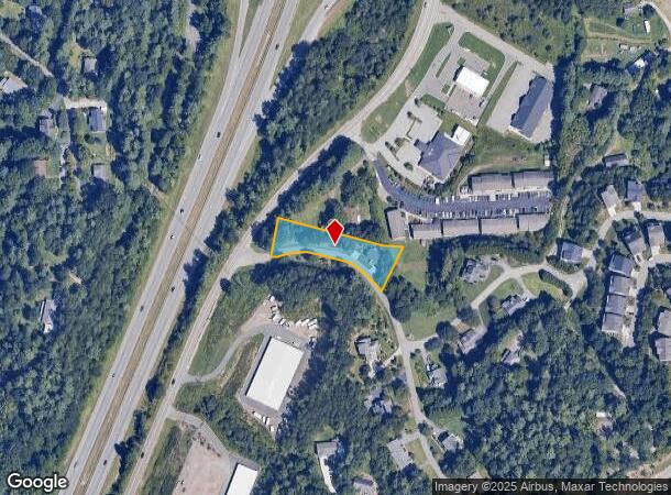
DEMOGRAPHICS near 14 Red Maple Dr
1 Mile
3 Mile
5 Mile
2024 Total Population
1,909
15,539
29,811
2029 Population
1,991
16,140
30,999
Pop Growth 2024-2029
+ 4.30%
+ 3.87%
+ 3.99%
Average Age
45
46
45
2024 Total Households
781
6,639
12,432
HH Growth 2024-2029
+ 3.97%
+ 3.57%
+ 3.76%
Median Household Inc
$79,141
$84,105
$82,169
Avg Household Size
2.40
2.30
2.30
2024 Avg HH Vehicles
2.00
2.00
2.00
Median Home Value
$493,366
$472,044
$459,244
Median Year Built
1996
1995
1995
Nearby Places
Map Layers
Map Styles
 Street
 Aerial
- Restaurants
- Banks
- Shops
- Fitness
- Groceries
PUBLIC TRANSPORTATION
AIRPORT
Asheville Regional
DRIVE
WALK
Distance
Asheville Regional
32 min
23.7 mi
Freight Ports
North Charleston Terminal
DRIVE
WALK
Distance
North Charleston Terminal
303 min
267.5 mi
Nearby Properties
Address
Land Use
TOTAL SIZE
Lot Size
Zoning
Address
Land Use
TOTAL SIZE
Lot Size
Zoning
101,676 SF
19.40 AC
EMP
Address
Land Use
TOTAL SIZE
Lot Size
Zoning
177,630 SF
45.11 AC
OU
Address
Land Use
TOTAL SIZE
Lot Size
Zoning
70,312 SF
16.85 AC
I-1
Address
Land Use
TOTAL SIZE
Lot Size
Zoning
64,521 SF
14.16 AC
R-3
Address
Land Use
TOTAL SIZE
Lot Size
Zoning
52,470 SF
10.50 AC
I-1
Address
Land Use
TOTAL SIZE
Lot Size
Zoning
134,304 SF
16.10 AC
C-2
Address
Land Use
TOTAL SIZE
Lot Size
Zoning
93,500 SF
60.64 AC
OU
Address
Land Use
TOTAL SIZE
Lot Size
Zoning
51,555 SF
8.34 AC
R-1
Address
Land Use
TOTAL SIZE
Lot Size
Zoning
187,648 SF
18.85 AC
I-1
Address
Land Use
TOTAL SIZE
Lot Size
Zoning
63,570 SF
1,923.55 AC
OU
Address
Land Use
TOTAL SIZE
Lot Size
Zoning
414,493 SF
34.02 AC
I-1
Address
Land Use
TOTAL SIZE
Lot Size
Zoning
139,265 SF
14.97 AC
I-1
Address
Land Use
TOTAL SIZE
Lot Size
Zoning
98,003 SF
11.96 AC
C-2
Address
Land Use
TOTAL SIZE
Lot Size
Zoning
28,247 SF
3.22 AC
C-2
Address
Land Use
TOTAL SIZE
Lot Size
Zoning
34,646 SF
99.64 AC
OU
Address
Land Use
TOTAL SIZE
Lot Size
Zoning
47,374 SF
6.84 AC
C-2
Address
Land Use
TOTAL SIZE
Lot Size
Zoning
166,387 SF
23.84 AC
I-1
Address
Land Use
TOTAL SIZE
Lot Size
Zoning
91,988 SF
28.95 AC
R-3
Address
Land Use
TOTAL SIZE
Lot Size
Zoning
23,112 SF
12.95 AC
OU
Address
Land Use
TOTAL SIZE
Lot Size
Zoning
7.54 AC
R-1
Address
Land Use
TOTAL SIZE
Lot Size
Zoning
38,346 SF
4.96 AC
R-1
Address
Land Use
TOTAL SIZE
Lot Size
Zoning
37,419 SF
4.15 AC
C-2
Address
Land Use
TOTAL SIZE
Lot Size
Zoning
265,885 SF
33.47 AC
I-1
Address
Land Use
TOTAL SIZE
Lot Size
Zoning
53,760 SF
4.04 AC
R-3
Address
Land Use
TOTAL SIZE
Lot Size
Zoning
20,000 SF
5.70 AC
C-2
Address
Land Use
TOTAL SIZE
Lot Size
Zoning
30,468 SF
3.48 AC
C-2
Address
Land Use
TOTAL SIZE
Lot Size
Zoning
78,237 SF
10.07 AC
I-1
Address
Land Use
TOTAL SIZE
Lot Size
Zoning
14,857 SF
426.55 AC
OU
Address
Land Use
TOTAL SIZE
Lot Size
Zoning
16,000 SF
3.22 AC
C-2
Address
Land Use
TOTAL SIZE
Lot Size
Zoning
7,549 SF
3.43 AC
C-2
The World's #1 Commercial Real Estate Marketplace
Connect with us
© 2025 CoStar Group
The information above has been obtained from sources believed reliable. While we do not doubt its accuracy we have not verified it and make no guarantee, warranty or representation about it. It is your responsibility to independently confirm its accuracy and completeness. Any projections, opinions, assumptions, or estimates used are for example only and do not represent the current or future performance of the property. The value of this transaction to you depends on tax and other factors which should be evaluated by your tax, financial, and legal advisors. You and your advisors should conduct a careful, independent investigation of the property to determine to your satisfaction the suitability of the property for your needs.