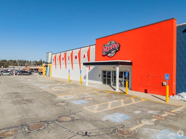
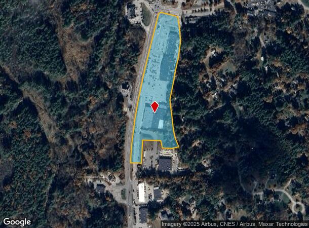
Property Record
150 Bridge St, Pelham, NH 03076
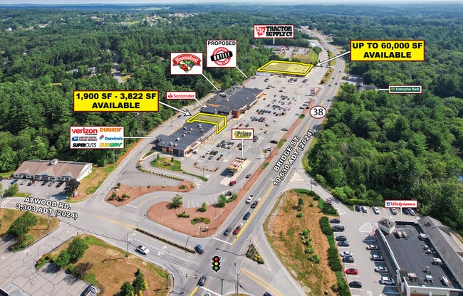
Current Lease Availabilities
NEARBY LISTINGS FOR SALE OR LEASE
Property Detail
150 Bridge St
PLHM-000029-000000-000007-000095
Hillsborough
Commercialnec
New Hampshire
X
12.21 AC
25009C0200F
Hillsborough
2024
Boston
2024
Manchester-Nashua, NH
200300
DEMOGRAPHICS near 150 Bridge St
1 Mile
3 Mile
5 Mile
2024 Total Population
2,589
18,084
83,224
2029 Population
2,669
18,421
83,290
Pop Growth 2024-2029
+ 3.09%
+ 1.86%
+ 0.08%
Average Age
43
42
41
2024 Total Households
928
6,296
29,833
HH Growth 2024-2029
+ 3.02%
+ 1.86%
(0.05%)
Median Household Inc
$118,956
$119,376
$103,001
Avg Household Size
2.70
2.80
2.70
2024 Avg HH Vehicles
3.00
2.00
2.00
Median Home Value
$435,906
$454,570
$433,257
Median Year Built
1977
1982
1976
Nearby Places
- Restaurants
- Banks
- Shops
- Fitness
- Groceries
PUBLIC TRANSPORTATION
COMMUTER RAIL
Lowell (Lowell Line - Massachusetts Bay Transportation Authority Commuter Rail (Purple Line))
DRIVE
WALK
Distance
Lowell (Lowell Line - Massachusetts Bay Transportation Authority Commuter Rail (Purple Line))
15 min
6.8 mi
AIRPORT
Manchester Boston Regional
DRIVE
WALK
Distance
Manchester Boston Regional
42 min
23.8 mi
General Edward Lawrence Logan International
DRIVE
WALK
Distance
General Edward Lawrence Logan International
55 min
36.6 mi
Freight Ports
Port of Boston
DRIVE
WALK
Distance
Port of Boston
56 min
36.4 mi
Nearby Properties
Address
Land Use
TOTAL SIZE
Lot Size
Zoning
Address
Land Use
TOTAL SIZE
Lot Size
Zoning
803 SF
3.29 AC
R1
Address
Land Use
TOTAL SIZE
Lot Size
Zoning
Address
Land Use
TOTAL SIZE
Lot Size
Zoning
50 AC
R
Address
Land Use
TOTAL SIZE
Lot Size
Zoning
76 AC
R
Address
Land Use
TOTAL SIZE
Lot Size
Zoning
2.15 AC
R
Address
Land Use
TOTAL SIZE
Lot Size
Zoning
171,166 SF
11 AC
I
Address
Land Use
TOTAL SIZE
Lot Size
Zoning
Address
Land Use
TOTAL SIZE
Lot Size
Zoning
19 AC
MUZD
Address
Land Use
TOTAL SIZE
Lot Size
Zoning
8.76 AC
I
Address
Land Use
TOTAL SIZE
Lot Size
Zoning
42,659 SF
23 AC
R
Address
Land Use
TOTAL SIZE
Lot Size
Zoning
86,561 SF
2.40 AC
B4
Address
Land Use
TOTAL SIZE
Lot Size
Zoning
46,324 SF
19 AC
B
Address
Land Use
TOTAL SIZE
Lot Size
Zoning
69,523 SF
25 AC
I
Address
Land Use
TOTAL SIZE
Lot Size
Zoning
27,057 SF
3.38 AC
MUZD
Address
Land Use
TOTAL SIZE
Lot Size
Zoning
16.30 AC
R
Address
Land Use
TOTAL SIZE
Lot Size
Zoning
30,060 SF
1.43 AC
R1
Address
Land Use
TOTAL SIZE
Lot Size
Zoning
15,294 SF
5.50 AC
B
Address
Land Use
TOTAL SIZE
Lot Size
Zoning
27,277 SF
4.76 AC
R
Address
Land Use
TOTAL SIZE
Lot Size
Zoning
290.73 AC
R
Address
Land Use
TOTAL SIZE
Lot Size
Zoning
14.64 AC
R1
Address
Land Use
TOTAL SIZE
Lot Size
Zoning
40,320 SF
3.79 AC
B
Address
Land Use
TOTAL SIZE
Lot Size
Zoning
4 AC
B
Address
Land Use
TOTAL SIZE
Lot Size
Zoning
1,600 SF
53.50 AC
B4
Address
Land Use
TOTAL SIZE
Lot Size
Zoning
17,456 SF
3.15 AC
I
Address
Land Use
TOTAL SIZE
Lot Size
Zoning
4.44 AC
MUZD
Address
Land Use
TOTAL SIZE
Lot Size
Zoning
4.26 AC
B
Address
Land Use
TOTAL SIZE
Lot Size
Zoning
11,186 SF
3.48 AC
R
Address
Land Use
TOTAL SIZE
Lot Size
Zoning
18,940 SF
11.37 AC
B
Address
Land Use
TOTAL SIZE
Lot Size
Zoning
18,900 SF
4.72 AC
B
The World's #1 Commercial Real Estate Marketplace
Connect with us
© 2025 CoStar Group
The information above has been obtained from sources believed reliable. While we do not doubt its accuracy we have not verified it and make no guarantee, warranty or representation about it. It is your responsibility to independently confirm its accuracy and completeness. Any projections, opinions, assumptions, or estimates used are for example only and do not represent the current or future performance of the property. The value of this transaction to you depends on tax and other factors which should be evaluated by your tax, financial, and legal advisors. You and your advisors should conduct a careful, independent investigation of the property to determine to your satisfaction the suitability of the property for your needs.