Property Record
140 Broiles St, Jacksonville, TX 75766


NEARBY LISTINGS FOR SALE OR LEASE
Property Detail
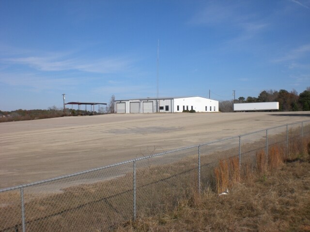
140 Broiles St
000000136704
S A Norman Industrial Park Phase 2
Industrialgeneral
A 44 BLK 3439 TR 21A T QUEVADO
X
Cherokee
48073C0285D
Texas
2025
17.80 AC
2025
Texas East Area
950700
Other Market Areas
163,090 SF
Jacksonville, TX
DEMOGRAPHICS near 140 Broiles St
1 mile
3 mile
5 mile
2024 Total Population
2,640
16,433
21,650
2029 Population
2,801
17,536
23,074
Pop Growth 2024-2029
+ 6.10%
+ 6.71%
+ 6.58%
Average Age
36
37
38
2024 Total Households
982
5,909
7,827
HH Growth 2024-2029
+ 6.31%
+ 6.89%
+ 6.77%
Median Household Inc
$43,437
$45,147
$45,851
Avg Household Size
2.60
2.70
2.70
2024 Avg HH Vehicles
2.00
2.00
2.00
Median Home Value
$122,280
$119,592
$129,209
Median Year Built
1982
1978
1979
Nearby Places
Map Layers
Map Styles
 Street
 Aerial
Transit
 Traffic
 Biking
Places
Listings with unknown addresses are not visible on the map
- Restaurants
- Banks
- Shops
- Fitness
- Groceries
PUBLIC TRANSPORTATION
AIRPORT
Tyler Pounds Regional
Drive
Walk
Distance
Tyler Pounds Regional
50 min
37.9 mi
SALE & LEASE HISTORY
LISTING DATE
SALE/LEASE

Sep 23, 2016
For Sale
Nearby Properties
Address
Land Use
TOTAL SIZE
Lot Size
Zoning
Address
Land Use
TOTAL SIZE
Lot Size
Zoning
240,478 SF
3.65 AC
Address
Land Use
TOTAL SIZE
Lot Size
Zoning
128,378 SF
8.85 AC
Address
Land Use
TOTAL SIZE
Lot Size
Zoning
13,471 SF
20 AC
Address
Land Use
TOTAL SIZE
Lot Size
Zoning
271,920 SF
16.25 AC
Address
Land Use
TOTAL SIZE
Lot Size
Zoning
593,739 SF
23.67 AC
Address
Land Use
TOTAL SIZE
Lot Size
Zoning
14,924 SF
12.50 AC
Address
Land Use
TOTAL SIZE
Lot Size
Zoning
132,402 SF
5.25 AC
Address
Land Use
TOTAL SIZE
Lot Size
Zoning
438,688 SF
29.75 AC
Address
Land Use
TOTAL SIZE
Lot Size
Zoning
107,512 SF
36.50 AC
Address
Land Use
TOTAL SIZE
Lot Size
Zoning
361,673 SF
9.16 AC
Address
Land Use
TOTAL SIZE
Lot Size
Zoning
132,758 SF
7.79 AC
Address
Land Use
TOTAL SIZE
Lot Size
Zoning
42,150 SF
2.85 AC
Address
Land Use
TOTAL SIZE
Lot Size
Zoning
109,917 SF
6.44 AC
Address
Land Use
TOTAL SIZE
Lot Size
Zoning
109,636 SF
1.54 AC
Address
Land Use
TOTAL SIZE
Lot Size
Zoning
240,296 SF
6.45 AC
Address
Land Use
TOTAL SIZE
Lot Size
Zoning
37,556 SF
Address
Land Use
TOTAL SIZE
Lot Size
Zoning
78,238 SF
1.98 AC
Address
Land Use
TOTAL SIZE
Lot Size
Zoning
14,816 SF
47.17 AC
Address
Land Use
TOTAL SIZE
Lot Size
Zoning
96,420 SF
1.32 AC
Address
Land Use
TOTAL SIZE
Lot Size
Zoning
83,091 SF
5.72 AC
Address
Land Use
TOTAL SIZE
Lot Size
Zoning
95,655 SF
1.80 AC
Address
Land Use
TOTAL SIZE
Lot Size
Zoning
145,656 SF
3.75 AC
Address
Land Use
TOTAL SIZE
Lot Size
Zoning
148,881 SF
5.28 AC
Address
Land Use
TOTAL SIZE
Lot Size
Zoning
17,875 SF
1.12 AC
Address
Land Use
TOTAL SIZE
Lot Size
Zoning
10,323 SF
2.80 AC
Address
Land Use
TOTAL SIZE
Lot Size
Zoning
35,204 SF
8 AC
Address
Land Use
TOTAL SIZE
Lot Size
Zoning
60,175 SF
22.54 AC
Address
Land Use
TOTAL SIZE
Lot Size
Zoning
87,834 SF
10.59 AC
Address
Land Use
TOTAL SIZE
Lot Size
Zoning
14,512 SF
0.52 AC
Address
Land Use
TOTAL SIZE
Lot Size
Zoning
30,899 SF
0.85 AC
The World's #1 Commercial Real Estate Marketplace
Connect with us
© 2026 CoStar Group
The information above has been obtained from sources believed reliable. While we do not doubt its accuracy we have not verified it and make no guarantee, warranty or representation about it. It is your responsibility to independently confirm its accuracy and completeness. Any projections, opinions, assumptions, or estimates used are for example only and do not represent the current or future performance of the property. The value of this transaction to you depends on tax and other factors which should be evaluated by your tax, financial, and legal advisors. You and your advisors should conduct a careful, independent investigation of the property to determine to your satisfaction the suitability of the property for your needs.