Property Record
140 E Hintz Rd, Wheeling, IL 60090

NEARBY LISTINGS FOR SALE OR LEASE
Property Detail
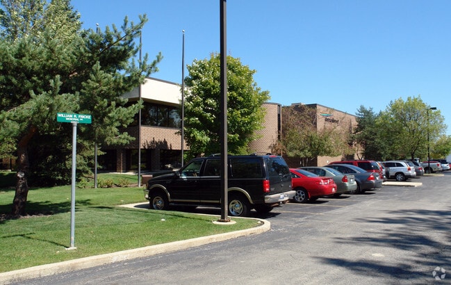
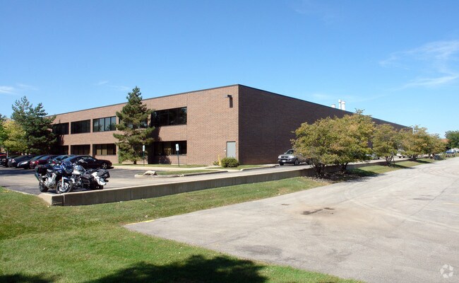
140 E Hintz Rd
Chicago-Naperville-Elgin, IL-IN-WI
Palwaukee Business Center Unit1
03-11-408-011-0000
(PALWAUKEE) (BUSINESS) (CENTER) (UNIT1) A SUB IN THE SE SEC 11-42-11
Industrialgeneral
Cook
X
Illinois
17097C0270K
23
2023
0.83 AC
2024
North Cook
802505
Chicago
59,817 SF
DEMOGRAPHICS near 140 E Hintz Rd
1 Mile
3 Mile
5 Mile
2024 Total Population
7,711
99,357
274,510
2029 Population
7,529
96,678
267,656
Pop Growth 2024-2029
(2.36%)
(2.70%)
(2.50%)
Average Age
39
43
43
2024 Total Households
3,020
39,064
104,885
HH Growth 2024-2029
(2.62%)
(3.01%)
(2.76%)
Median Household Inc
$69,285
$86,239
$105,453
Avg Household Size
2.50
2.50
2.50
2024 Avg HH Vehicles
2.00
2.00
2.00
Median Home Value
$259,360
$323,935
$390,676
Median Year Built
1975
1976
1975
Nearby Places
Map Layers
Map Styles
 Street
 Aerial
- Restaurants
- Banks
- Shops
- Fitness
- Groceries
PUBLIC TRANSPORTATION
COMMUTER RAIL
Wheeling Station (North Central Service - Northeast Illinois Regional Commuter Railroad (Metra))
DRIVE
WALK
Distance
Wheeling Station (North Central Service - Northeast Illinois Regional Commuter Railroad (Metra))
5 min
2.4 mi
Prospect Heights Station (North Central Service - Northeast Illinois Regional Commuter Railroad (Metra))
DRIVE
WALK
Distance
Prospect Heights Station (North Central Service - Northeast Illinois Regional Commuter Railroad (Metra))
6 min
2.7 mi
AIRPORT
Chicago O'Hare International
DRIVE
WALK
Distance
Chicago O'Hare International
22 min
14.0 mi
Chicago Midway International
DRIVE
WALK
Distance
Chicago Midway International
48 min
27.4 mi
Freight Ports
Port Milwaukee
DRIVE
WALK
Distance
Port Milwaukee
82 min
67.3 mi
Nearby Properties
Address
Land Use
TOTAL SIZE
Lot Size
Zoning
Address
Land Use
TOTAL SIZE
Lot Size
Zoning
6,783,684 SF
69.84 AC
Address
Land Use
TOTAL SIZE
Lot Size
Zoning
21.58 AC
Address
Land Use
TOTAL SIZE
Lot Size
Zoning
24.64 AC
Address
Land Use
TOTAL SIZE
Lot Size
Zoning
1,049,337 SF
24.57 AC
Address
Land Use
TOTAL SIZE
Lot Size
Zoning
22.72 AC
Address
Land Use
TOTAL SIZE
Lot Size
Zoning
8,586,994 SF
10.41 AC
Address
Land Use
TOTAL SIZE
Lot Size
Zoning
14.26 AC
Address
Land Use
TOTAL SIZE
Lot Size
Zoning
443,916 SF
5.61 AC
Address
Land Use
TOTAL SIZE
Lot Size
Zoning
Address
Land Use
TOTAL SIZE
Lot Size
Zoning
186,646 SF
26.69 AC
Address
Land Use
TOTAL SIZE
Lot Size
Zoning
349,846 SF
5.11 AC
Address
Land Use
TOTAL SIZE
Lot Size
Zoning
221,786 SF
6.33 AC
Address
Land Use
TOTAL SIZE
Lot Size
Zoning
46.27 AC
Address
Land Use
TOTAL SIZE
Lot Size
Zoning
362,944 SF
12.74 AC
Address
Land Use
TOTAL SIZE
Lot Size
Zoning
Address
Land Use
TOTAL SIZE
Lot Size
Zoning
510,569 SF
3.55 AC
Address
Land Use
TOTAL SIZE
Lot Size
Zoning
20.79 AC
Address
Land Use
TOTAL SIZE
Lot Size
Zoning
6.32 AC
Address
Land Use
TOTAL SIZE
Lot Size
Zoning
247,655 SF
12.19 AC
Address
Land Use
TOTAL SIZE
Lot Size
Zoning
579,858 SF
3.56 AC
Address
Land Use
TOTAL SIZE
Lot Size
Zoning
20.95 AC
Address
Land Use
TOTAL SIZE
Lot Size
Zoning
Address
Land Use
TOTAL SIZE
Lot Size
Zoning
89,080 SF
6.81 AC
Address
Land Use
TOTAL SIZE
Lot Size
Zoning
65,401 SF
5.05 AC
Address
Land Use
TOTAL SIZE
Lot Size
Zoning
561,594 SF
29.88 AC
Address
Land Use
TOTAL SIZE
Lot Size
Zoning
690,195 SF
39.48 AC
Address
Land Use
TOTAL SIZE
Lot Size
Zoning
Address
Land Use
TOTAL SIZE
Lot Size
Zoning
Address
Land Use
TOTAL SIZE
Lot Size
Zoning
25.54 AC
Address
Land Use
TOTAL SIZE
Lot Size
Zoning
162,375 SF
15.36 AC
The World's #1 Commercial Real Estate Marketplace
Connect with us
© 2025 CoStar Group
The information above has been obtained from sources believed reliable. While we do not doubt its accuracy we have not verified it and make no guarantee, warranty or representation about it. It is your responsibility to independently confirm its accuracy and completeness. Any projections, opinions, assumptions, or estimates used are for example only and do not represent the current or future performance of the property. The value of this transaction to you depends on tax and other factors which should be evaluated by your tax, financial, and legal advisors. You and your advisors should conduct a careful, independent investigation of the property to determine to your satisfaction the suitability of the property for your needs.