Property Record
140 Enterprise Pky, Boerne, TX 78006

Property Detail
140 Enterprise Pky
San Antonio-New Braunfels, TX
ENTERPRISE PARK LOT 1, 0.518 ACRES
12255
Kendall
Commercialbuilding
Texas
B and X Area of moderate flood hazard, usually the area between the limits of the 100-year and 500-year floods.
1
2024
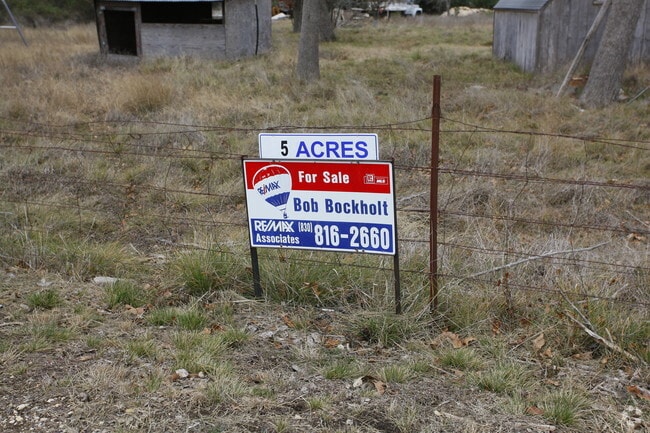
4.99 AC
2025
Kendall County
970405
San Antonio
32,684 SF
NEARBY LISTINGS FOR SALE OR LEASE
DEMOGRAPHICS near 140 Enterprise Pky
1 mile
3 mile
5 mile
2025 Total Population
2,617
18,632
55,391
2030 Population
3,014
20,928
61,290
Pop Growth 2025-2030
+ 15.17%
+ 12.32%
+ 10.65%
Average Age
42
41
41
2025 Total Households
927
6,643
19,754
HH Growth 2025-2030
+ 15.53%
+ 12.54%
+ 10.89%
Median Household Inc
$118,373
$119,900
$125,211
Avg Household Size
2.70
2.80
2.80
2025 Avg HH Vehicles
2.00
2.00
2.00
Median Home Value
$516,245
$570,906
$504,824
Median Year Built
2008
2007
2008
Nearby Places
Map Layers
Map Styles
 Street
 Aerial
Layers
 Traffic
 Biking
Places
Listings with unknown addresses are not visible on the map
- Restaurants
- Banks
- Shops
- Fitness
- Groceries
PUBLIC TRANSPORTATION
AIRPORT
San Antonio International
Drive
Walk
Distance
San Antonio International
34 min
26.2 mi
Freight Ports
Calhoun Port
Drive
Walk
Distance
Calhoun Port
213 min
177.8 mi
Nearby Properties
Address
Land Use
TOTAL SIZE
Lot Size
Zoning
Address
Land Use
TOTAL SIZE
Lot Size
Zoning
315,748 SF
102.19 AC
Address
Land Use
TOTAL SIZE
Lot Size
Zoning
384,453 SF
34.24 AC
Address
Land Use
TOTAL SIZE
Lot Size
Zoning
252,468 SF
56.42 AC
Address
Land Use
TOTAL SIZE
Lot Size
Zoning
255,907 SF
19.93 AC
Address
Land Use
TOTAL SIZE
Lot Size
Zoning
126,885 SF
16 AC
Address
Land Use
TOTAL SIZE
Lot Size
Zoning
91,430 SF
3.99 AC
Address
Land Use
TOTAL SIZE
Lot Size
Zoning
247,144 SF
17.49 AC
Address
Land Use
TOTAL SIZE
Lot Size
Zoning
145,171 SF
13.65 AC
Address
Land Use
TOTAL SIZE
Lot Size
Zoning
215,475 SF
13.14 AC
Address
Land Use
TOTAL SIZE
Lot Size
Zoning
257,805 SF
15.54 AC
Address
Land Use
TOTAL SIZE
Lot Size
Zoning
297,618 SF
13.20 AC
Address
Land Use
TOTAL SIZE
Lot Size
Zoning
36,632 SF
142.92 AC
Address
Land Use
TOTAL SIZE
Lot Size
Zoning
38,159 SF
9.91 AC
Address
Land Use
TOTAL SIZE
Lot Size
Zoning
94,142 SF
40.34 AC
Address
Land Use
TOTAL SIZE
Lot Size
Zoning
185,852 SF
22.38 AC
Address
Land Use
TOTAL SIZE
Lot Size
Zoning
70,036 SF
0.77 AC
Address
Land Use
TOTAL SIZE
Lot Size
Zoning
54,854 SF
4.44 AC
Address
Land Use
TOTAL SIZE
Lot Size
Zoning
8,515 SF
59.67 AC
Address
Land Use
TOTAL SIZE
Lot Size
Zoning
42,101 SF
6.03 AC
Address
Land Use
TOTAL SIZE
Lot Size
Zoning
60,750 SF
15.53 AC
Address
Land Use
TOTAL SIZE
Lot Size
Zoning
175.13 AC
Address
Land Use
TOTAL SIZE
Lot Size
Zoning
48,139 SF
10.38 AC
Address
Land Use
TOTAL SIZE
Lot Size
Zoning
46,649 SF
17.82 AC
Address
Land Use
TOTAL SIZE
Lot Size
Zoning
30,448 SF
4.18 AC
Address
Land Use
TOTAL SIZE
Lot Size
Zoning
21,868 SF
19.88 AC
Address
Land Use
TOTAL SIZE
Lot Size
Zoning
89,054 SF
6.64 AC
Address
Land Use
TOTAL SIZE
Lot Size
Zoning
113,692 SF
6.52 AC
Address
Land Use
TOTAL SIZE
Lot Size
Zoning
52,496 SF
5.64 AC
Address
Land Use
TOTAL SIZE
Lot Size
Zoning
10,078 SF
15.47 AC
Address
Land Use
TOTAL SIZE
Lot Size
Zoning
107,081 SF
7.41 AC
The World's #1 Commercial Real Estate Marketplace
Connect with us
© 2026 CoStar Group
The information above has been obtained from sources believed reliable. While we do not doubt its accuracy we have not verified it and make no guarantee, warranty or representation about it. It is your responsibility to independently confirm its accuracy and completeness. Any projections, opinions, assumptions, or estimates used are for example only and do not represent the current or future performance of the property. The value of this transaction to you depends on tax and other factors which should be evaluated by your tax, financial, and legal advisors. You and your advisors should conduct a careful, independent investigation of the property to determine to your satisfaction the suitability of the property for your needs.