Property Record
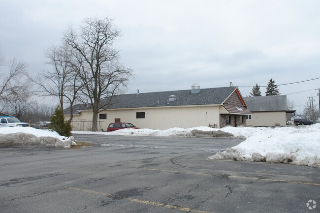
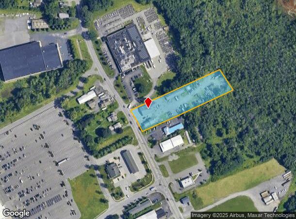
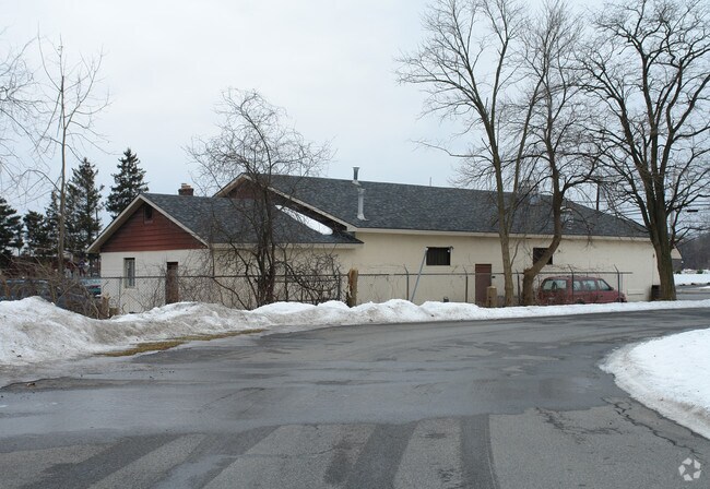
140 Freemans Bridge Rd, Schenectady, NY 12302
NEARBY LISTINGS FOR SALE OR LEASE
Property Detail
140 Freemans Bridge Rd
030-010-0003-008-000-0000
Schenectady
Restaurantbuilding
New York
X
8.000
36093C0154D
1.90 AC
2025
Outer Schenectady County
2024
Albany/Schenectady/Troy
032402
Albany-Schenectady-Troy, NY
4,523 SF
DEMOGRAPHICS near 140 Freemans Bridge Rd
1 Mile
3 Mile
5 Mile
2024 Total Population
3,658
63,810
134,911
2029 Population
3,901
67,405
142,012
Pop Growth 2024-2029
+ 6.64%
+ 5.63%
+ 5.26%
Average Age
47
40
40
2024 Total Households
1,697
26,812
55,562
HH Growth 2024-2029
+ 6.89%
+ 5.92%
+ 5.53%
Median Household Inc
$69,818
$68,232
$72,360
Avg Household Size
2.00
2.20
2.30
2024 Avg HH Vehicles
2.00
1.00
2.00
Median Home Value
$217,827
$186,575
$184,713
Median Year Built
1982
1953
1952
Nearby Places
Map Layers
Map Styles
 Street
 Aerial
- Restaurants
- Banks
- Shops
- Fitness
- Groceries
PUBLIC TRANSPORTATION
COMMUTER RAIL
DRIVE
WALK
Distance
6 min
2.5 mi
AIRPORT
Albany International
DRIVE
WALK
Distance
Albany International
24 min
11.4 mi
Nearby Properties
Address
Land Use
TOTAL SIZE
Lot Size
Zoning
Address
Land Use
TOTAL SIZE
Lot Size
Zoning
2,068,862 SF
204.52 AC
I-2
Address
Land Use
TOTAL SIZE
Lot Size
Zoning
583,211 SF
9.95 AC
03 - MULTI
Address
Land Use
TOTAL SIZE
Lot Size
Zoning
155,023 SF
18.81 AC
06 - INDUS
Address
Land Use
TOTAL SIZE
Lot Size
Zoning
6,733 SF
100 AC
03 - MULTI
Address
Land Use
TOTAL SIZE
Lot Size
Zoning
600 SF
28.40 AC
06 - INDUS
Address
Land Use
TOTAL SIZE
Lot Size
Zoning
0.01 AC
06 - INDUS
Address
Land Use
TOTAL SIZE
Lot Size
Zoning
184,878 SF
15.58 AC
03 - MULTI
Address
Land Use
TOTAL SIZE
Lot Size
Zoning
246,000 SF
9.85 AC
Address
Land Use
TOTAL SIZE
Lot Size
Zoning
59,240 SF
0.72 AC
05 - COMME
Address
Land Use
TOTAL SIZE
Lot Size
Zoning
123,030 SF
7.21 AC
03 - MULTI
Address
Land Use
TOTAL SIZE
Lot Size
Zoning
306,803 SF
3.20 AC
Address
Land Use
TOTAL SIZE
Lot Size
Zoning
234,485 SF
42.50 AC
02 - SINGL
Address
Land Use
TOTAL SIZE
Lot Size
Zoning
32,385 SF
5.02 AC
Address
Land Use
TOTAL SIZE
Lot Size
Zoning
19,080 SF
602.20 AC
CON
Address
Land Use
TOTAL SIZE
Lot Size
Zoning
12,528 SF
20.66 AC
R2
Address
Land Use
TOTAL SIZE
Lot Size
Zoning
184,376 SF
1.66 AC
03 - MULTI
Address
Land Use
TOTAL SIZE
Lot Size
Zoning
60,274 SF
12.95 AC
OT
Address
Land Use
TOTAL SIZE
Lot Size
Zoning
23,923 SF
109.83 AC
CON
Address
Land Use
TOTAL SIZE
Lot Size
Zoning
11,424 SF
42.41 AC
CON
Address
Land Use
TOTAL SIZE
Lot Size
Zoning
183,759 SF
1.40 AC
05 - COMME
Address
Land Use
TOTAL SIZE
Lot Size
Zoning
181,230 SF
1.02 AC
05 - COMME
Address
Land Use
TOTAL SIZE
Lot Size
Zoning
194.77 AC
Address
Land Use
TOTAL SIZE
Lot Size
Zoning
9.38 AC
I-2
Address
Land Use
TOTAL SIZE
Lot Size
Zoning
117,849 SF
5.76 AC
05 - COMME
Address
Land Use
TOTAL SIZE
Lot Size
Zoning
136,722 SF
2.01 AC
05 - COMME
Address
Land Use
TOTAL SIZE
Lot Size
Zoning
32,626 SF
81.39 AC
IR
Address
Land Use
TOTAL SIZE
Lot Size
Zoning
34,807 SF
15.91 AC
R2
Address
Land Use
TOTAL SIZE
Lot Size
Zoning
35,800 SF
8.80 AC
PD
Address
Land Use
TOTAL SIZE
Lot Size
Zoning
141,145 SF
1.11 AC
05 - COMME
Address
Land Use
TOTAL SIZE
Lot Size
Zoning
204,167 SF
33.90 AC
CON
The World's #1 Commercial Real Estate Marketplace
Connect with us
© 2026 CoStar Group
The information above has been obtained from sources believed reliable. While we do not doubt its accuracy we have not verified it and make no guarantee, warranty or representation about it. It is your responsibility to independently confirm its accuracy and completeness. Any projections, opinions, assumptions, or estimates used are for example only and do not represent the current or future performance of the property. The value of this transaction to you depends on tax and other factors which should be evaluated by your tax, financial, and legal advisors. You and your advisors should conduct a careful, independent investigation of the property to determine to your satisfaction the suitability of the property for your needs.