Property Record
140 Route 70 W, Marlton, NJ 08053
NEARBY LISTINGS FOR SALE OR LEASE
Property Detail
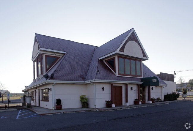
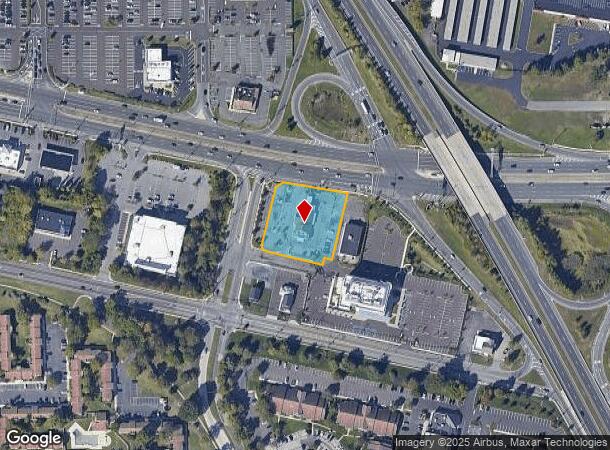
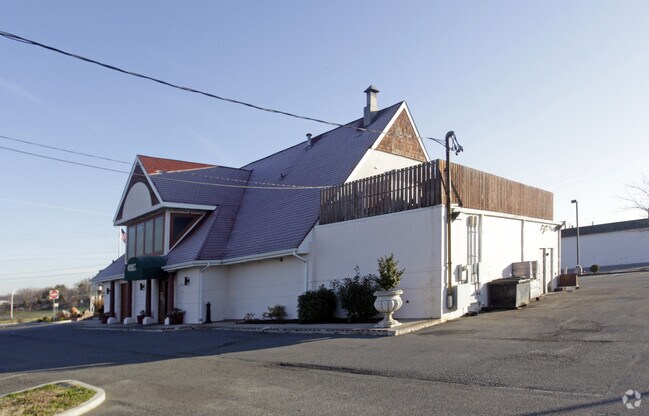
140 Route 70 W
13-00022-02-00030
Burlington
Restaurantbuilding
New Jersey
X
30
34005C0243F
0.99 AC
2024
South Burlington County
2025
Philadelphia
704006
Philadelphia-Camden-Wilmington, PA-NJ-DE-MD
3,432 SF
DEMOGRAPHICS near 140 Route 70 W
1 Mile
3 Mile
5 Mile
2024 Total Population
10,764
72,257
177,995
2029 Population
10,955
72,969
179,647
Pop Growth 2024-2029
+ 1.77%
+ 0.99%
+ 0.93%
Average Age
42
43
43
2024 Total Households
4,386
27,830
70,126
HH Growth 2024-2029
+ 1.96%
+ 1.01%
+ 0.93%
Median Household Inc
$99,129
$120,525
$111,397
Avg Household Size
2.40
2.50
2.50
2024 Avg HH Vehicles
2.00
2.00
2.00
Median Home Value
$315,261
$347,810
$343,820
Median Year Built
1976
1982
1979
Nearby Places
Map Layers
Map Styles
 Street
 Aerial
- Restaurants
- Banks
- Shops
- Fitness
- Groceries
PUBLIC TRANSPORTATION
COMMUTER RAIL
Lindenwold (Njt) (Atlantic City Line - NJ Transit Commuter Rail (NJ Transit))
DRIVE
WALK
Distance
Lindenwold (Njt) (Atlantic City Line - NJ Transit Commuter Rail (NJ Transit))
14 min
7.4 mi
Cherry Hill (Atlantic City Line - NJ Transit Commuter Rail (NJ Transit))
DRIVE
WALK
Distance
Cherry Hill (Atlantic City Line - NJ Transit Commuter Rail (NJ Transit))
12 min
7.4 mi
AIRPORT
Philadelphia International
DRIVE
WALK
Distance
Philadelphia International
36 min
23.2 mi
Trenton Mercer
DRIVE
WALK
Distance
Trenton Mercer
52 min
37.0 mi
Freight Ports
Broadway Terminal - Pier 5
DRIVE
WALK
Distance
Broadway Terminal - Pier 5
20 min
12.5 mi
Nearby Properties
Address
Land Use
TOTAL SIZE
Lot Size
Zoning
Address
Land Use
TOTAL SIZE
Lot Size
Zoning
1,896 SF
93.79 AC
LD
Address
Land Use
TOTAL SIZE
Lot Size
Zoning
270,246 SF
0.71 AC
RA
Address
Land Use
TOTAL SIZE
Lot Size
Zoning
25,536 SF
18.71 AC
Address
Land Use
TOTAL SIZE
Lot Size
Zoning
53.35 AC
LD
Address
Land Use
TOTAL SIZE
Lot Size
Zoning
44.80 AC
C-1
Address
Land Use
TOTAL SIZE
Lot Size
Zoning
5 AC
C-1
Address
Land Use
TOTAL SIZE
Lot Size
Zoning
58.48 AC
MD
Address
Land Use
TOTAL SIZE
Lot Size
Zoning
52.30 AC
MD
Address
Land Use
TOTAL SIZE
Lot Size
Zoning
2,600 SF
37.38 AC
AH-1
Address
Land Use
TOTAL SIZE
Lot Size
Zoning
114,852 SF
12.73 AC
GB2
Address
Land Use
TOTAL SIZE
Lot Size
Zoning
38.13 AC
CP
Address
Land Use
TOTAL SIZE
Lot Size
Zoning
57.50 AC
Address
Land Use
TOTAL SIZE
Lot Size
Zoning
Address
Land Use
TOTAL SIZE
Lot Size
Zoning
9.38 AC
C-1
Address
Land Use
TOTAL SIZE
Lot Size
Zoning
122,264 SF
5 AC
RR
Address
Land Use
TOTAL SIZE
Lot Size
Zoning
42.80 AC
MF
Address
Land Use
TOTAL SIZE
Lot Size
Zoning
11.29 AC
Address
Land Use
TOTAL SIZE
Lot Size
Zoning
25.28 AC
C-1
Address
Land Use
TOTAL SIZE
Lot Size
Zoning
23.43 AC
INS
Address
Land Use
TOTAL SIZE
Lot Size
Zoning
2,264 SF
17.30 AC
C-1
Address
Land Use
TOTAL SIZE
Lot Size
Zoning
31.88 AC
MD
Address
Land Use
TOTAL SIZE
Lot Size
Zoning
84.19 AC
Address
Land Use
TOTAL SIZE
Lot Size
Zoning
11.73 AC
GB2
Address
Land Use
TOTAL SIZE
Lot Size
Zoning
77,224 SF
7.65 AC
RR
Address
Land Use
TOTAL SIZE
Lot Size
Zoning
10.38 AC
C-1
Address
Land Use
TOTAL SIZE
Lot Size
Zoning
1,416 SF
16.88 AC
C-1
Address
Land Use
TOTAL SIZE
Lot Size
Zoning
165,328 SF
8.82 AC
GB2
Address
Land Use
TOTAL SIZE
Lot Size
Zoning
12.62 AC
C-1
Address
Land Use
TOTAL SIZE
Lot Size
Zoning
23.57 AC
Address
Land Use
TOTAL SIZE
Lot Size
Zoning
5,484 SF
12.90 AC
C-1
The World's #1 Commercial Real Estate Marketplace
Connect with us
© 2025 CoStar Group
The information above has been obtained from sources believed reliable. While we do not doubt its accuracy we have not verified it and make no guarantee, warranty or representation about it. It is your responsibility to independently confirm its accuracy and completeness. Any projections, opinions, assumptions, or estimates used are for example only and do not represent the current or future performance of the property. The value of this transaction to you depends on tax and other factors which should be evaluated by your tax, financial, and legal advisors. You and your advisors should conduct a careful, independent investigation of the property to determine to your satisfaction the suitability of the property for your needs.