Property Record
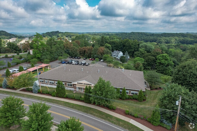
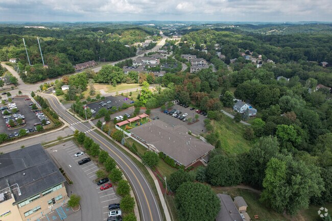
140 Swinderman Rd, Wexford, PA 15090

Property Detail
140 Swinderman Rd
Pittsburgh, PA
LEARNING CHILD CENTER PLAN LOT 5R = 290 FRONTING WITH 10 TOTAL BEARINGS
1825-N-00017-0000-00
Allegheny
Privateschool
Pennsylvania
B and X Area of moderate flood hazard, usually the area between the limits of the 100-year and 500-year floods.
17
2026
2.33 AC
2026
North Pittsburgh/Rte 19
409001
Pittsburgh
NEARBY LISTINGS FOR SALE OR LEASE
DEMOGRAPHICS near 140 Swinderman Rd
1 mile
3 mile
5 mile
2025 Total Population
5,184
29,151
80,488
2030 Population
5,136
28,812
79,829
Pop Growth 2025-2030
(0.93%)
(1.16%)
(0.82%)
Average Age
40
40
42
2025 Total Households
1,886
10,556
30,287
HH Growth 2025-2030
(1.06%)
(1.17%)
(0.82%)
Median Household Inc
$155,494
$163,917
$140,842
Avg Household Size
2.70
2.70
2.60
2025 Avg HH Vehicles
2.00
2.00
2.00
Median Home Value
$474,999
$493,428
$452,697
Median Year Built
2001
1995
1990
Nearby Places
Map Layers
Map Styles
 Street
 Aerial
Layers
 Traffic
 Biking
Places
Listings with unknown addresses are not visible on the map
- Restaurants
- Banks
- Shops
- Fitness
- Groceries
PUBLIC TRANSPORTATION
AIRPORT
Pittsburgh International
Drive
Walk
Distance
Pittsburgh International
37 min
18.8 mi
Freight Ports
Port of Toledo
Drive
Walk
Distance
Port of Toledo
245 min
215.3 mi
Nearby Properties
Address
Land Use
TOTAL SIZE
Lot Size
Zoning
Address
Land Use
TOTAL SIZE
Lot Size
Zoning
1.82 AC
Address
Land Use
TOTAL SIZE
Lot Size
Zoning
80.58 AC
Address
Land Use
TOTAL SIZE
Lot Size
Zoning
75.05 AC
Address
Land Use
TOTAL SIZE
Lot Size
Zoning
30.03 AC
Address
Land Use
TOTAL SIZE
Lot Size
Zoning
48.35 AC
Address
Land Use
TOTAL SIZE
Lot Size
Zoning
101.14 AC
Address
Land Use
TOTAL SIZE
Lot Size
Zoning
2.58 AC
Address
Land Use
TOTAL SIZE
Lot Size
Zoning
18.78 AC
Address
Land Use
TOTAL SIZE
Lot Size
Zoning
23.48 AC
Address
Land Use
TOTAL SIZE
Lot Size
Zoning
10.62 AC
Address
Land Use
TOTAL SIZE
Lot Size
Zoning
1,421 SF
24.62 AC
Address
Land Use
TOTAL SIZE
Lot Size
Zoning
16.90 AC
Address
Land Use
TOTAL SIZE
Lot Size
Zoning
7.80 AC
Address
Land Use
TOTAL SIZE
Lot Size
Zoning
11.95 AC
Address
Land Use
TOTAL SIZE
Lot Size
Zoning
12.73 AC
Address
Land Use
TOTAL SIZE
Lot Size
Zoning
14.80 AC
Address
Land Use
TOTAL SIZE
Lot Size
Zoning
Address
Land Use
TOTAL SIZE
Lot Size
Zoning
7.21 AC
Address
Land Use
TOTAL SIZE
Lot Size
Zoning
10.62 AC
Address
Land Use
TOTAL SIZE
Lot Size
Zoning
9.20 AC
Address
Land Use
TOTAL SIZE
Lot Size
Zoning
39.82 AC
Address
Land Use
TOTAL SIZE
Lot Size
Zoning
29.52 AC
Address
Land Use
TOTAL SIZE
Lot Size
Zoning
12.44 AC
Address
Land Use
TOTAL SIZE
Lot Size
Zoning
9.51 AC
Address
Land Use
TOTAL SIZE
Lot Size
Zoning
9.04 AC
Address
Land Use
TOTAL SIZE
Lot Size
Zoning
7.58 AC
Address
Land Use
TOTAL SIZE
Lot Size
Zoning
1.59 AC
Address
Land Use
TOTAL SIZE
Lot Size
Zoning
20.84 AC
Address
Land Use
TOTAL SIZE
Lot Size
Zoning
2.35 AC
Address
Land Use
TOTAL SIZE
Lot Size
Zoning
The World's #1 Commercial Real Estate Marketplace
Connect with us
© 2026 CoStar Group
The information above has been obtained from sources believed reliable. While we do not doubt its accuracy we have not verified it and make no guarantee, warranty or representation about it. It is your responsibility to independently confirm its accuracy and completeness. Any projections, opinions, assumptions, or estimates used are for example only and do not represent the current or future performance of the property. The value of this transaction to you depends on tax and other factors which should be evaluated by your tax, financial, and legal advisors. You and your advisors should conduct a careful, independent investigation of the property to determine to your satisfaction the suitability of the property for your needs.