Property Record
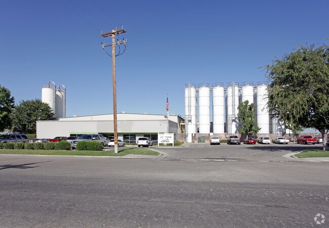
140 Vineland Rd, Bakersfield, CA 93307


Property Detail
140 Vineland Rd
388-160-16-00-1
CITY 1STED , BLOCK , LOT P 53
Lightindustrial
Kern
M2
California
AH Areas with a 1% annual chance of shallow flooding, usually in the form of a pond, withan average depth ranging from 1 to 3 feet. These areas have a 26% chance of flooding over the life of a 30-year mortgage.
p
2025
12.21 AC
2025
NE Outlying Kern County
001001
Bakersfield
39,175 SF
Bakersfield-Delano, CA
NEARBY LISTINGS FOR SALE OR LEASE
-
-
View all Bakersfield listings for sale on LoopNet.com
DEMOGRAPHICS near 140 Vineland Rd
1 mile
3 mile
5 mile
2025 Total Population
3,539
40,404
107,967
2030 Population
3,544
41,062
109,429
Pop Growth 2025-2030
+ 0.14%
+ 1.63%
+ 1.35%
Average Age
34
34
35
2025 Total Households
944
10,877
31,629
HH Growth 2025-2030
(0.11%)
+ 1.56%
+ 1.33%
Median Household Inc
$71,305
$61,717
$63,128
Avg Household Size
3.60
3.60
3.30
2025 Avg HH Vehicles
2.00
2.00
2.00
Median Home Value
$287,054
$299,171
$318,317
Median Year Built
1992
1984
1978
Nearby Places
Map Layers
Map Styles
 Street
 Aerial
Layers
 Traffic
 Biking
Places
Listings with unknown addresses are not visible on the map
- Restaurants
- Banks
- Shops
- Fitness
- Groceries
PUBLIC TRANSPORTATION
COMMUTER RAIL
Drive
Walk
Distance
13 min
6.9 mi
AIRPORT
Meadows Field
Drive
Walk
Distance
Meadows Field
25 min
13.0 mi
Nearby Properties
Address
Land Use
TOTAL SIZE
Lot Size
Zoning
Address
Land Use
TOTAL SIZE
Lot Size
Zoning
18,000 SF
35.01 AC
M-2
Address
Land Use
TOTAL SIZE
Lot Size
Zoning
1.38 AC
C-2
Address
Land Use
TOTAL SIZE
Lot Size
Zoning
66,139 SF
4.48 AC
CO
Address
Land Use
TOTAL SIZE
Lot Size
Zoning
66,139 SF
4.48 AC
CO
Address
Land Use
TOTAL SIZE
Lot Size
Zoning
50,445 SF
2.53 AC
C2
Address
Land Use
TOTAL SIZE
Lot Size
Zoning
10.31 AC
Address
Land Use
TOTAL SIZE
Lot Size
Zoning
17.85 AC
M3
Address
Land Use
TOTAL SIZE
Lot Size
Zoning
33,264 SF
28.68 AC
AG
Address
Land Use
TOTAL SIZE
Lot Size
Zoning
68,264 SF
6.56 AC
C2
Address
Land Use
TOTAL SIZE
Lot Size
Zoning
46,522 SF
3.35 AC
R2
Address
Land Use
TOTAL SIZE
Lot Size
Zoning
11.05 AC
C2/PCD
Address
Land Use
TOTAL SIZE
Lot Size
Zoning
95,258 SF
5.34 AC
PUD
Address
Land Use
TOTAL SIZE
Lot Size
Zoning
9,627 SF
12.37 AC
C2
Address
Land Use
TOTAL SIZE
Lot Size
Zoning
93,070 SF
7.98 AC
PUD
Address
Land Use
TOTAL SIZE
Lot Size
Zoning
97,900 SF
6.98 AC
M-2 PD
Address
Land Use
TOTAL SIZE
Lot Size
Zoning
44,779 SF
2.17 AC
M2
Address
Land Use
TOTAL SIZE
Lot Size
Zoning
41,089 SF
5.96 AC
C-2 PD
Address
Land Use
TOTAL SIZE
Lot Size
Zoning
47,592 SF
35.87 AC
M2
Address
Land Use
TOTAL SIZE
Lot Size
Zoning
5.63 AC
C2
Address
Land Use
TOTAL SIZE
Lot Size
Zoning
85,718 SF
4.72 AC
R-3
Address
Land Use
TOTAL SIZE
Lot Size
Zoning
12,124 SF
10.06 AC
M2
Address
Land Use
TOTAL SIZE
Lot Size
Zoning
26,295 SF
1.25 AC
R2
Address
Land Use
TOTAL SIZE
Lot Size
Zoning
0.96 AC
C-2 PD
Address
Land Use
TOTAL SIZE
Lot Size
Zoning
944 SF
4.81 AC
E(1/2AC)RS
Address
Land Use
TOTAL SIZE
Lot Size
Zoning
113,326 SF
8.35 AC
R2
Address
Land Use
TOTAL SIZE
Lot Size
Zoning
56,700 SF
20.51 AC
M-2
Address
Land Use
TOTAL SIZE
Lot Size
Zoning
246.66 AC
A
Address
Land Use
TOTAL SIZE
Lot Size
Zoning
26,850 SF
2.50 AC
C-2
Address
Land Use
TOTAL SIZE
Lot Size
Zoning
12.58 AC
The World's #1 Commercial Real Estate Marketplace
Connect with us
© 2026 CoStar Group
The information above has been obtained from sources believed reliable. While we do not doubt its accuracy we have not verified it and make no guarantee, warranty or representation about it. It is your responsibility to independently confirm its accuracy and completeness. Any projections, opinions, assumptions, or estimates used are for example only and do not represent the current or future performance of the property. The value of this transaction to you depends on tax and other factors which should be evaluated by your tax, financial, and legal advisors. You and your advisors should conduct a careful, independent investigation of the property to determine to your satisfaction the suitability of the property for your needs.