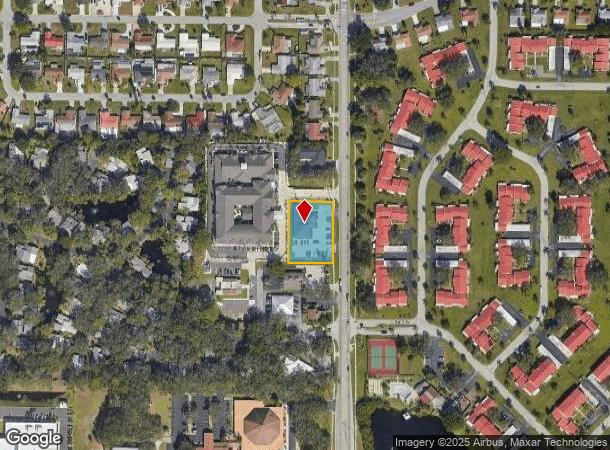
Property Record
1400 59Th St W, Bradenton, FL 34209

NEARBY LISTINGS FOR SALE OR LEASE
Property Detail
1400 59Th St W
39382-2000-5
FROM THE NE COR OF SE1/4 OF NW1/4 OF SEC 32 RUN S 00 DEG 29 MIN 29 SEC E ALG E LN OF SD SE1/4 OF NW1/4 A DIST OF 205 FT; TH N 89 DEG 42 MIN 33 SEC W, PARALLEL WITH & 205 FT S OF N
Medicalbuilding
Manatee
X
Florida
12081C0301F
0.72 AC
2024
Manatee
2025
Tampa/St Petersburg
000407
North Port-Sarasota-Bradenton, FL
6,210 SF
DEMOGRAPHICS near 1400 59Th St W
1 Mile
3 Mile
5 Mile
2024 Total Population
10,871
76,135
165,755
2029 Population
12,631
88,783
194,582
Pop Growth 2024-2029
+ 16.19%
+ 16.61%
+ 17.39%
Average Age
53
48
46
2024 Total Households
4,969
33,842
72,313
HH Growth 2024-2029
+ 15.42%
+ 15.91%
+ 16.72%
Median Household Inc
$66,365
$60,677
$51,535
Avg Household Size
2.00
2.10
2.20
2024 Avg HH Vehicles
2.00
2.00
2.00
Median Home Value
$284,510
$260,196
$224,353
Median Year Built
1978
1978
1978
Nearby Places
Map Layers
Map Styles
 Street
 Aerial
- Restaurants
- Banks
- Shops
- Fitness
- Groceries
PUBLIC TRANSPORTATION
AIRPORT
Sarasota/Bradenton International
DRIVE
WALK
Distance
Sarasota/Bradenton International
19 min
9.6 mi
St Pete-Clearwater International
DRIVE
WALK
Distance
St Pete-Clearwater International
60 min
39.9 mi
Freight Ports
Port Manatee
DRIVE
WALK
Distance
Port Manatee
28 min
15.5 mi
SALE & LEASE HISTORY
LISTING DATE
SALE/LEASE

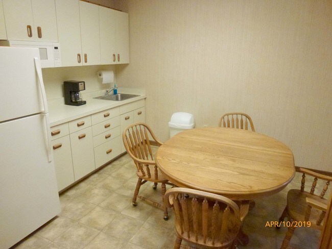
Apr 10, 2019
For Sale
Nearby Properties
Address
Land Use
TOTAL SIZE
Lot Size
Zoning
Address
Land Use
TOTAL SIZE
Lot Size
Zoning
508,298 SF
18.71 AC
P
Address
Land Use
TOTAL SIZE
Lot Size
Zoning
356,808 SF
24.25 AC
RMF-9 MULT
Address
Land Use
TOTAL SIZE
Lot Size
Zoning
456,263 SF
28.02 AC
BR_R-3
Address
Land Use
TOTAL SIZE
Lot Size
Zoning
314,018 SF
28.20 AC
BR_R-3
Address
Land Use
TOTAL SIZE
Lot Size
Zoning
297,456 SF
17.24 AC
GC,RMF-9
Address
Land Use
TOTAL SIZE
Lot Size
Zoning
279,545 SF
19.41 AC
BR_R-1
Address
Land Use
TOTAL SIZE
Lot Size
Zoning
395,543 SF
29.18 AC
BR_R-3
Address
Land Use
TOTAL SIZE
Lot Size
Zoning
432,078 SF
1.64 AC
BR_T6
Address
Land Use
TOTAL SIZE
Lot Size
Zoning
235,443 SF
14.75 AC
RMF-9 MULT
Address
Land Use
TOTAL SIZE
Lot Size
Zoning
214,906 SF
20.71 AC
BR_R-1
Address
Land Use
TOTAL SIZE
Lot Size
Zoning
223,974 SF
17.41 AC
BR_R-2
Address
Land Use
TOTAL SIZE
Lot Size
Zoning
335,019 SF
32.58 AC
BR_R-3
Address
Land Use
TOTAL SIZE
Lot Size
Zoning
247,592 SF
13.39 AC
GC,RMF-6
Address
Land Use
TOTAL SIZE
Lot Size
Zoning
198,036 SF
8.32 AC
GC GENERA
Address
Land Use
TOTAL SIZE
Lot Size
Zoning
163,868 SF
12.60 AC
BR_R-3
Address
Land Use
TOTAL SIZE
Lot Size
Zoning
162,027 SF
14.21 AC
BR_R-2
Address
Land Use
TOTAL SIZE
Lot Size
Zoning
583,480 SF
16.52 AC
BR_R-3
Address
Land Use
TOTAL SIZE
Lot Size
Zoning
166,810 SF
3.16 AC
BR_T4-O
Address
Land Use
TOTAL SIZE
Lot Size
Zoning
106,355 SF
120.66 AC
BR_PDP
Address
Land Use
TOTAL SIZE
Lot Size
Zoning
196,346 SF
33.03 AC
BR_R-1
Address
Land Use
TOTAL SIZE
Lot Size
Zoning
183,257 SF
4.19 AC
PD-R
Address
Land Use
TOTAL SIZE
Lot Size
Zoning
118,425 SF
320.26 AC
Address
Land Use
TOTAL SIZE
Lot Size
Zoning
360,846 SF
1.13 AC
BR_T5
Address
Land Use
TOTAL SIZE
Lot Size
Zoning
285,307 SF
5.17 AC
BR_T4-O
Address
Land Use
TOTAL SIZE
Lot Size
Zoning
171,396 SF
15.03 AC
GC GENERA
Address
Land Use
TOTAL SIZE
Lot Size
Zoning
211,632 SF
24.68 AC
BR_SCC
Address
Land Use
TOTAL SIZE
Lot Size
Zoning
96,342 SF
0.58 AC
BR_T5
Address
Land Use
TOTAL SIZE
Lot Size
Zoning
228,067 SF
4.39 AC
BR_T4-O
Address
Land Use
TOTAL SIZE
Lot Size
Zoning
259,675 SF
12.46 AC
GC,RMF-6
Address
Land Use
TOTAL SIZE
Lot Size
Zoning
201,088 SF
20.94 AC
PD-R
The World's #1 Commercial Real Estate Marketplace
Connect with us
© 2025 CoStar Group
The information above has been obtained from sources believed reliable. While we do not doubt its accuracy we have not verified it and make no guarantee, warranty or representation about it. It is your responsibility to independently confirm its accuracy and completeness. Any projections, opinions, assumptions, or estimates used are for example only and do not represent the current or future performance of the property. The value of this transaction to you depends on tax and other factors which should be evaluated by your tax, financial, and legal advisors. You and your advisors should conduct a careful, independent investigation of the property to determine to your satisfaction the suitability of the property for your needs.