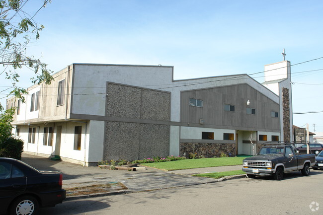
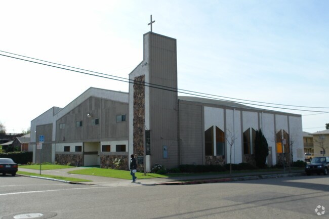
Property Record
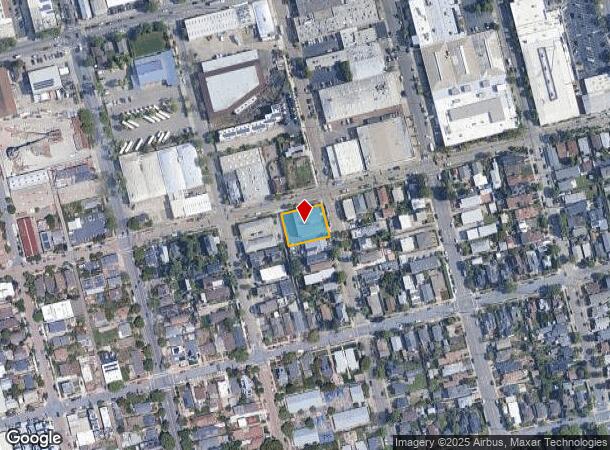
1400 8Th St, Berkeley, CA 94710
Property Detail
1400 8Th St
059-2335-002-00
Berkeley Lti Association B
Religious
Alameda
X
California
06001C0018H
6-10
2024
0.30 AC
2025
Berkeley
422100
East Bay/Oakland
8,284 SF
Oakland-Fremont-Berkeley, CA
NEARBY LISTINGS FOR SALE OR LEASE
DEMOGRAPHICS near 1400 8Th St
1 mile
3 mile
5 mile
2024 Total Population
28,463
187,521
350,687
2029 Population
27,729
182,770
342,937
Pop Growth 2024-2029
(2.58%)
(2.53%)
(2.21%)
Average Age
40
39
40
2024 Total Households
10,941
74,305
140,961
HH Growth 2024-2029
(2.75%)
(2.65%)
(2.33%)
Median Household Inc
$102,845
$101,411
$101,583
Avg Household Size
2.30
2.20
2.20
2024 Avg HH Vehicles
1.00
1.00
1.00
Median Home Value
$1,069,381
$1,068,283
$1,033,676
Median Year Built
1953
1951
1954
Nearby Places
Map Layers
Map Styles
 Street
 Aerial
Transit
 Traffic
 Biking
Places
Listings with unknown addresses are not visible on the map
- Restaurants
- Banks
- Shops
- Fitness
- Groceries
PUBLIC TRANSPORTATION
COMMUTER RAIL
Drive
Walk
Distance
4 min
18 min
1.0 mi
Drive
Walk
Distance
8 min
4.1 mi
AIRPORT
Metro Oakland International
Drive
Walk
Distance
Metro Oakland International
26 min
16.8 mi
San Francisco International
Drive
Walk
Distance
San Francisco International
38 min
24.4 mi
Freight Ports
Port of Oakland
Drive
Walk
Distance
Port of Oakland
14 min
8.1 mi
Nearby Properties
Address
Land Use
TOTAL SIZE
Lot Size
Zoning
Address
Land Use
TOTAL SIZE
Lot Size
Zoning
354,263 SF
4.06 AC
Address
Land Use
TOTAL SIZE
Lot Size
Zoning
358,014 SF
5.03 AC
Address
Land Use
TOTAL SIZE
Lot Size
Zoning
167,071 SF
0.70 AC
Address
Land Use
TOTAL SIZE
Lot Size
Zoning
540,434 SF
14.37 AC
Address
Land Use
TOTAL SIZE
Lot Size
Zoning
395,549 SF
17.05 AC
Address
Land Use
TOTAL SIZE
Lot Size
Zoning
240,633 SF
1.59 AC
Address
Land Use
TOTAL SIZE
Lot Size
Zoning
261,134 SF
2.23 AC
Address
Land Use
TOTAL SIZE
Lot Size
Zoning
169,157 SF
10.20 AC
Address
Land Use
TOTAL SIZE
Lot Size
Zoning
224,160 SF
5.03 AC
Address
Land Use
TOTAL SIZE
Lot Size
Zoning
226,800 SF
4.63 AC
Address
Land Use
TOTAL SIZE
Lot Size
Zoning
370,806 SF
2.24 AC
Address
Land Use
TOTAL SIZE
Lot Size
Zoning
4.77 AC
Address
Land Use
TOTAL SIZE
Lot Size
Zoning
292,430 SF
2.09 AC
Address
Land Use
TOTAL SIZE
Lot Size
Zoning
397,378 SF
4.52 AC
Address
Land Use
TOTAL SIZE
Lot Size
Zoning
309,451 SF
0.87 AC
Address
Land Use
TOTAL SIZE
Lot Size
Zoning
2.29 AC
Address
Land Use
TOTAL SIZE
Lot Size
Zoning
238,118 SF
2.14 AC
Address
Land Use
TOTAL SIZE
Lot Size
Zoning
60,670 SF
1.57 AC
Address
Land Use
TOTAL SIZE
Lot Size
Zoning
196,209 SF
3.14 AC
Address
Land Use
TOTAL SIZE
Lot Size
Zoning
123,750 SF
0.81 AC
Address
Land Use
TOTAL SIZE
Lot Size
Zoning
270,667 SF
2.76 AC
Address
Land Use
TOTAL SIZE
Lot Size
Zoning
254,000 SF
1.71 AC
Address
Land Use
TOTAL SIZE
Lot Size
Zoning
127,260 SF
5 AC
I
Address
Land Use
TOTAL SIZE
Lot Size
Zoning
203,859 SF
2.35 AC
Address
Land Use
TOTAL SIZE
Lot Size
Zoning
250,152 SF
9.26 AC
Address
Land Use
TOTAL SIZE
Lot Size
Zoning
166,731 SF
0.54 AC
Address
Land Use
TOTAL SIZE
Lot Size
Zoning
180,977 SF
1.21 AC
Address
Land Use
TOTAL SIZE
Lot Size
Zoning
86,144 SF
0.52 AC
Address
Land Use
TOTAL SIZE
Lot Size
Zoning
126,087 SF
2.29 AC
Address
Land Use
TOTAL SIZE
Lot Size
Zoning
137,102 SF
3.63 AC
The World's #1 Commercial Real Estate Marketplace
Connect with us
© 2026 CoStar Group
The information above has been obtained from sources believed reliable. While we do not doubt its accuracy we have not verified it and make no guarantee, warranty or representation about it. It is your responsibility to independently confirm its accuracy and completeness. Any projections, opinions, assumptions, or estimates used are for example only and do not represent the current or future performance of the property. The value of this transaction to you depends on tax and other factors which should be evaluated by your tax, financial, and legal advisors. You and your advisors should conduct a careful, independent investigation of the property to determine to your satisfaction the suitability of the property for your needs.