Property Record
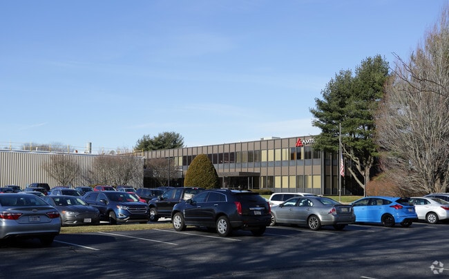
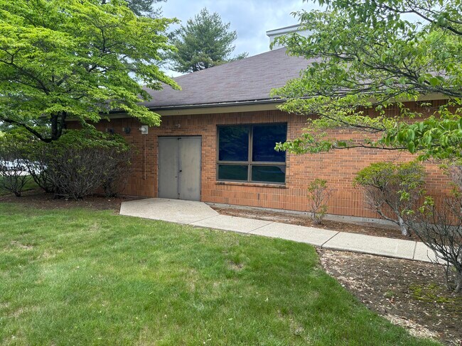
1400 Division Rd, West Warwick, RI 02893
Property Detail
1400 Division Rd
WWAR-000030-000041-000000
Kent
Industrialgeneral
Rhode Island
B
28.16 AC
B and X Area of moderate flood hazard, usually the area between the limits of the 100-year and 500-year floods.
West Warwick
2025
Providence
2025
Providence-Warwick, RI-MA
020101
NEARBY LISTINGS FOR SALE OR LEASE
DEMOGRAPHICS near 1400 Division Rd
1 mile
3 mile
5 mile
2025 Total Population
4,003
51,659
117,764
2030 Population
4,047
52,342
119,058
Pop Growth 2025-2030
+ 1.10%
+ 1.32%
+ 1.10%
Average Age
45
43
43
2025 Total Households
1,874
22,142
50,688
HH Growth 2025-2030
+ 1.01%
+ 1.31%
+ 1.08%
Median Household Inc
$74,815
$93,266
$94,253
Avg Household Size
2.10
2.30
2.30
2025 Avg HH Vehicles
2.00
2.00
2.00
Median Home Value
$366,720
$411,375
$372,767
Median Year Built
1985
1972
1968
Nearby Places
Map Layers
Map Styles
 Street
 Aerial
Layers
 Traffic
 Biking
Places
Listings with unknown addresses are not visible on the map
- Restaurants
- Banks
- Shops
- Fitness
- Groceries
PUBLIC TRANSPORTATION
COMMUTER RAIL
Drive
Walk
Distance
13 min
7.1 mi
Drive
Walk
Distance
13 min
7.7 mi
AIRPORT
Rhode Island Tf Green International
Drive
Walk
Distance
Rhode Island Tf Green International
19 min
8.9 mi
Freight Ports
Port of Davisville, RI
Drive
Walk
Distance
Port of Davisville, RI
18 min
8.7 mi
SALE & LEASE HISTORY
LISTING DATE
SALE/LEASE

Jun 26, 2025
For Sale
Nearby Properties
Address
Land Use
TOTAL SIZE
Lot Size
Zoning
Address
Land Use
TOTAL SIZE
Lot Size
Zoning
31,158 SF
20.36 AC
SMD
Address
Land Use
TOTAL SIZE
Lot Size
Zoning
24,276 SF
0.01 AC
A15
Address
Land Use
TOTAL SIZE
Lot Size
Zoning
83,747 SF
20.32 AC
GB
Address
Land Use
TOTAL SIZE
Lot Size
Zoning
171,576 SF
0.70 AC
O
Address
Land Use
TOTAL SIZE
Lot Size
Zoning
283,536 SF
97.97 AC
O
Address
Land Use
TOTAL SIZE
Lot Size
Zoning
19.60 AC
CH
Address
Land Use
TOTAL SIZE
Lot Size
Zoning
18,720 SF
15 AC
PDR
Address
Land Use
TOTAL SIZE
Lot Size
Zoning
3,743 SF
A15
Address
Land Use
TOTAL SIZE
Lot Size
Zoning
Address
Land Use
TOTAL SIZE
Lot Size
Zoning
20.43 AC
MUPD
Address
Land Use
TOTAL SIZE
Lot Size
Zoning
212,745 SF
19 AC
9239
Address
Land Use
TOTAL SIZE
Lot Size
Zoning
541,370 SF
34.08 AC
CI
Address
Land Use
TOTAL SIZE
Lot Size
Zoning
25,632 SF
A15
Address
Land Use
TOTAL SIZE
Lot Size
Zoning
19.65 AC
BP
Address
Land Use
TOTAL SIZE
Lot Size
Zoning
161,263 SF
61.75 AC
R30
Address
Land Use
TOTAL SIZE
Lot Size
Zoning
107,212 SF
18.50 AC
R10
Address
Land Use
TOTAL SIZE
Lot Size
Zoning
118,798 SF
25.61 AC
GB
Address
Land Use
TOTAL SIZE
Lot Size
Zoning
131,136 SF
32.78 AC
GB
Address
Land Use
TOTAL SIZE
Lot Size
Zoning
5.31 AC
M/LI
Address
Land Use
TOTAL SIZE
Lot Size
Zoning
160,971 SF
175 AC
A15
Address
Land Use
TOTAL SIZE
Lot Size
Zoning
83.12 AC
MLIO
Address
Land Use
TOTAL SIZE
Lot Size
Zoning
103,712 SF
12.20 AC
5314
Address
Land Use
TOTAL SIZE
Lot Size
Zoning
102,720 SF
4.10 AC
Address
Land Use
TOTAL SIZE
Lot Size
Zoning
9,216 SF
A7
Address
Land Use
TOTAL SIZE
Lot Size
Zoning
147,866 SF
6.08 AC
A7
Address
Land Use
TOTAL SIZE
Lot Size
Zoning
147,866 SF
A7
Address
Land Use
TOTAL SIZE
Lot Size
Zoning
164,592 SF
3.02 AC
O
Address
Land Use
TOTAL SIZE
Lot Size
Zoning
6.36 AC
CI
Address
Land Use
TOTAL SIZE
Lot Size
Zoning
137,511 SF
14.80 AC
GB
Address
Land Use
TOTAL SIZE
Lot Size
Zoning
112,360 SF
9.29 AC
4046
The World's #1 Commercial Real Estate Marketplace
Connect with us
© 2026 CoStar Group
The information above has been obtained from sources believed reliable. While we do not doubt its accuracy we have not verified it and make no guarantee, warranty or representation about it. It is your responsibility to independently confirm its accuracy and completeness. Any projections, opinions, assumptions, or estimates used are for example only and do not represent the current or future performance of the property. The value of this transaction to you depends on tax and other factors which should be evaluated by your tax, financial, and legal advisors. You and your advisors should conduct a careful, independent investigation of the property to determine to your satisfaction the suitability of the property for your needs.