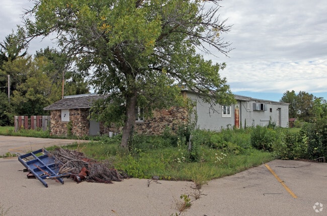
Property Record
1400 Edgewood Ave, Mukwonago, WI 53149


NEARBY LISTINGS FOR SALE OR LEASE
Property Detail
1400 Edgewood Ave
Milwaukee-Waukesha-West Allis, WI
Edgewood
MUKV-2091-998
PT SW1/4 SEC 19 T5N R19E; COM S1/4 COR; N0017E 481.61 FT AT INTERSEC OF S1/4 LI SEC 19 & CTRLI OF TOWN RD; S7729W 621.74 FT; N2452W 1459.38 FT THE BGN; N2452W 320.49 FT; N5543E 413.32 FT; S2452E 320.49 FT ; S5543W 413.32 FT TO BGN :: ALSO COM SE1/4 C
Commercialnec
Waukesha
X
Wisconsin
55133C0318H
5
2024
4.43 AC
2024
SW/Mukwonago
202001
Milwaukee/Madison
DEMOGRAPHICS near 1400 Edgewood Ave
1 Mile
3 Mile
5 Mile
2024 Total Population
5,564
12,568
20,600
2029 Population
5,704
12,888
21,033
Pop Growth 2024-2029
+ 2.52%
+ 2.55%
+ 2.10%
Average Age
43
42
43
2024 Total Households
2,116
4,968
7,917
HH Growth 2024-2029
+ 2.50%
+ 2.60%
+ 2.11%
Median Household Inc
$96,171
$92,476
$100,468
Avg Household Size
2.60
2.50
2.60
2024 Avg HH Vehicles
2.00
2.00
2.00
Median Home Value
$370,861
$329,344
$349,670
Median Year Built
1983
1981
1981
Nearby Places
Map Layers
Map Styles
 Street
 Aerial
- Restaurants
- Banks
- Shops
- Fitness
- Groceries
PUBLIC TRANSPORTATION
AIRPORT
General Mitchell International
DRIVE
WALK
Distance
General Mitchell International
36 min
23.5 mi
Freight Ports
Port Milwaukee
DRIVE
WALK
Distance
Port Milwaukee
36 min
25.4 mi
Nearby Properties
Address
Land Use
TOTAL SIZE
Lot Size
Zoning
Address
Land Use
TOTAL SIZE
Lot Size
Zoning
15.47 AC
Address
Land Use
TOTAL SIZE
Lot Size
Zoning
15.59 AC
Address
Land Use
TOTAL SIZE
Lot Size
Zoning
21.46 AC
Address
Land Use
TOTAL SIZE
Lot Size
Zoning
4.37 AC
Address
Land Use
TOTAL SIZE
Lot Size
Zoning
15.80 AC
Address
Land Use
TOTAL SIZE
Lot Size
Zoning
14.61 AC
Address
Land Use
TOTAL SIZE
Lot Size
Zoning
17.43 AC
Address
Land Use
TOTAL SIZE
Lot Size
Zoning
41.22 AC
Address
Land Use
TOTAL SIZE
Lot Size
Zoning
10.35 AC
Address
Land Use
TOTAL SIZE
Lot Size
Zoning
12.89 AC
Address
Land Use
TOTAL SIZE
Lot Size
Zoning
12.25 AC
Address
Land Use
TOTAL SIZE
Lot Size
Zoning
10.92 AC
Address
Land Use
TOTAL SIZE
Lot Size
Zoning
11.41 AC
Address
Land Use
TOTAL SIZE
Lot Size
Zoning
Address
Land Use
TOTAL SIZE
Lot Size
Zoning
Address
Land Use
TOTAL SIZE
Lot Size
Zoning
10.97 AC
Address
Land Use
TOTAL SIZE
Lot Size
Zoning
2.32 AC
Address
Land Use
TOTAL SIZE
Lot Size
Zoning
7.50 AC
Address
Land Use
TOTAL SIZE
Lot Size
Zoning
Address
Land Use
TOTAL SIZE
Lot Size
Zoning
9.62 AC
Address
Land Use
TOTAL SIZE
Lot Size
Zoning
3.70 AC
Address
Land Use
TOTAL SIZE
Lot Size
Zoning
3.82 AC
Address
Land Use
TOTAL SIZE
Lot Size
Zoning
Address
Land Use
TOTAL SIZE
Lot Size
Zoning
2.99 AC
Address
Land Use
TOTAL SIZE
Lot Size
Zoning
Address
Land Use
TOTAL SIZE
Lot Size
Zoning
Address
Land Use
TOTAL SIZE
Lot Size
Zoning
The World's #1 Commercial Real Estate Marketplace
Connect with us
© 2025 CoStar Group
The information above has been obtained from sources believed reliable. While we do not doubt its accuracy we have not verified it and make no guarantee, warranty or representation about it. It is your responsibility to independently confirm its accuracy and completeness. Any projections, opinions, assumptions, or estimates used are for example only and do not represent the current or future performance of the property. The value of this transaction to you depends on tax and other factors which should be evaluated by your tax, financial, and legal advisors. You and your advisors should conduct a careful, independent investigation of the property to determine to your satisfaction the suitability of the property for your needs.