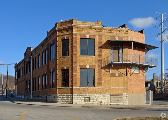
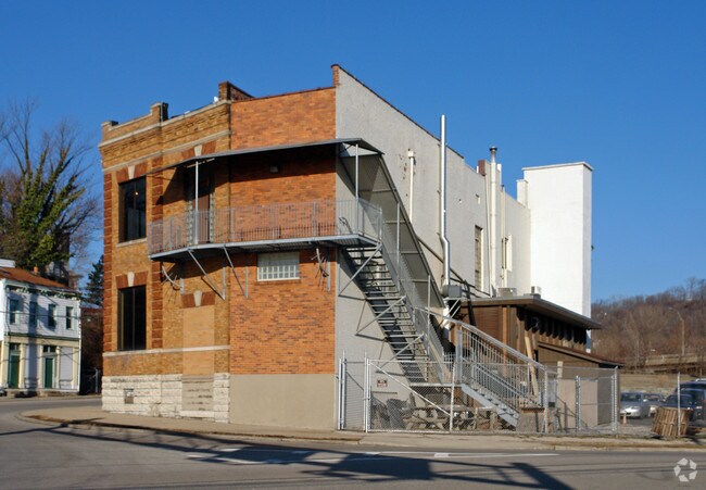
Property Record
1400 Harrison Ave, Cincinnati, OH 45214

Property Detail
1400 Harrison Ave
169-0006-0020
ES HARRISON AVE 0.449 AC PT LOT 71 A H ERNSTS SUB-PT JOS A JAMES SUB PARS 20-106 CONS
Municipalproperty
Hamilton
MG
Ohio
B and X Area of moderate flood hazard, usually the area between the limits of the 100-year and 500-year floods.
71
0
0.45 AC
2025
Queensgate
027200
Cincinnati/Dayton
10,360 SF
Cincinnati, OH-KY-IN
NEARBY LISTINGS FOR SALE OR LEASE
DEMOGRAPHICS near 1400 Harrison Ave
1 mile
3 mile
5 mile
2025 Total Population
8,921
152,294
344,993
2030 Population
9,273
156,896
353,163
Pop Growth 2025-2030
+ 3.95%
+ 3.02%
+ 2.37%
Average Age
35
35
37
2025 Total Households
3,822
66,117
149,719
HH Growth 2025-2030
+ 3.92%
+ 3.27%
+ 2.53%
Median Household Inc
$36,191
$47,275
$56,065
Avg Household Size
2.20
2.10
2.10
2025 Avg HH Vehicles
1.00
1.00
1.00
Median Home Value
$96,247
$224,858
$220,941
Median Year Built
1947
1951
1953
Nearby Places
Map Layers
Map Styles
 Street
 Aerial
Layers
 Traffic
 Biking
Places
Listings with unknown addresses are not visible on the map
- Restaurants
- Banks
- Shops
- Fitness
- Groceries
PUBLIC TRANSPORTATION
COMMUTER RAIL
Drive
Walk
Distance
4 min
1.9 mi
AIRPORT
Cincinnati/Northern Kentucky International
Drive
Walk
Distance
Cincinnati/Northern Kentucky International
25 min
14.2 mi
Nearby Properties
Address
Land Use
TOTAL SIZE
Lot Size
Zoning
Address
Land Use
TOTAL SIZE
Lot Size
Zoning
77.73 AC
IR
Address
Land Use
TOTAL SIZE
Lot Size
Zoning
6.35 AC
IR
Address
Land Use
TOTAL SIZE
Lot Size
Zoning
39.99 AC
MG
Address
Land Use
TOTAL SIZE
Lot Size
Zoning
11.82 AC
Address
Land Use
TOTAL SIZE
Lot Size
Zoning
11.62 AC
Address
Land Use
TOTAL SIZE
Lot Size
Zoning
19.36 AC
Address
Land Use
TOTAL SIZE
Lot Size
Zoning
17.10 AC
DD
Address
Land Use
TOTAL SIZE
Lot Size
Zoning
1.97 AC
DD
Address
Land Use
TOTAL SIZE
Lot Size
Zoning
11.41 AC
IR
Address
Land Use
TOTAL SIZE
Lot Size
Zoning
22.45 AC
Address
Land Use
TOTAL SIZE
Lot Size
Zoning
3.09 AC
Address
Land Use
TOTAL SIZE
Lot Size
Zoning
2.80 AC
IR
Address
Land Use
TOTAL SIZE
Lot Size
Zoning
3.40 AC
IR
Address
Land Use
TOTAL SIZE
Lot Size
Zoning
Address
Land Use
TOTAL SIZE
Lot Size
Zoning
290,233 SF
Address
Land Use
TOTAL SIZE
Lot Size
Zoning
3.51 AC
DD
Address
Land Use
TOTAL SIZE
Lot Size
Zoning
Address
Land Use
TOTAL SIZE
Lot Size
Zoning
298,611 SF
Address
Land Use
TOTAL SIZE
Lot Size
Zoning
2.46 AC
Address
Land Use
TOTAL SIZE
Lot Size
Zoning
7.14 AC
Address
Land Use
TOTAL SIZE
Lot Size
Zoning
256,000 SF
Address
Land Use
TOTAL SIZE
Lot Size
Zoning
Address
Land Use
TOTAL SIZE
Lot Size
Zoning
844,128 SF
1.22 AC
DD
Address
Land Use
TOTAL SIZE
Lot Size
Zoning
186,600 SF
Address
Land Use
TOTAL SIZE
Lot Size
Zoning
0.43 AC
DD
Address
Land Use
TOTAL SIZE
Lot Size
Zoning
4.46 AC
DD
Address
Land Use
TOTAL SIZE
Lot Size
Zoning
204,000 SF
2.14 AC
Address
Land Use
TOTAL SIZE
Lot Size
Zoning
254,366 SF
Address
Land Use
TOTAL SIZE
Lot Size
Zoning
0.91 AC
DD
Address
Land Use
TOTAL SIZE
Lot Size
Zoning
13.32 AC
The World's #1 Commercial Real Estate Marketplace
Connect with us
© 2026 CoStar Group
The information above has been obtained from sources believed reliable. While we do not doubt its accuracy we have not verified it and make no guarantee, warranty or representation about it. It is your responsibility to independently confirm its accuracy and completeness. Any projections, opinions, assumptions, or estimates used are for example only and do not represent the current or future performance of the property. The value of this transaction to you depends on tax and other factors which should be evaluated by your tax, financial, and legal advisors. You and your advisors should conduct a careful, independent investigation of the property to determine to your satisfaction the suitability of the property for your needs.