Property Record
1400 Mccreary Rd, Wylie, TX 75098
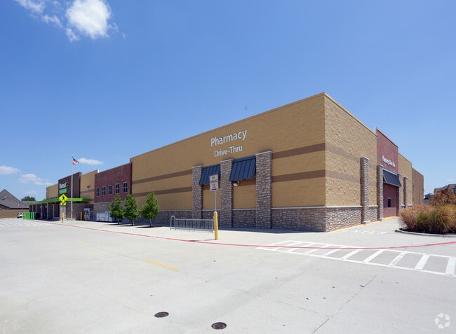
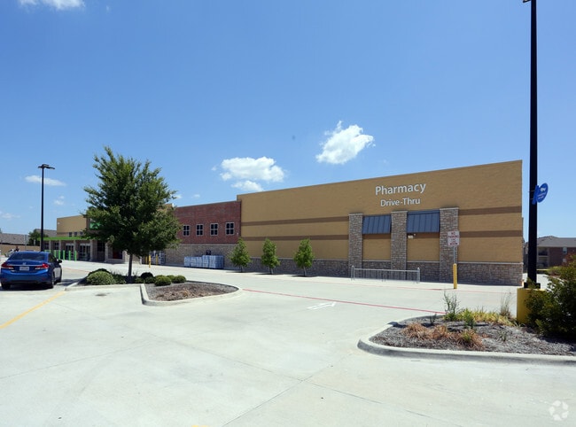
Property Detail
1400 Mccreary Rd
Dallas-Fort Worth-Arlington, TX
CREEKSIDE RETAIL ADDITION, BLK A, LOT 2
R-10697-00A-0010-1
COLLIN
Commercialnec
Texas
B and X Area of moderate flood hazard, usually the area between the limits of the 100-year and 500-year floods.
2
2025
5.25 AC
2025
Murphy/Wylie
031319
Dallas/Ft Worth
42,544 SF
NEARBY LISTINGS FOR SALE OR LEASE
DEMOGRAPHICS near 1400 Mccreary Rd
1 mile
3 mile
5 mile
2025 Total Population
14,757
70,861
194,972
2030 Population
16,660
80,397
219,407
Pop Growth 2025-2030
+ 12.90%
+ 13.46%
+ 12.53%
Average Age
37
38
38
2025 Total Households
4,312
21,193
62,138
HH Growth 2025-2030
+ 13.08%
+ 13.73%
+ 12.66%
Median Household Inc
$137,733
$139,182
$128,636
Avg Household Size
3.40
3.30
3.10
2025 Avg HH Vehicles
2.00
2.00
2.00
Median Home Value
$521,250
$503,439
$478,504
Median Year Built
2005
2005
2003
Nearby Places
Map Layers
Map Styles
 Street
 Aerial
Layers
 Traffic
 Biking
Places
Listings with unknown addresses are not visible on the map
- Restaurants
- Banks
- Shops
- Fitness
- Groceries
PUBLIC TRANSPORTATION
AIRPORT
Dallas Love Field
Drive
Walk
Distance
Dallas Love Field
42 min
27.6 mi
Dallas-Fort Worth International
Drive
Walk
Distance
Dallas-Fort Worth International
47 min
35.6 mi
Nearby Properties
Address
Land Use
TOTAL SIZE
Lot Size
Zoning
Address
Land Use
TOTAL SIZE
Lot Size
Zoning
418,520 SF
103.29 AC
Address
Land Use
TOTAL SIZE
Lot Size
Zoning
339,663 SF
95.04 AC
Address
Land Use
TOTAL SIZE
Lot Size
Zoning
285,392 SF
19.44 AC
MF-M
Address
Land Use
TOTAL SIZE
Lot Size
Zoning
441,356 SF
74.94 AC
Address
Land Use
TOTAL SIZE
Lot Size
Zoning
385,735 SF
13.13 AC
Address
Land Use
TOTAL SIZE
Lot Size
Zoning
332,047 SF
18.48 AC
MF-L
Address
Land Use
TOTAL SIZE
Lot Size
Zoning
257,718 SF
13.10 AC
RESIDENTIA
Address
Land Use
TOTAL SIZE
Lot Size
Zoning
368,750 SF
26.71 AC
A
Address
Land Use
TOTAL SIZE
Lot Size
Zoning
203,383 SF
11.91 AC
MF-M
Address
Land Use
TOTAL SIZE
Lot Size
Zoning
274,329 SF
44.89 AC
Address
Land Use
TOTAL SIZE
Lot Size
Zoning
114,945 SF
19.71 AC
TC
Address
Land Use
TOTAL SIZE
Lot Size
Zoning
746 SF
115.14 AC
Address
Land Use
TOTAL SIZE
Lot Size
Zoning
140,130 SF
19.67 AC
Address
Land Use
TOTAL SIZE
Lot Size
Zoning
78,708 SF
9.55 AC
Address
Land Use
TOTAL SIZE
Lot Size
Zoning
102,786 SF
28.88 AC
Address
Land Use
TOTAL SIZE
Lot Size
Zoning
77,225 SF
9.59 AC
Address
Land Use
TOTAL SIZE
Lot Size
Zoning
191,200 SF
20.69 AC
TC
Address
Land Use
TOTAL SIZE
Lot Size
Zoning
186,220 SF
13.64 AC
Address
Land Use
TOTAL SIZE
Lot Size
Zoning
123,621 SF
12.22 AC
Address
Land Use
TOTAL SIZE
Lot Size
Zoning
141,396 SF
8.40 AC
NS
Address
Land Use
TOTAL SIZE
Lot Size
Zoning
221,982 SF
17.21 AC
Address
Land Use
TOTAL SIZE
Lot Size
Zoning
36,305 SF
3.55 AC
COMM
Address
Land Use
TOTAL SIZE
Lot Size
Zoning
123,540 SF
8.04 AC
LC
Address
Land Use
TOTAL SIZE
Lot Size
Zoning
71,636 SF
16.56 AC
Address
Land Use
TOTAL SIZE
Lot Size
Zoning
79,636 SF
10.16 AC
Address
Land Use
TOTAL SIZE
Lot Size
Zoning
51,878 SF
3.30 AC
PD
Address
Land Use
TOTAL SIZE
Lot Size
Zoning
139,454 SF
14.53 AC
TC
Address
Land Use
TOTAL SIZE
Lot Size
Zoning
63,446 SF
10.25 AC
IP-M(1)/SP
Address
Land Use
TOTAL SIZE
Lot Size
Zoning
84,874 SF
9 AC
SFR
Address
Land Use
TOTAL SIZE
Lot Size
Zoning
105,113 SF
2.12 AC
PD
The World's #1 Commercial Real Estate Marketplace
Connect with us
© 2026 CoStar Group
The information above has been obtained from sources believed reliable. While we do not doubt its accuracy we have not verified it and make no guarantee, warranty or representation about it. It is your responsibility to independently confirm its accuracy and completeness. Any projections, opinions, assumptions, or estimates used are for example only and do not represent the current or future performance of the property. The value of this transaction to you depends on tax and other factors which should be evaluated by your tax, financial, and legal advisors. You and your advisors should conduct a careful, independent investigation of the property to determine to your satisfaction the suitability of the property for your needs.