Property Record
1400 N 3Rd St, Lawrence, KS 66044


NEARBY LISTINGS FOR SALE OR LEASE
Property Detail
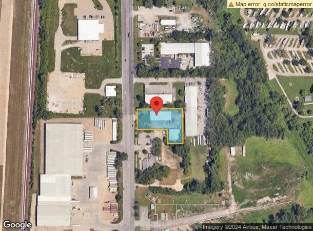
1400 N 3Rd St
Lawrence, KS
Subdivision 1564
023-074-19-0-10-02-005.03-0
RM ONE SUB A REPLAT OF FRONTIER LAND SUB IN NE 1/4 19-12-20 LT 1
Warehouse
Douglas
X
Kansas
20045C0176E
1
2025
0.94 AC
2025
Lawrence
000100
Kansas City
6,250 SF
DEMOGRAPHICS near 1400 N 3Rd St
1 Mile
3 Mile
5 Mile
2024 Total Population
790
32,320
84,967
2029 Population
822
33,021
86,717
Pop Growth 2024-2029
+ 4.05%
+ 2.17%
+ 2.06%
Average Age
41
35
35
2024 Total Households
307
13,569
35,526
HH Growth 2024-2029
+ 3.91%
+ 2.34%
+ 2.25%
Median Household Inc
$66,409
$52,037
$54,453
Avg Household Size
2.40
2.10
2.10
2024 Avg HH Vehicles
2.00
2.00
2.00
Median Home Value
$213,978
$224,983
$227,200
Median Year Built
1993
1976
1984
Nearby Places
Map Layers
Map Styles
 Street
 Aerial
- Restaurants
- Banks
- Shops
- Fitness
- Groceries
PUBLIC TRANSPORTATION
COMMUTER RAIL
DRIVE
WALK
Distance
5 min
2.2 mi
AIRPORT
Kansas City International
DRIVE
WALK
Distance
Kansas City International
56 min
48.8 mi
Nearby Properties
Address
Land Use
TOTAL SIZE
Lot Size
Zoning
Address
Land Use
TOTAL SIZE
Lot Size
Zoning
1,709,524 SF
32.03 AC
RD
Address
Land Use
TOTAL SIZE
Lot Size
Zoning
1,258,819 SF
106.65 AC
RD
Address
Land Use
TOTAL SIZE
Lot Size
Zoning
63,837 SF
20.79 AC
H
Address
Land Use
TOTAL SIZE
Lot Size
Zoning
335,349 SF
3.17 AC
RD
Address
Land Use
TOTAL SIZE
Lot Size
Zoning
112,500 SF
3.90 AC
RM1
Address
Land Use
TOTAL SIZE
Lot Size
Zoning
47,457 SF
2.58 AC
Address
Land Use
TOTAL SIZE
Lot Size
Zoning
220,557 SF
8.90 AC
RD
Address
Land Use
TOTAL SIZE
Lot Size
Zoning
162,086 SF
3 AC
RD
Address
Land Use
TOTAL SIZE
Lot Size
Zoning
67,500 SF
4.03 AC
RM1
Address
Land Use
TOTAL SIZE
Lot Size
Zoning
181,346 SF
21.40 AC
497
Address
Land Use
TOTAL SIZE
Lot Size
Zoning
186,889 SF
3.60 AC
RD
Address
Land Use
TOTAL SIZE
Lot Size
Zoning
143,467 SF
2.80 AC
RM1
Address
Land Use
TOTAL SIZE
Lot Size
Zoning
5,984 SF
142.30 AC
M2
Address
Land Use
TOTAL SIZE
Lot Size
Zoning
337,280 SF
0.60 AC
RD
Address
Land Use
TOTAL SIZE
Lot Size
Zoning
31,750 SF
0.73 AC
Address
Land Use
TOTAL SIZE
Lot Size
Zoning
34,479 SF
1.08 AC
C4
Address
Land Use
TOTAL SIZE
Lot Size
Zoning
131,625 SF
2.32 AC
C3
Address
Land Use
TOTAL SIZE
Lot Size
Zoning
2,728 SF
305 AC
RS1
Address
Land Use
TOTAL SIZE
Lot Size
Zoning
24,600 SF
8.90 AC
M3
Address
Land Use
TOTAL SIZE
Lot Size
Zoning
53,064 SF
5.79 AC
M2
Address
Land Use
TOTAL SIZE
Lot Size
Zoning
53,678 SF
9.40 AC
RS2
Address
Land Use
TOTAL SIZE
Lot Size
Zoning
54,719 SF
5.30 AC
RS2
Address
Land Use
TOTAL SIZE
Lot Size
Zoning
47,152 SF
4.16 AC
RS2
Address
Land Use
TOTAL SIZE
Lot Size
Zoning
5,506 SF
6.10 AC
Address
Land Use
TOTAL SIZE
Lot Size
Zoning
35,209 SF
4.56 AC
O1
Address
Land Use
TOTAL SIZE
Lot Size
Zoning
21,856 SF
0.86 AC
RO1
Address
Land Use
TOTAL SIZE
Lot Size
Zoning
467,472 SF
5.06 AC
RD
Address
Land Use
TOTAL SIZE
Lot Size
Zoning
38,914 SF
0.67 AC
C3
Address
Land Use
TOTAL SIZE
Lot Size
Zoning
48,077 SF
8.70 AC
RS2
Address
Land Use
TOTAL SIZE
Lot Size
Zoning
49,918 SF
3 AC
RD
The World's #1 Commercial Real Estate Marketplace
Connect with us
© 2025 CoStar Group
The information above has been obtained from sources believed reliable. While we do not doubt its accuracy we have not verified it and make no guarantee, warranty or representation about it. It is your responsibility to independently confirm its accuracy and completeness. Any projections, opinions, assumptions, or estimates used are for example only and do not represent the current or future performance of the property. The value of this transaction to you depends on tax and other factors which should be evaluated by your tax, financial, and legal advisors. You and your advisors should conduct a careful, independent investigation of the property to determine to your satisfaction the suitability of the property for your needs.