Property Record
1400 Noxon Rd, Lagrangeville, NY 12540


NEARBY LISTINGS FOR SALE OR LEASE
-
-
View all Lagrangeville listings for sale on LoopNet.com
Property Detail
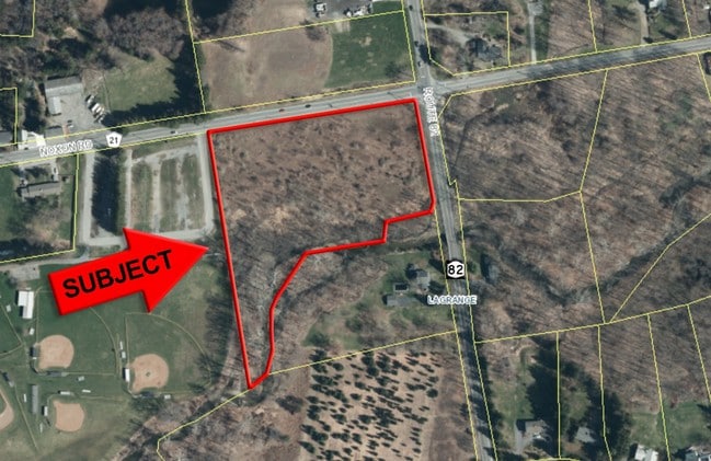
1400 Noxon Rd
133400-6560-04-672178-0000
6 AC
Apartment
Dutchess
AE
New York
36027C0394E
672
2025
5.47 AC
2024
Fishkill
080104
Westchester/So Connecticut
22,816 SF
Dutchess County-Putnam County, NY
DEMOGRAPHICS near 1400 Noxon Rd
1 Mile
3 Mile
5 Mile
2024 Total Population
1,351
12,203
34,800
2029 Population
1,344
12,247
34,789
Pop Growth 2024-2029
(0.52%)
+ 0.36%
(0.03%)
Average Age
43
42
42
2024 Total Households
485
4,339
11,856
HH Growth 2024-2029
(0.62%)
+ 0.37%
(0.04%)
Median Household Inc
$107,291
$110,902
$120,501
Avg Household Size
2.80
2.80
2.80
2024 Avg HH Vehicles
2.00
2.00
2.00
Median Home Value
$441,562
$414,090
$414,926
Median Year Built
1973
1980
1980
Nearby Places
Map Layers
Map Styles
 Street
 Aerial
- Restaurants
- Banks
- Shops
- Fitness
- Groceries
PUBLIC TRANSPORTATION
AIRPORT
New York Stewart International
DRIVE
WALK
Distance
New York Stewart International
44 min
29.9 mi
Freight Ports
Port of New Haven
DRIVE
WALK
Distance
Port of New Haven
98 min
70.0 mi
SALE & LEASE HISTORY
LISTING DATE
SALE/LEASE

Jul 19, 2017
For Sale
Nearby Properties
Address
Land Use
TOTAL SIZE
Lot Size
Zoning
Address
Land Use
TOTAL SIZE
Lot Size
Zoning
247,216 SF
65.67 AC
RFD
Address
Land Use
TOTAL SIZE
Lot Size
Zoning
100 SF
86.38 AC
TC
Address
Land Use
TOTAL SIZE
Lot Size
Zoning
13.98 AC
TC
Address
Land Use
TOTAL SIZE
Lot Size
Zoning
122,319 SF
23.12 AC
TCR
Address
Land Use
TOTAL SIZE
Lot Size
Zoning
10,448 SF
80.50 AC
RLD
Address
Land Use
TOTAL SIZE
Lot Size
Zoning
55,520 SF
26.30 AC
RLD
Address
Land Use
TOTAL SIZE
Lot Size
Zoning
200 SF
486.87 AC
SPR
Address
Land Use
TOTAL SIZE
Lot Size
Zoning
48,720 SF
12 AC
RMD
Address
Land Use
TOTAL SIZE
Lot Size
Zoning
Address
Land Use
TOTAL SIZE
Lot Size
Zoning
3.65 AC
RFD
Address
Land Use
TOTAL SIZE
Lot Size
Zoning
Address
Land Use
TOTAL SIZE
Lot Size
Zoning
171,944 SF
10.49 AC
GB
Address
Land Use
TOTAL SIZE
Lot Size
Zoning
64,052 SF
18.57 AC
GH
Address
Land Use
TOTAL SIZE
Lot Size
Zoning
48,600 SF
3.88 AC
TCB
Address
Land Use
TOTAL SIZE
Lot Size
Zoning
38,610 SF
14.52 AC
TCB
Address
Land Use
TOTAL SIZE
Lot Size
Zoning
Address
Land Use
TOTAL SIZE
Lot Size
Zoning
4,611 SF
388.78 AC
RA3
Address
Land Use
TOTAL SIZE
Lot Size
Zoning
23,053 SF
165.05 AC
RA3
Address
Land Use
TOTAL SIZE
Lot Size
Zoning
71,124 SF
5.05 AC
TCB
Address
Land Use
TOTAL SIZE
Lot Size
Zoning
21,925 SF
4.20 AC
GB
Address
Land Use
TOTAL SIZE
Lot Size
Zoning
2,024 SF
1.86 AC
B1
Address
Land Use
TOTAL SIZE
Lot Size
Zoning
83,570 SF
21 AC
C
Address
Land Use
TOTAL SIZE
Lot Size
Zoning
22,912 SF
14.47 AC
C
Address
Land Use
TOTAL SIZE
Lot Size
Zoning
100.30 AC
RD10
Address
Land Use
TOTAL SIZE
Lot Size
Zoning
11,472 SF
28.56 AC
TCR
Address
Land Use
TOTAL SIZE
Lot Size
Zoning
7,458 SF
246.70 AC
RLD
Address
Land Use
TOTAL SIZE
Lot Size
Zoning
Address
Land Use
TOTAL SIZE
Lot Size
Zoning
32,484 SF
13.49 AC
TCB
Address
Land Use
TOTAL SIZE
Lot Size
Zoning
16,171 SF
2.80 AC
B1
Address
Land Use
TOTAL SIZE
Lot Size
Zoning
15,240 SF
4.03 AC
B1
The World's #1 Commercial Real Estate Marketplace
Connect with us
© 2026 CoStar Group
The information above has been obtained from sources believed reliable. While we do not doubt its accuracy we have not verified it and make no guarantee, warranty or representation about it. It is your responsibility to independently confirm its accuracy and completeness. Any projections, opinions, assumptions, or estimates used are for example only and do not represent the current or future performance of the property. The value of this transaction to you depends on tax and other factors which should be evaluated by your tax, financial, and legal advisors. You and your advisors should conduct a careful, independent investigation of the property to determine to your satisfaction the suitability of the property for your needs.