Property Record
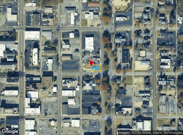
1400 Quintard Ave, Anniston, AL 36201
NEARBY LISTINGS FOR SALE OR LEASE
Property Detail
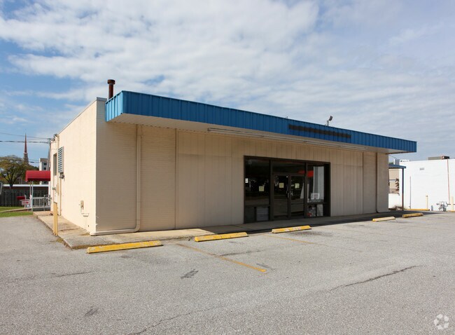
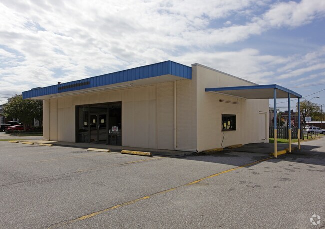
1400 Quintard Ave
21-03-05-3-003-067.000
Anniston City Land Company
Restaurantdrivein
SEC 05 TSP 16S RNG 08E ANNISTON CITY LAND CO BLK 12 E 95 LOT 7 ANNISTON AL S5 T16 R8
X
Calhoun
01015C0312E
Alabama
2025
7
2025
0.15 AC
000800
Other Market Areas
2,087 SF
Anniston-Oxford-Jacksonville, AL
DEMOGRAPHICS near 1400 Quintard Ave
1 Mile
3 Mile
5 Mile
2024 Total Population
7,084
24,068
46,086
2029 Population
7,214
24,199
45,799
Pop Growth 2024-2029
+ 1.84%
+ 0.54%
(0.62%)
Average Age
42
42
42
2024 Total Households
2,992
10,167
19,301
HH Growth 2024-2029
+ 2.01%
+ 0.52%
(0.66%)
Median Household Inc
$24,653
$32,360
$40,008
Avg Household Size
2.10
2.20
2.20
2024 Avg HH Vehicles
1.00
2.00
2.00
Median Home Value
$68,829
$84,409
$109,688
Median Year Built
1957
1967
1972
Nearby Places
Map Layers
Map Styles
 Street
 Aerial
- Restaurants
- Banks
- Shops
- Fitness
- Groceries
PUBLIC TRANSPORTATION
COMMUTER RAIL
DRIVE
WALK
Distance
3 min
1.2 mi
SALE & LEASE HISTORY
LISTING DATE
SALE/LEASE

May 08, 2018
For Lease
Nearby Properties
Address
Land Use
TOTAL SIZE
Lot Size
Zoning
Address
Land Use
TOTAL SIZE
Lot Size
Zoning
319,650 SF
10.69 AC
Address
Land Use
TOTAL SIZE
Lot Size
Zoning
12,496 SF
7.39 AC
Address
Land Use
TOTAL SIZE
Lot Size
Zoning
4,520 SF
8.20 AC
Address
Land Use
TOTAL SIZE
Lot Size
Zoning
73,027 SF
1.60 AC
Address
Land Use
TOTAL SIZE
Lot Size
Zoning
21,766 SF
3.06 AC
Address
Land Use
TOTAL SIZE
Lot Size
Zoning
5.32 AC
Address
Land Use
TOTAL SIZE
Lot Size
Zoning
17,254 SF
22 AC
Address
Land Use
TOTAL SIZE
Lot Size
Zoning
341,374 SF
15.88 AC
Address
Land Use
TOTAL SIZE
Lot Size
Zoning
31,832 SF
16 AC
Address
Land Use
TOTAL SIZE
Lot Size
Zoning
14,082 SF
3.85 AC
Address
Land Use
TOTAL SIZE
Lot Size
Zoning
5,581 SF
1.01 AC
Address
Land Use
TOTAL SIZE
Lot Size
Zoning
42,158 SF
5.20 AC
Address
Land Use
TOTAL SIZE
Lot Size
Zoning
3.67 AC
Address
Land Use
TOTAL SIZE
Lot Size
Zoning
71,060 SF
2.20 AC
Address
Land Use
TOTAL SIZE
Lot Size
Zoning
103,550 SF
9.15 AC
Address
Land Use
TOTAL SIZE
Lot Size
Zoning
6.94 AC
Address
Land Use
TOTAL SIZE
Lot Size
Zoning
6,400 SF
12.24 AC
Address
Land Use
TOTAL SIZE
Lot Size
Zoning
6,912 SF
12.68 AC
Address
Land Use
TOTAL SIZE
Lot Size
Zoning
34,564 SF
1.60 AC
Address
Land Use
TOTAL SIZE
Lot Size
Zoning
24,132 SF
5.02 AC
Address
Land Use
TOTAL SIZE
Lot Size
Zoning
Address
Land Use
TOTAL SIZE
Lot Size
Zoning
13,568 SF
1.60 AC
Address
Land Use
TOTAL SIZE
Lot Size
Zoning
11,880 SF
23.44 AC
Address
Land Use
TOTAL SIZE
Lot Size
Zoning
40,520 SF
4.01 AC
Address
Land Use
TOTAL SIZE
Lot Size
Zoning
8,032 SF
10.30 AC
Address
Land Use
TOTAL SIZE
Lot Size
Zoning
24,700 SF
2.32 AC
Address
Land Use
TOTAL SIZE
Lot Size
Zoning
100,000 SF
4.83 AC
Address
Land Use
TOTAL SIZE
Lot Size
Zoning
53,200 SF
45.40 AC
Address
Land Use
TOTAL SIZE
Lot Size
Zoning
47,164 SF
1.37 AC
Address
Land Use
TOTAL SIZE
Lot Size
Zoning
The World's #1 Commercial Real Estate Marketplace
Connect with us
© 2025 CoStar Group
The information above has been obtained from sources believed reliable. While we do not doubt its accuracy we have not verified it and make no guarantee, warranty or representation about it. It is your responsibility to independently confirm its accuracy and completeness. Any projections, opinions, assumptions, or estimates used are for example only and do not represent the current or future performance of the property. The value of this transaction to you depends on tax and other factors which should be evaluated by your tax, financial, and legal advisors. You and your advisors should conduct a careful, independent investigation of the property to determine to your satisfaction the suitability of the property for your needs.