Property Record
1400 S Dixie Hwy, Lantana, FL 33462
NEARBY LISTINGS FOR SALE OR LEASE
Property Detail
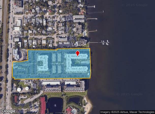
1400 S Dixie Hwy
40-43-45-03-46-000-0000
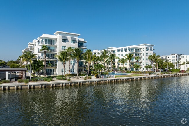
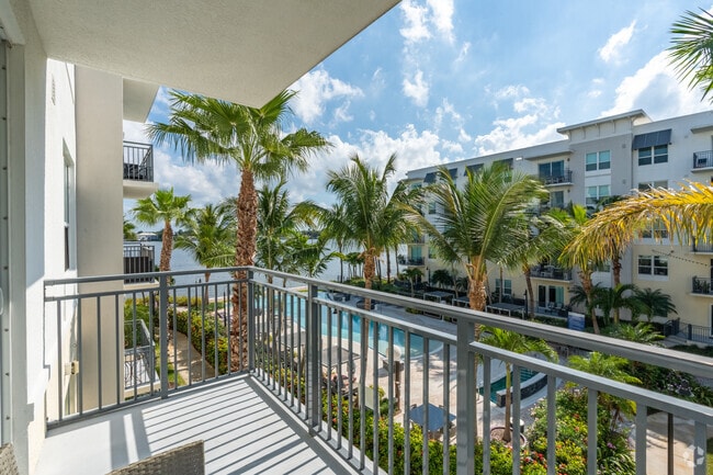
Aura Seaside
Multifamilydwelling
AURA SEASIDE REPLAT PAR A
AE
Palm Beach
12099C0783G
Florida
2024
9.21 AC
2025
Outer Boynton Beach
005501
South Florida
327,864 SF
West Palm Beach-Boca Raton-Delray Beach, FL
DEMOGRAPHICS near 1400 S Dixie Hwy
1 Mile
3 Mile
5 Mile
2024 Total Population
11,456
88,662
230,120
2029 Population
11,752
93,087
239,853
Pop Growth 2024-2029
+ 2.58%
+ 4.99%
+ 4.23%
Average Age
42
42
42
2024 Total Households
4,563
35,341
90,918
HH Growth 2024-2029
+ 2.34%
+ 5.39%
+ 4.46%
Median Household Inc
$70,961
$60,945
$63,827
Avg Household Size
2.40
2.30
2.40
2024 Avg HH Vehicles
2.00
2.00
2.00
Median Home Value
$295,631
$289,554
$296,758
Median Year Built
1975
1980
1981
Nearby Places
Map Layers
Map Styles
 Street
 Aerial
- Restaurants
- Banks
- Shops
- Fitness
- Groceries
PUBLIC TRANSPORTATION
COMMUTER RAIL
Boynton Beach (Mangonia Park - Miami Airport - Tri-Rail, Tri-County Commuter - Tri-Rail)
DRIVE
WALK
Distance
Boynton Beach (Mangonia Park - Miami Airport - Tri-Rail, Tri-County Commuter - Tri-Rail)
8 min
3.4 mi
Lake Worth (Mangonia Park - Miami Airport - Tri-Rail, Tri-County Commuter - Tri-Rail)
DRIVE
WALK
Distance
Lake Worth (Mangonia Park - Miami Airport - Tri-Rail, Tri-County Commuter - Tri-Rail)
10 min
4.8 mi
AIRPORT
Palm Beach International
DRIVE
WALK
Distance
Palm Beach International
18 min
11.4 mi
Freight Ports
Port of Palm Beach
DRIVE
WALK
Distance
Port of Palm Beach
28 min
16.8 mi
Nearby Properties
Address
Land Use
TOTAL SIZE
Lot Size
Zoning
Address
Land Use
TOTAL SIZE
Lot Size
Zoning
337,437 SF
8.01 AC
C3
Address
Land Use
TOTAL SIZE
Lot Size
Zoning
1,028,686 SF
63.78 AC
PID
Address
Land Use
TOTAL SIZE
Lot Size
Zoning
508,032 SF
18 AC
MXD
Address
Land Use
TOTAL SIZE
Lot Size
Zoning
357,168 SF
16.13 AC
MXD
Address
Land Use
TOTAL SIZE
Lot Size
Zoning
311,983 SF
7.15 AC
C1
Address
Land Use
TOTAL SIZE
Lot Size
Zoning
211,774 SF
304.50 AC
PO
Address
Land Use
TOTAL SIZE
Lot Size
Zoning
353,007 SF
33.60 AC
RS
Address
Land Use
TOTAL SIZE
Lot Size
Zoning
437,380 SF
18.05 AC
PID
Address
Land Use
TOTAL SIZE
Lot Size
Zoning
214,095 SF
7.67 AC
PUD
Address
Land Use
TOTAL SIZE
Lot Size
Zoning
240,786 SF
10.63 AC
R3
Address
Land Use
TOTAL SIZE
Lot Size
Zoning
476,774 SF
38.76 AC
RM
Address
Land Use
TOTAL SIZE
Lot Size
Zoning
296,033 SF
2.04 AC
TOD-E
Address
Land Use
TOTAL SIZE
Lot Size
Zoning
291,589 SF
11.63 AC
PID
Address
Land Use
TOTAL SIZE
Lot Size
Zoning
215,310 SF
21.35 AC
PUD
Address
Land Use
TOTAL SIZE
Lot Size
Zoning
263,799 SF
8.36 AC
PUD
Address
Land Use
TOTAL SIZE
Lot Size
Zoning
12,856 SF
2.03 AC
R1-C
Address
Land Use
TOTAL SIZE
Lot Size
Zoning
84,999 SF
10.28 AC
R-C2
Address
Land Use
TOTAL SIZE
Lot Size
Zoning
198,114 SF
13.75 AC
PID
Address
Land Use
TOTAL SIZE
Lot Size
Zoning
142,635 SF
10.66 AC
PID
Address
Land Use
TOTAL SIZE
Lot Size
Zoning
7,284 SF
19.49 AC
BAC
Address
Land Use
TOTAL SIZE
Lot Size
Zoning
11,762 SF
1.46 AC
R1-C
Address
Land Use
TOTAL SIZE
Lot Size
Zoning
122,613 SF
63.40 AC
P
Address
Land Use
TOTAL SIZE
Lot Size
Zoning
10,775 SF
1.60 AC
R1-C
Address
Land Use
TOTAL SIZE
Lot Size
Zoning
12,354 SF
1.84 AC
RHM
Address
Land Use
TOTAL SIZE
Lot Size
Zoning
58,081 SF
67.01 AC
MI
Address
Land Use
TOTAL SIZE
Lot Size
Zoning
68,055 SF
11.76 AC
CM
Address
Land Use
TOTAL SIZE
Lot Size
Zoning
141,623 SF
11.39 AC
PID
Address
Land Use
TOTAL SIZE
Lot Size
Zoning
97,059 SF
6.55 AC
PID
Address
Land Use
TOTAL SIZE
Lot Size
Zoning
97,976 SF
4.41 AC
PID
The World's #1 Commercial Real Estate Marketplace
Connect with us
© 2026 CoStar Group
The information above has been obtained from sources believed reliable. While we do not doubt its accuracy we have not verified it and make no guarantee, warranty or representation about it. It is your responsibility to independently confirm its accuracy and completeness. Any projections, opinions, assumptions, or estimates used are for example only and do not represent the current or future performance of the property. The value of this transaction to you depends on tax and other factors which should be evaluated by your tax, financial, and legal advisors. You and your advisors should conduct a careful, independent investigation of the property to determine to your satisfaction the suitability of the property for your needs.