Property Record
14001 N Shadowglen Blvd, Austin, TX 78723
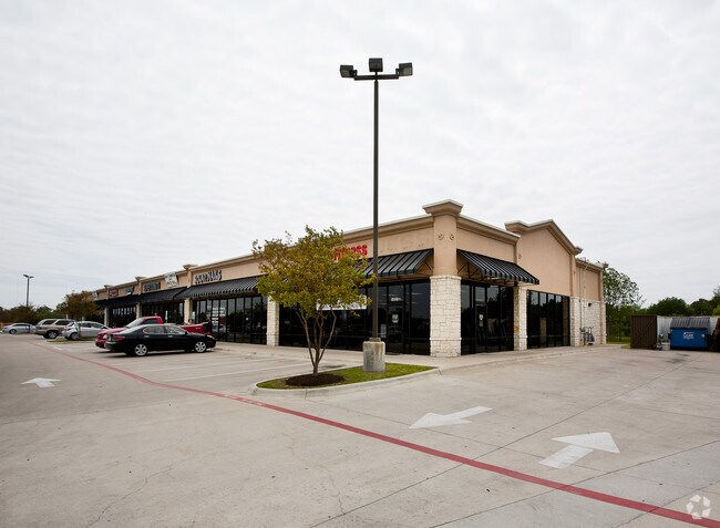

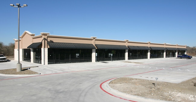
Property Detail
14001 N Shadowglen Blvd
Austin-Round Rock-San Marcos, TX
LOT 1 SHADOWGLEN COMMERCIAL LOTS SUBD
707692
TRAVIS
Stripcommercialcenter
Texas
A Areas with a 1% annual chance of flooding and a 26% chance of flooding over the life of a 30-year mortgage.
1
2025
2.50 AC
2025
Far Northeast
002106
Austin
15,470 SF
NEARBY LISTINGS FOR SALE OR LEASE
-
-
View all Austin listings for lease on LoopNet.com
DEMOGRAPHICS near 14001 N Shadowglen Blvd
1 mile
3 mile
5 mile
2025 Total Population
5,532
30,725
47,612
2030 Population
5,959
33,007
51,009
Pop Growth 2025-2030
+ 7.72%
+ 7.43%
+ 7.13%
Average Age
37
35
36
2025 Total Households
1,817
9,738
15,300
HH Growth 2025-2030
+ 8.37%
+ 8.14%
+ 7.82%
Median Household Inc
$80,800
$93,713
$100,701
Avg Household Size
3.00
3.10
3.10
2025 Avg HH Vehicles
2.00
2.00
2.00
Median Home Value
$382,524
$355,781
$365,142
Median Year Built
2010
2010
2010
Nearby Places
Map Layers
Map Styles
 Street
 Aerial
Layers
 Traffic
 Biking
Places
Listings with unknown addresses are not visible on the map
- Restaurants
- Banks
- Shops
- Fitness
- Groceries
PUBLIC TRANSPORTATION
AIRPORT
Austin-Bergstrom International
Drive
Walk
Distance
Austin-Bergstrom International
29 min
18.6 mi
SALE & LEASE HISTORY
LISTING DATE
SALE/LEASE

Sep 24, 2016
For Lease
Oct 08, 2021
For Lease
Mar 18, 2024
For Lease
Nearby Properties
Address
Land Use
TOTAL SIZE
Lot Size
Zoning
Address
Land Use
TOTAL SIZE
Lot Size
Zoning
411,429 SF
61.03 AC
Address
Land Use
TOTAL SIZE
Lot Size
Zoning
358,683 SF
17.54 AC
Address
Land Use
TOTAL SIZE
Lot Size
Zoning
483,840 SF
47.88 AC
Address
Land Use
TOTAL SIZE
Lot Size
Zoning
469,500 SF
24.44 AC
Address
Land Use
TOTAL SIZE
Lot Size
Zoning
255,750 SF
13.38 AC
Address
Land Use
TOTAL SIZE
Lot Size
Zoning
264,000 SF
14.22 AC
Address
Land Use
TOTAL SIZE
Lot Size
Zoning
300,492 SF
13.20 AC
Address
Land Use
TOTAL SIZE
Lot Size
Zoning
266,564 SF
27.40 AC
Address
Land Use
TOTAL SIZE
Lot Size
Zoning
204,356 SF
12.18 AC
Address
Land Use
TOTAL SIZE
Lot Size
Zoning
423,360 SF
32.31 AC
Address
Land Use
TOTAL SIZE
Lot Size
Zoning
223,575 SF
12.47 AC
Address
Land Use
TOTAL SIZE
Lot Size
Zoning
149,640 SF
10.39 AC
Address
Land Use
TOTAL SIZE
Lot Size
Zoning
178,200 SF
31.29 AC
Address
Land Use
TOTAL SIZE
Lot Size
Zoning
191,300 SF
30.73 AC
Address
Land Use
TOTAL SIZE
Lot Size
Zoning
158,000 SF
23.60 AC
Address
Land Use
TOTAL SIZE
Lot Size
Zoning
351,000 SF
23.22 AC
Address
Land Use
TOTAL SIZE
Lot Size
Zoning
150,000 SF
10.04 AC
Address
Land Use
TOTAL SIZE
Lot Size
Zoning
75,000 SF
97.48 AC
Address
Land Use
TOTAL SIZE
Lot Size
Zoning
248,325 SF
14.73 AC
Address
Land Use
TOTAL SIZE
Lot Size
Zoning
111,966 SF
11.61 AC
Address
Land Use
TOTAL SIZE
Lot Size
Zoning
138,000 SF
9.69 AC
Address
Land Use
TOTAL SIZE
Lot Size
Zoning
109,184 SF
13.45 AC
Address
Land Use
TOTAL SIZE
Lot Size
Zoning
132,500 SF
15.56 AC
Address
Land Use
TOTAL SIZE
Lot Size
Zoning
147,908 SF
15.54 AC
Address
Land Use
TOTAL SIZE
Lot Size
Zoning
200.38 AC
Address
Land Use
TOTAL SIZE
Lot Size
Zoning
51,910 SF
13.19 AC
Address
Land Use
TOTAL SIZE
Lot Size
Zoning
3,460 SF
150.67 AC
Address
Land Use
TOTAL SIZE
Lot Size
Zoning
100,100 SF
8.52 AC
Address
Land Use
TOTAL SIZE
Lot Size
Zoning
137.27 AC
Address
Land Use
TOTAL SIZE
Lot Size
Zoning
67,410 SF
7 AC
The World's #1 Commercial Real Estate Marketplace
Connect with us
© 2026 CoStar Group
The information above has been obtained from sources believed reliable. While we do not doubt its accuracy we have not verified it and make no guarantee, warranty or representation about it. It is your responsibility to independently confirm its accuracy and completeness. Any projections, opinions, assumptions, or estimates used are for example only and do not represent the current or future performance of the property. The value of this transaction to you depends on tax and other factors which should be evaluated by your tax, financial, and legal advisors. You and your advisors should conduct a careful, independent investigation of the property to determine to your satisfaction the suitability of the property for your needs.