Property Record
14004 Immokalee Rd, Naples, FL 34120

Save to a Folder
{{folder.Name}}
{{folder.ListingIds.length}} Properties
{{folder.ListingIds.length}} Property
Create a New Folder
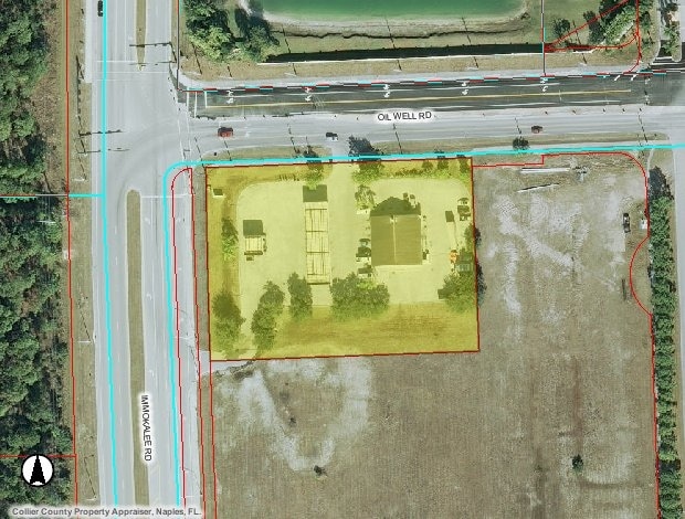
Property Detail
14004 Immokalee Rd
64700625608
ORANGE TREE UNIT THREE CITRUS GREENS SECTION, PH 1-A N 245FT OF W 380FT LESS W 25FT LESS ORDER OF TAKING 02-2212 DESC IN OR 3111 PG 557
Servicestation
COLLIER
PUD
Florida
AH Areas with a 1% annual chance of shallow flooding, usually in the form of a pond, withan average depth ranging from 1 to 3 feet. These areas have a 26% chance of flooding over the life of a 30-year mortgage.
1.1
2024
1.91 AC
2025
Outlying Collier County
011212
Southwest Florida
3,111 SF
Naples-Marco Island, FL
NEARBY LISTINGS FOR SALE OR LEASE
-
-
View all Naples listings for sale on LoopNet.com
DEMOGRAPHICS near 14004 Immokalee Rd
1 mile
3 mile
5 mile
2025 Total Population
2,710
14,939
33,424
2030 Population
2,910
16,088
36,087
Pop Growth 2025-2030
+ 7.38%
+ 7.69%
+ 7.97%
Average Age
39
41
42
2025 Total Households
854
4,861
11,283
HH Growth 2025-2030
+ 6.56%
+ 7.04%
+ 7.76%
Median Household Inc
$72,668
$97,757
$101,768
Avg Household Size
3.00
2.90
2.80
2025 Avg HH Vehicles
2.00
2.00
2.00
Median Home Value
$537,859
$533,788
$536,654
Median Year Built
2004
2005
2006
Nearby Places
Map Layers
Map Styles
 Street
 Aerial
Layers
 Traffic
 Biking
Places
Listings with unknown addresses are not visible on the map
- Restaurants
- Banks
- Shops
- Fitness
- Groceries
PUBLIC TRANSPORTATION
AIRPORT
Southwest Florida International
Drive
Walk
Distance
Southwest Florida International
45 min
32.8 mi
Nearby Properties
Address
Land Use
TOTAL SIZE
Lot Size
Zoning
Address
Land Use
TOTAL SIZE
Lot Size
Zoning
233,528 SF
133.41 AC
PUD
Address
Land Use
TOTAL SIZE
Lot Size
Zoning
235,587 SF
53.75 AC
PUD
Address
Land Use
TOTAL SIZE
Lot Size
Zoning
36,827 SF
216.19 AC
PUD
Address
Land Use
TOTAL SIZE
Lot Size
Zoning
62,557 SF
254.05 AC
A-MHO
Address
Land Use
TOTAL SIZE
Lot Size
Zoning
67,872 SF
13.39 AC
Address
Land Use
TOTAL SIZE
Lot Size
Zoning
32.90 AC
Address
Land Use
TOTAL SIZE
Lot Size
Zoning
33,307 SF
85.96 AC
PUD
Address
Land Use
TOTAL SIZE
Lot Size
Zoning
50,770 SF
6.60 AC
MPUD
Address
Land Use
TOTAL SIZE
Lot Size
Zoning
5,760 SF
2.01 AC
Address
Land Use
TOTAL SIZE
Lot Size
Zoning
1,332 SF
16.86 AC
PUD
Address
Land Use
TOTAL SIZE
Lot Size
Zoning
13,301 SF
2.09 AC
MPUD
Address
Land Use
TOTAL SIZE
Lot Size
Zoning
2,182 SF
346.36 AC
PUD
Address
Land Use
TOTAL SIZE
Lot Size
Zoning
784 SF
390.87 AC
A
Address
Land Use
TOTAL SIZE
Lot Size
Zoning
20,356 SF
2.55 AC
PUD
Address
Land Use
TOTAL SIZE
Lot Size
Zoning
2.18 AC
Address
Land Use
TOTAL SIZE
Lot Size
Zoning
672 SF
633.94 AC
A-MHO
Address
Land Use
TOTAL SIZE
Lot Size
Zoning
2.07 AC
Address
Land Use
TOTAL SIZE
Lot Size
Zoning
2.07 AC
Address
Land Use
TOTAL SIZE
Lot Size
Zoning
2.82 AC
Address
Land Use
TOTAL SIZE
Lot Size
Zoning
4,462 SF
1.17 AC
Address
Land Use
TOTAL SIZE
Lot Size
Zoning
5,454 SF
1.28 AC
MPUD
Address
Land Use
TOTAL SIZE
Lot Size
Zoning
1.60 AC
Address
Land Use
TOTAL SIZE
Lot Size
Zoning
1.45 AC
Address
Land Use
TOTAL SIZE
Lot Size
Zoning
14,450 SF
6.91 AC
MPUD
Address
Land Use
TOTAL SIZE
Lot Size
Zoning
3.23 AC
E
The World's #1 Commercial Real Estate Marketplace
Connect with us
© 2026 CoStar Group
The information above has been obtained from sources believed reliable. While we do not doubt its accuracy we have not verified it and make no guarantee, warranty or representation about it. It is your responsibility to independently confirm its accuracy and completeness. Any projections, opinions, assumptions, or estimates used are for example only and do not represent the current or future performance of the property. The value of this transaction to you depends on tax and other factors which should be evaluated by your tax, financial, and legal advisors. You and your advisors should conduct a careful, independent investigation of the property to determine to your satisfaction the suitability of the property for your needs.