Property Record
1401 E Main St, Magnolia, AR 71753


Property Detail
1401 E Main St
Magnolia, AR
TULLIS ADDITION BLOCK 1 LOTS 4, 5, 6; 15, AND 16 BOOK 2017 PAGE 2655 1401 E MAIN LOTS 4, 5, 6, 15 AND 16, BLOCK 1 OF TULLIS A
01-03603-00000
Columbia
Restaurantdrivein
Arkansas
B and X Area of moderate flood hazard, usually the area between the limits of the 100-year and 500-year floods.
4-6,15
2025
0.90 AC
2025
Arkansas South Area
950500
Other Market Areas
2,962 SF
NEARBY LISTINGS FOR SALE OR LEASE
DEMOGRAPHICS near 1401 E Main St
1 mile
3 mile
5 mile
2025 Total Population
3,533
11,859
13,606
2030 Population
3,475
11,679
13,359
Pop Growth 2025-2030
(1.64%)
(1.52%)
(1.82%)
Average Age
38
37
38
2025 Total Households
1,657
4,436
5,158
HH Growth 2025-2030
(1.57%)
(1.47%)
(1.80%)
Median Household Inc
$33,401
$42,091
$43,198
Avg Household Size
2.10
2.20
2.20
2025 Avg HH Vehicles
2.00
2.00
2.00
Median Home Value
$142,537
$185,687
$196,788
Median Year Built
1969
1971
1973
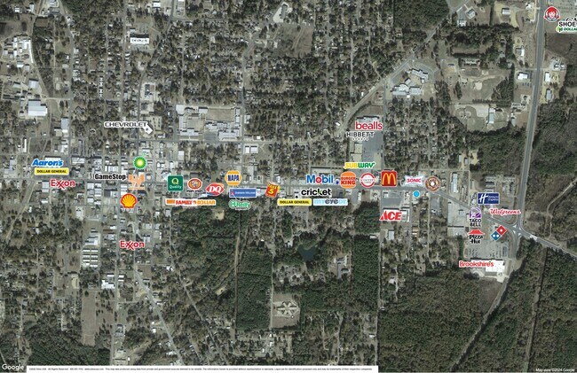
Nearby Places
Map Layers
Map Styles
 Street
 Aerial
Transit
 Traffic
 Biking
Places
Listings with unknown addresses are not visible on the map
- Restaurants
- Banks
- Shops
- Fitness
- Groceries
SALE & LEASE HISTORY
LISTING DATE
SALE/LEASE

May 12, 2017
For Sale
Jul 26, 2024
For Lease
Nearby Properties
Address
Land Use
TOTAL SIZE
Lot Size
Zoning
Address
Land Use
TOTAL SIZE
Lot Size
Zoning
432,882 SF
16.37 AC
Address
Land Use
TOTAL SIZE
Lot Size
Zoning
156,106 SF
17.99 AC
Address
Land Use
TOTAL SIZE
Lot Size
Zoning
19,314 SF
9.50 AC
Address
Land Use
TOTAL SIZE
Lot Size
Zoning
44,014 SF
15.20 AC
Address
Land Use
TOTAL SIZE
Lot Size
Zoning
37,516 SF
1.69 AC
Address
Land Use
TOTAL SIZE
Lot Size
Zoning
109,820 SF
13.67 AC
Address
Land Use
TOTAL SIZE
Lot Size
Zoning
25,848 SF
0.57 AC
Address
Land Use
TOTAL SIZE
Lot Size
Zoning
33,104 SF
2 AC
Address
Land Use
TOTAL SIZE
Lot Size
Zoning
40,496 SF
Address
Land Use
TOTAL SIZE
Lot Size
Zoning
2,172 SF
6.36 AC
Address
Land Use
TOTAL SIZE
Lot Size
Zoning
25,900 SF
12 AC
Address
Land Use
TOTAL SIZE
Lot Size
Zoning
32,705 SF
2.50 AC
Address
Land Use
TOTAL SIZE
Lot Size
Zoning
65,394 SF
6.98 AC
Address
Land Use
TOTAL SIZE
Lot Size
Zoning
67,332 SF
3.45 AC
Address
Land Use
TOTAL SIZE
Lot Size
Zoning
282,499 SF
9.08 AC
Address
Land Use
TOTAL SIZE
Lot Size
Zoning
74,783 SF
7.26 AC
Address
Land Use
TOTAL SIZE
Lot Size
Zoning
35,680 SF
2.82 AC
Address
Land Use
TOTAL SIZE
Lot Size
Zoning
43,913 SF
2.40 AC
Address
Land Use
TOTAL SIZE
Lot Size
Zoning
20,024 SF
2.95 AC
Address
Land Use
TOTAL SIZE
Lot Size
Zoning
1,288 SF
9.25 AC
Address
Land Use
TOTAL SIZE
Lot Size
Zoning
80,892 SF
3.45 AC
Address
Land Use
TOTAL SIZE
Lot Size
Zoning
42,336 SF
5.35 AC
Address
Land Use
TOTAL SIZE
Lot Size
Zoning
9,320 SF
7.08 AC
Address
Land Use
TOTAL SIZE
Lot Size
Zoning
55,580 SF
2.29 AC
Address
Land Use
TOTAL SIZE
Lot Size
Zoning
14,796 SF
0.82 AC
Address
Land Use
TOTAL SIZE
Lot Size
Zoning
118,818 SF
7.88 AC
Address
Land Use
TOTAL SIZE
Lot Size
Zoning
1,263 SF
4 AC
Address
Land Use
TOTAL SIZE
Lot Size
Zoning
14,980 SF
1.76 AC
Address
Land Use
TOTAL SIZE
Lot Size
Zoning
31,702 SF
1.55 AC
Address
Land Use
TOTAL SIZE
Lot Size
Zoning
35,292 SF
The World's #1 Commercial Real Estate Marketplace
Connect with us
© 2026 CoStar Group
The information above has been obtained from sources believed reliable. While we do not doubt its accuracy we have not verified it and make no guarantee, warranty or representation about it. It is your responsibility to independently confirm its accuracy and completeness. Any projections, opinions, assumptions, or estimates used are for example only and do not represent the current or future performance of the property. The value of this transaction to you depends on tax and other factors which should be evaluated by your tax, financial, and legal advisors. You and your advisors should conduct a careful, independent investigation of the property to determine to your satisfaction the suitability of the property for your needs.