Property Record
1401 Kassan Dr N, Prescott, WI 54021


NEARBY LISTINGS FOR SALE OR LEASE
-
-
View all Prescott listings for sale on LoopNet.com
Property Detail
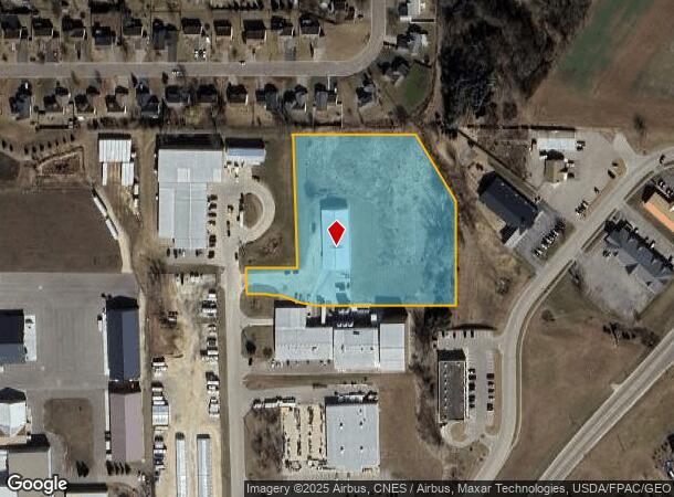
1401 Kassan Dr N
Minneapolis-St. Paul-Bloomington, MN-WI
LOT 1 CSM V 3 P 203 CONT 4.13 A BEING PRT OF SE 1/4 OF SW 1/4 SUBJ TO RDWAY EASEMENT RDWAY EASEMENTS REMOVED DOC 597087 (#129
271-01150-2000
Pierce
Commercialnec
Wisconsin
X
1
27037C0175E
4.13 AC
2024
Pierce County
2024
Minneapolis/St Paul
960500
DEMOGRAPHICS near 1401 Kassan Dr N
1 Mile
3 Mile
5 Mile
2024 Total Population
3,717
7,404
27,125
2029 Population
3,883
7,705
27,881
Pop Growth 2024-2029
+ 4.47%
+ 4.07%
+ 2.79%
Average Age
40
41
41
2024 Total Households
1,457
2,914
11,050
HH Growth 2024-2029
+ 4.60%
+ 4.08%
+ 2.73%
Median Household Inc
$75,463
$85,873
$85,495
Avg Household Size
2.50
2.50
2.40
2024 Avg HH Vehicles
2.00
2.00
2.00
Median Home Value
$253,554
$284,261
$279,427
Median Year Built
1985
1985
1982
Nearby Places
Map Layers
Map Styles
 Street
 Aerial
- Restaurants
- Banks
- Shops
- Fitness
- Groceries
PUBLIC TRANSPORTATION
AIRPORT
Minneapolis-St Paul International/Wold-Chamberlain
DRIVE
WALK
Distance
Minneapolis-St Paul International/Wold-Chamberlain
42 min
28.7 mi
Nearby Properties
Address
Land Use
TOTAL SIZE
Lot Size
Zoning
Address
Land Use
TOTAL SIZE
Lot Size
Zoning
42.33 AC
Address
Land Use
TOTAL SIZE
Lot Size
Zoning
15.71 AC
Address
Land Use
TOTAL SIZE
Lot Size
Zoning
6.63 AC
Address
Land Use
TOTAL SIZE
Lot Size
Zoning
12.17 AC
Address
Land Use
TOTAL SIZE
Lot Size
Zoning
Address
Land Use
TOTAL SIZE
Lot Size
Zoning
5.30 AC
Address
Land Use
TOTAL SIZE
Lot Size
Zoning
11,496 SF
81.36 AC
Address
Land Use
TOTAL SIZE
Lot Size
Zoning
4.57 AC
Address
Land Use
TOTAL SIZE
Lot Size
Zoning
2,076 SF
Address
Land Use
TOTAL SIZE
Lot Size
Zoning
3.55 AC
Address
Land Use
TOTAL SIZE
Lot Size
Zoning
6.60 AC
Address
Land Use
TOTAL SIZE
Lot Size
Zoning
1,460 SF
35.71 AC
Address
Land Use
TOTAL SIZE
Lot Size
Zoning
1.51 AC
Address
Land Use
TOTAL SIZE
Lot Size
Zoning
2,980 SF
Address
Land Use
TOTAL SIZE
Lot Size
Zoning
3,949 SF
Address
Land Use
TOTAL SIZE
Lot Size
Zoning
Address
Land Use
TOTAL SIZE
Lot Size
Zoning
1.41 AC
Address
Land Use
TOTAL SIZE
Lot Size
Zoning
1.23 AC
Address
Land Use
TOTAL SIZE
Lot Size
Zoning
16,304 SF
29.12 AC
Address
Land Use
TOTAL SIZE
Lot Size
Zoning
1,902 SF
88.83 AC
Address
Land Use
TOTAL SIZE
Lot Size
Zoning
1,514 SF
Address
Land Use
TOTAL SIZE
Lot Size
Zoning
3,159 SF
44.01 AC
Address
Land Use
TOTAL SIZE
Lot Size
Zoning
3.31 AC
Address
Land Use
TOTAL SIZE
Lot Size
Zoning
1.03 AC
Address
Land Use
TOTAL SIZE
Lot Size
Zoning
159.67 AC
Address
Land Use
TOTAL SIZE
Lot Size
Zoning
0.46 AC
Address
Land Use
TOTAL SIZE
Lot Size
Zoning
2,512 SF
Address
Land Use
TOTAL SIZE
Lot Size
Zoning
2,256 SF
43.85 AC
The World's #1 Commercial Real Estate Marketplace
Connect with us
© 2026 CoStar Group
The information above has been obtained from sources believed reliable. While we do not doubt its accuracy we have not verified it and make no guarantee, warranty or representation about it. It is your responsibility to independently confirm its accuracy and completeness. Any projections, opinions, assumptions, or estimates used are for example only and do not represent the current or future performance of the property. The value of this transaction to you depends on tax and other factors which should be evaluated by your tax, financial, and legal advisors. You and your advisors should conduct a careful, independent investigation of the property to determine to your satisfaction the suitability of the property for your needs.