Property Record
1401 N Main St, Manahawkin, NJ 08050


This Property Is For Sale
NEARBY LISTINGS FOR SALE OR LEASE
-
-
View all Manahawkin listings for sale on LoopNet.com
Property Detail
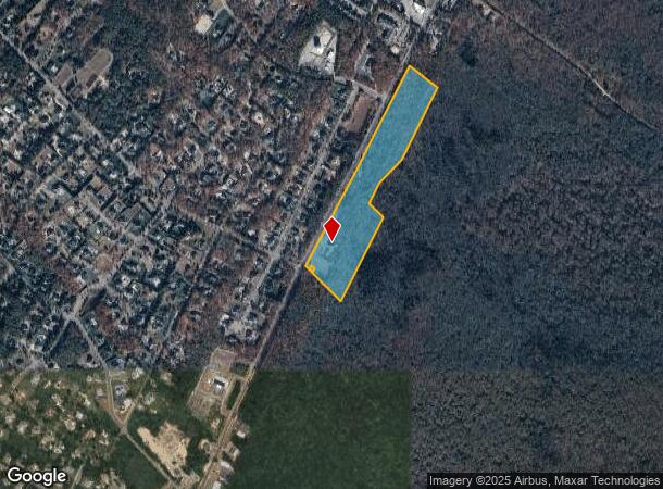
1401 N Main St
31-00296-0000-00001-01
25.459AC MAUSOLEUM
Cemetery
Ocean
X
New Jersey
34029C0501G
1.1
0
25.46 AC
2025
Ocean County
735104
Northern New Jersey
1,809 SF
New York-Jersey City-White Plains, NY-NJ
DEMOGRAPHICS near 1401 N Main St
1 Mile
3 Mile
5 Mile
2024 Total Population
2,450
34,199
63,859
2029 Population
2,586
36,450
69,045
Pop Growth 2024-2029
+ 5.55%
+ 6.58%
+ 8.12%
Average Age
38
39
44
2024 Total Households
828
11,966
25,111
HH Growth 2024-2029
+ 5.43%
+ 6.18%
+ 7.92%
Median Household Inc
$91,666
$87,809
$90,097
Avg Household Size
2.90
2.70
2.50
2024 Avg HH Vehicles
2.00
2.00
2.00
Median Home Value
$356,541
$297,534
$329,017
Median Year Built
1990
1992
1992
Nearby Places
Map Layers
Map Styles
 Street
 Aerial
- Restaurants
- Banks
- Shops
- Fitness
- Groceries
PUBLIC TRANSPORTATION
AIRPORT
Atlantic City International
DRIVE
WALK
Distance
Atlantic City International
63 min
33.8 mi
Freight Ports
Port of Philadelphia
DRIVE
WALK
Distance
Port of Philadelphia
70 min
56.9 mi
Nearby Properties
Address
Land Use
TOTAL SIZE
Lot Size
Zoning
Address
Land Use
TOTAL SIZE
Lot Size
Zoning
107,490 SF
30 AC
HC
Address
Land Use
TOTAL SIZE
Lot Size
Zoning
21.78 AC
HMC
Address
Land Use
TOTAL SIZE
Lot Size
Zoning
13.83 AC
CN
Address
Land Use
TOTAL SIZE
Lot Size
Zoning
15.71 AC
BP
Address
Land Use
TOTAL SIZE
Lot Size
Zoning
22.43 AC
BP
Address
Land Use
TOTAL SIZE
Lot Size
Zoning
12.04 AC
BP
Address
Land Use
TOTAL SIZE
Lot Size
Zoning
15.03 AC
BP
Address
Land Use
TOTAL SIZE
Lot Size
Zoning
9,920 SF
20.75 AC
HC
Address
Land Use
TOTAL SIZE
Lot Size
Zoning
4,232 SF
119.80 AC
R3P/
Address
Land Use
TOTAL SIZE
Lot Size
Zoning
125,352 SF
12.86 AC
HC
Address
Land Use
TOTAL SIZE
Lot Size
Zoning
118,850 SF
21.73 AC
HC
Address
Land Use
TOTAL SIZE
Lot Size
Zoning
100,988 SF
7.72 AC
HC
Address
Land Use
TOTAL SIZE
Lot Size
Zoning
4,479 SF
18.27 AC
MU
Address
Land Use
TOTAL SIZE
Lot Size
Zoning
44.75 AC
MLS/
Address
Land Use
TOTAL SIZE
Lot Size
Zoning
13.99 AC
MLSC
Address
Land Use
TOTAL SIZE
Lot Size
Zoning
55,605 SF
9.25 AC
HC
Address
Land Use
TOTAL SIZE
Lot Size
Zoning
91.97 AC
RGL/
Address
Land Use
TOTAL SIZE
Lot Size
Zoning
28.01 AC
BP
Address
Land Use
TOTAL SIZE
Lot Size
Zoning
7.49 AC
R20
Address
Land Use
TOTAL SIZE
Lot Size
Zoning
116,625 SF
17.46 AC
HC
Address
Land Use
TOTAL SIZE
Lot Size
Zoning
101,202 SF
16.10 AC
HC
Address
Land Use
TOTAL SIZE
Lot Size
Zoning
7.54 AC
BP
Address
Land Use
TOTAL SIZE
Lot Size
Zoning
67,548 SF
10.98 AC
CN
Address
Land Use
TOTAL SIZE
Lot Size
Zoning
11.06 AC
MLS/
Address
Land Use
TOTAL SIZE
Lot Size
Zoning
86,000 SF
2.87 AC
R20
Address
Land Use
TOTAL SIZE
Lot Size
Zoning
8,300 SF
1.07 AC
HMC/
Address
Land Use
TOTAL SIZE
Lot Size
Zoning
6.21 AC
BP
Address
Land Use
TOTAL SIZE
Lot Size
Zoning
3.81 AC
HMC
Address
Land Use
TOTAL SIZE
Lot Size
Zoning
37.27 AC
RGL/
Address
Land Use
TOTAL SIZE
Lot Size
Zoning
6.36 AC
RGL/
The World's #1 Commercial Real Estate Marketplace
Connect with us
© 2025 CoStar Group
The information above has been obtained from sources believed reliable. While we do not doubt its accuracy we have not verified it and make no guarantee, warranty or representation about it. It is your responsibility to independently confirm its accuracy and completeness. Any projections, opinions, assumptions, or estimates used are for example only and do not represent the current or future performance of the property. The value of this transaction to you depends on tax and other factors which should be evaluated by your tax, financial, and legal advisors. You and your advisors should conduct a careful, independent investigation of the property to determine to your satisfaction the suitability of the property for your needs.