Property Record
1401 N Maize Rd, Wichita, KS 67212
NEARBY LISTINGS FOR SALE OR LEASE
Property Detail
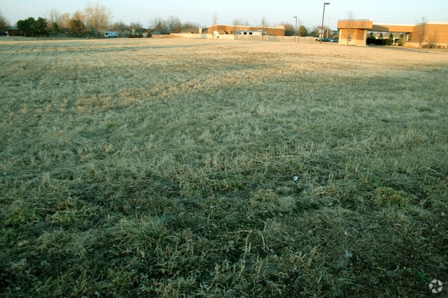
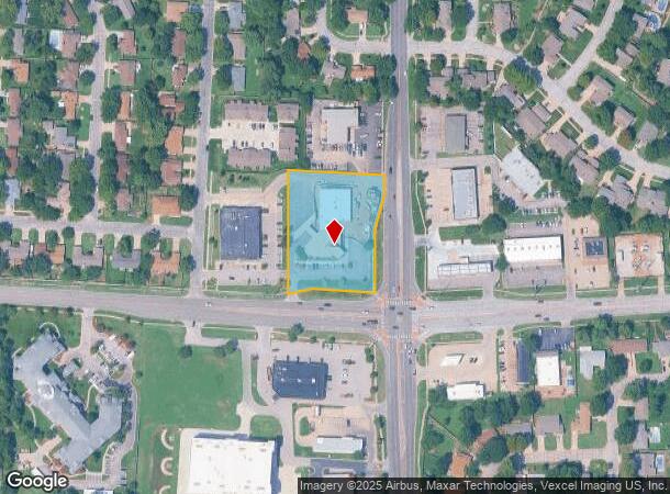
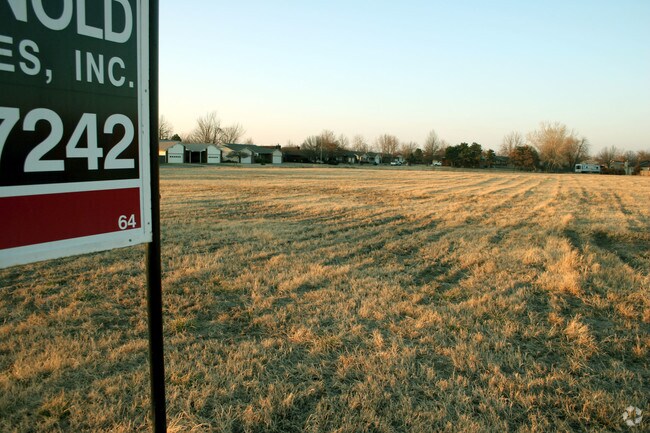
1401 N Maize Rd
Wichita, KS
Westgate Village 2Nd Add
133-07-0-41-04-026.01
LOT 1 WESTGATE VILLAGE 2ND ADD.
Financialbuilding
Sedgwick
X
Kansas
20173C0329G
1
2024
1.96 AC
2025
Goddard/West
009506
Wichita
15,549 SF
DEMOGRAPHICS near 1401 N Maize Rd
1 Mile
3 Mile
5 Mile
2024 Total Population
10,944
64,632
114,393
2029 Population
10,946
65,003
115,880
Pop Growth 2024-2029
+ 0.02%
+ 0.57%
+ 1.30%
Average Age
42
41
40
2024 Total Households
4,298
25,554
44,779
HH Growth 2024-2029
0.00%
+ 0.56%
+ 1.32%
Median Household Inc
$83,714
$77,951
$73,655
Avg Household Size
2.50
2.50
2.50
2024 Avg HH Vehicles
2.00
2.00
2.00
Median Home Value
$184,144
$212,868
$196,532
Median Year Built
1983
1988
1988
Nearby Places
Map Layers
Map Styles
 Street
 Aerial
- Restaurants
- Banks
- Shops
- Fitness
- Groceries
PUBLIC TRANSPORTATION
AIRPORT
Wichita Dwight D Eisenhower Ntl
DRIVE
WALK
Distance
Wichita Dwight D Eisenhower Ntl
12 min
6.5 mi
Freight Ports
Tulsa Port Of Catoosa
DRIVE
WALK
Distance
Tulsa Port Of Catoosa
215 min
199.1 mi
Nearby Properties
Address
Land Use
TOTAL SIZE
Lot Size
Zoning
Address
Land Use
TOTAL SIZE
Lot Size
Zoning
662,237 SF
179.74 AC
SF-5
Address
Land Use
TOTAL SIZE
Lot Size
Zoning
143,939 SF
10.88 AC
PUD
Address
Land Use
TOTAL SIZE
Lot Size
Zoning
303,559 SF
123.23 AC
SF-5
Address
Land Use
TOTAL SIZE
Lot Size
Zoning
82,854 SF
49.09 AC
LC,SF-5
Address
Land Use
TOTAL SIZE
Lot Size
Zoning
113,253 SF
21.17 AC
SF-5
Address
Land Use
TOTAL SIZE
Lot Size
Zoning
102,794 SF
14.78 AC
SF-5
Address
Land Use
TOTAL SIZE
Lot Size
Zoning
99,933 SF
9.98 AC
SF-5
Address
Land Use
TOTAL SIZE
Lot Size
Zoning
143,704 SF
19.22 AC
SF-5
Address
Land Use
TOTAL SIZE
Lot Size
Zoning
136,717 SF
11.18 AC
SF-5
Address
Land Use
TOTAL SIZE
Lot Size
Zoning
38,927 SF
5 AC
LC
Address
Land Use
TOTAL SIZE
Lot Size
Zoning
79,775 SF
7.94 AC
SF-5
Address
Land Use
TOTAL SIZE
Lot Size
Zoning
173,604 SF
21.29 AC
LC
Address
Land Use
TOTAL SIZE
Lot Size
Zoning
65,504 SF
6.81 AC
SF-5
Address
Land Use
TOTAL SIZE
Lot Size
Zoning
62,321 SF
13.21 AC
SF-5
Address
Land Use
TOTAL SIZE
Lot Size
Zoning
51,845 SF
5.51 AC
SF-5
Address
Land Use
TOTAL SIZE
Lot Size
Zoning
56,627 SF
14.01 AC
SF-5
Address
Land Use
TOTAL SIZE
Lot Size
Zoning
47,158 SF
211.18 AC
SF-20,LC
Address
Land Use
TOTAL SIZE
Lot Size
Zoning
60,085 SF
7.37 AC
SF-5
Address
Land Use
TOTAL SIZE
Lot Size
Zoning
31,132 SF
4.14 AC
B
Address
Land Use
TOTAL SIZE
Lot Size
Zoning
65,110 SF
3.94 AC
B
Address
Land Use
TOTAL SIZE
Lot Size
Zoning
50,188 SF
10.06 AC
LC
Address
Land Use
TOTAL SIZE
Lot Size
Zoning
33,953 SF
10.05 AC
SF-5
Address
Land Use
TOTAL SIZE
Lot Size
Zoning
63,178 SF
15.51 AC
MF-29
Address
Land Use
TOTAL SIZE
Lot Size
Zoning
37,055 SF
19.24 AC
SF-20
Address
Land Use
TOTAL SIZE
Lot Size
Zoning
56,821 SF
2.68 AC
SF-5
Address
Land Use
TOTAL SIZE
Lot Size
Zoning
46,007 SF
13.19 AC
MF-29
Address
Land Use
TOTAL SIZE
Lot Size
Zoning
87.72 AC
SF-5
Address
Land Use
TOTAL SIZE
Lot Size
Zoning
26,681 SF
9.54 AC
SF-5
Address
Land Use
TOTAL SIZE
Lot Size
Zoning
43,536 SF
6.35 AC
SF-5
Address
Land Use
TOTAL SIZE
Lot Size
Zoning
94,866 SF
7.40 AC
LC
The World's #1 Commercial Real Estate Marketplace
Connect with us
© 2025 CoStar Group
The information above has been obtained from sources believed reliable. While we do not doubt its accuracy we have not verified it and make no guarantee, warranty or representation about it. It is your responsibility to independently confirm its accuracy and completeness. Any projections, opinions, assumptions, or estimates used are for example only and do not represent the current or future performance of the property. The value of this transaction to you depends on tax and other factors which should be evaluated by your tax, financial, and legal advisors. You and your advisors should conduct a careful, independent investigation of the property to determine to your satisfaction the suitability of the property for your needs.