Property Record
1401 Root St, Plainfield, IL 60586
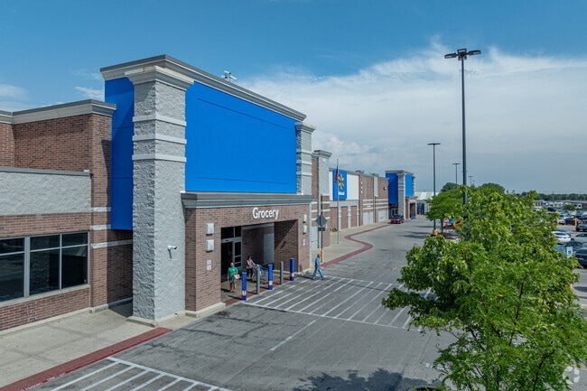

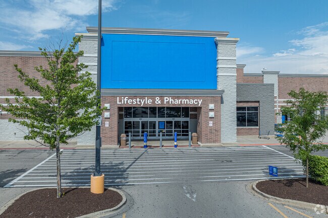
Property Detail
1401 Root St
Chicago-Naperville-Elgin, IL-IN
LOT 1 IN RESUB OF LOTS 1 2 OF WAL-MART SUB, BEING A SUB OF PRT OF THE E1/2 OF THE NE1/4 OF SEC 4, T35N-R9E.
05-06-04-201-016
WILL
Commercialnec
Illinois
B and X Area of moderate flood hazard, usually the area between the limits of the 100-year and 500-year floods.
1
2023
25 AC
2024
Joliet/Central Will
880430
Chicago
NEARBY LISTINGS FOR SALE OR LEASE
DEMOGRAPHICS near 1401 Root St
1 mile
3 mile
5 mile
2025 Total Population
14,086
76,476
163,116
2030 Population
14,221
77,645
166,765
Pop Growth 2025-2030
+ 0.96%
+ 1.53%
+ 2.24%
Average Age
38
39
39
2025 Total Households
4,631
25,697
56,559
HH Growth 2025-2030
+ 1.10%
+ 1.52%
+ 2.10%
Median Household Inc
$113,525
$112,230
$102,026
Avg Household Size
2.90
2.90
2.80
2025 Avg HH Vehicles
2.00
2.00
2.00
Median Home Value
$311,245
$307,608
$298,209
Median Year Built
2000
1997
1996
Nearby Places
Map Layers
Map Styles
 Street
 Aerial
Transit
 Traffic
 Biking
Places
Listings with unknown addresses are not visible on the map
- Restaurants
- Banks
- Shops
- Fitness
- Groceries
PUBLIC TRANSPORTATION
COMMUTER RAIL
Joliet Station (Heritage Corridor Line - Northeast Illinois Regional Commuter Railroad (Metra), Rock Island District Line - Northeast Illinois Regional Commuter Railroad (Metra))
Drive
Walk
Distance
Joliet Station (Heritage Corridor Line - Northeast Illinois Regional Commuter Railroad (Metra), Rock Island District Line - Northeast Illinois Regional Commuter Railroad (Metra))
18 min
8.3 mi
AIRPORT
Chicago Midway International
Drive
Walk
Distance
Chicago Midway International
49 min
32.2 mi
Freight Ports
Port Milwaukee
Drive
Walk
Distance
Port Milwaukee
147 min
115.4 mi
Nearby Properties
Address
Land Use
TOTAL SIZE
Lot Size
Zoning
Address
Land Use
TOTAL SIZE
Lot Size
Zoning
32.49 AC
Address
Land Use
TOTAL SIZE
Lot Size
Zoning
16.91 AC
Address
Land Use
TOTAL SIZE
Lot Size
Zoning
5.12 AC
Address
Land Use
TOTAL SIZE
Lot Size
Zoning
Address
Land Use
TOTAL SIZE
Lot Size
Zoning
1.66 AC
Address
Land Use
TOTAL SIZE
Lot Size
Zoning
84,899 SF
3.98 AC
Address
Land Use
TOTAL SIZE
Lot Size
Zoning
16,359 SF
1.26 AC
Address
Land Use
TOTAL SIZE
Lot Size
Zoning
8.46 AC
Address
Land Use
TOTAL SIZE
Lot Size
Zoning
64,046 SF
5.41 AC
Address
Land Use
TOTAL SIZE
Lot Size
Zoning
123,698 SF
10.88 AC
Address
Land Use
TOTAL SIZE
Lot Size
Zoning
105,825 SF
2.62 AC
Address
Land Use
TOTAL SIZE
Lot Size
Zoning
65,977 SF
5.07 AC
Address
Land Use
TOTAL SIZE
Lot Size
Zoning
52,132 SF
6.48 AC
Address
Land Use
TOTAL SIZE
Lot Size
Zoning
68,154 SF
6.94 AC
Address
Land Use
TOTAL SIZE
Lot Size
Zoning
64,624 SF
12.04 AC
Address
Land Use
TOTAL SIZE
Lot Size
Zoning
200,000 SF
5.82 AC
Address
Land Use
TOTAL SIZE
Lot Size
Zoning
2.64 AC
Address
Land Use
TOTAL SIZE
Lot Size
Zoning
16.46 AC
Address
Land Use
TOTAL SIZE
Lot Size
Zoning
8.55 AC
Address
Land Use
TOTAL SIZE
Lot Size
Zoning
106,715 SF
10.96 AC
Address
Land Use
TOTAL SIZE
Lot Size
Zoning
70,600 SF
5 AC
Address
Land Use
TOTAL SIZE
Lot Size
Zoning
45,838 SF
5.06 AC
Address
Land Use
TOTAL SIZE
Lot Size
Zoning
36,756 SF
4.06 AC
Address
Land Use
TOTAL SIZE
Lot Size
Zoning
2.58 AC
Address
Land Use
TOTAL SIZE
Lot Size
Zoning
38,835 SF
6.29 AC
Address
Land Use
TOTAL SIZE
Lot Size
Zoning
Address
Land Use
TOTAL SIZE
Lot Size
Zoning
145.35 AC
Address
Land Use
TOTAL SIZE
Lot Size
Zoning
3.27 AC
Address
Land Use
TOTAL SIZE
Lot Size
Zoning
34,557 SF
2.63 AC
The World's #1 Commercial Real Estate Marketplace
Connect with us
© 2026 CoStar Group
The information above has been obtained from sources believed reliable. While we do not doubt its accuracy we have not verified it and make no guarantee, warranty or representation about it. It is your responsibility to independently confirm its accuracy and completeness. Any projections, opinions, assumptions, or estimates used are for example only and do not represent the current or future performance of the property. The value of this transaction to you depends on tax and other factors which should be evaluated by your tax, financial, and legal advisors. You and your advisors should conduct a careful, independent investigation of the property to determine to your satisfaction the suitability of the property for your needs.