Property Record
1401 Route 130 Rd, Robbinsville, NJ 08691

NEARBY LISTINGS FOR SALE OR LEASE
Property Detail
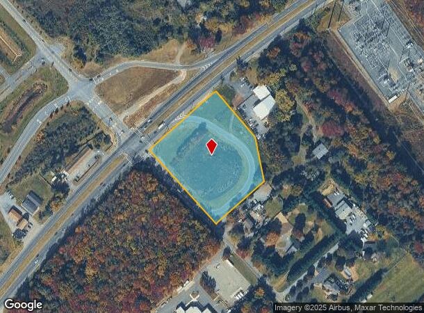
1401 Route 130 Rd
Trenton, NJ
Parcel Map For N J S H Us Route 130
12-00017-0000-00025
US HWY ROUTE 130 AT VOELBEL RD
Governmentalpublicusegeneral
Mercer
X
New Jersey
34021C0252F
25
0
3.46 AC
2025
Trenton
004309
Northern New Jersey
DEMOGRAPHICS near 1401 Route 130 Rd
1 Mile
3 Mile
5 Mile
2024 Total Population
1,292
28,870
79,417
2029 Population
1,278
28,347
78,310
Pop Growth 2024-2029
(1.08%)
(1.81%)
(1.39%)
Average Age
42
42
41
2024 Total Households
432
10,383
28,260
HH Growth 2024-2029
(1.16%)
(2.11%)
(1.59%)
Median Household Inc
$133,889
$117,960
$129,835
Avg Household Size
2.90
2.70
2.80
2024 Avg HH Vehicles
2.00
2.00
2.00
Median Home Value
$387,867
$416,616
$417,712
Median Year Built
1974
1981
1981
Nearby Places
Map Layers
Map Styles
 Street
 Aerial
- Restaurants
- Banks
- Shops
- Fitness
- Groceries
PUBLIC TRANSPORTATION
COMMUTER RAIL
Princeton Junction (Northeast Corridor Line - NJ Transit Commuter Rail (NJ Transit), Princeton Branch - NJ Transit Commuter Rail (NJ Transit))
DRIVE
WALK
Distance
Princeton Junction (Northeast Corridor Line - NJ Transit Commuter Rail (NJ Transit), Princeton Branch - NJ Transit Commuter Rail (NJ Transit))
15 min
7.8 mi
Hamilton (Northeast Corridor Line - NJ Transit Commuter Rail (NJ Transit))
DRIVE
WALK
Distance
Hamilton (Northeast Corridor Line - NJ Transit Commuter Rail (NJ Transit))
16 min
8.4 mi
AIRPORT
Trenton Mercer
DRIVE
WALK
Distance
Trenton Mercer
30 min
18.9 mi
Freight Ports
Port of Philadelphia
DRIVE
WALK
Distance
Port of Philadelphia
54 min
40.7 mi
Nearby Properties
Address
Land Use
TOTAL SIZE
Lot Size
Zoning
Address
Land Use
TOTAL SIZE
Lot Size
Zoning
57.09 AC
R-1
Address
Land Use
TOTAL SIZE
Lot Size
Zoning
2,448 SF
59.55 AC
RO
Address
Land Use
TOTAL SIZE
Lot Size
Zoning
110.44 AC
OW
Address
Land Use
TOTAL SIZE
Lot Size
Zoning
55.71 AC
PCD
Address
Land Use
TOTAL SIZE
Lot Size
Zoning
318,155 SF
36.28 AC
RO
Address
Land Use
TOTAL SIZE
Lot Size
Zoning
376,379 SF
81.40 AC
PRC
Address
Land Use
TOTAL SIZE
Lot Size
Zoning
23.13 AC
RR
Address
Land Use
TOTAL SIZE
Lot Size
Zoning
567,798 SF
134.06 AC
RO
Address
Land Use
TOTAL SIZE
Lot Size
Zoning
12.30 AC
R-1
Address
Land Use
TOTAL SIZE
Lot Size
Zoning
186,785 SF
29.83 AC
HC
Address
Land Use
TOTAL SIZE
Lot Size
Zoning
243,700 SF
34.78 AC
HC
Address
Land Use
TOTAL SIZE
Lot Size
Zoning
23.60 AC
R1
Address
Land Use
TOTAL SIZE
Lot Size
Zoning
161,588 SF
28 AC
RO
Address
Land Use
TOTAL SIZE
Lot Size
Zoning
281,154 SF
39.34 AC
RO
Address
Land Use
TOTAL SIZE
Lot Size
Zoning
36.99 AC
R-1
Address
Land Use
TOTAL SIZE
Lot Size
Zoning
153,230 SF
12.30 AC
HC
Address
Land Use
TOTAL SIZE
Lot Size
Zoning
26.65 AC
R-2
Address
Land Use
TOTAL SIZE
Lot Size
Zoning
107,069 SF
16.02 AC
HC
Address
Land Use
TOTAL SIZE
Lot Size
Zoning
21.81 AC
RO
Address
Land Use
TOTAL SIZE
Lot Size
Zoning
38.54 AC
OW
Address
Land Use
TOTAL SIZE
Lot Size
Zoning
224,512 SF
15.24 AC
RM
Address
Land Use
TOTAL SIZE
Lot Size
Zoning
14.10 AC
PRRC
Address
Land Use
TOTAL SIZE
Lot Size
Zoning
186,552 SF
10.10 AC
RM
Address
Land Use
TOTAL SIZE
Lot Size
Zoning
189,788 SF
14.52 AC
RM
Address
Land Use
TOTAL SIZE
Lot Size
Zoning
149,897 SF
18.95 AC
HC2
Address
Land Use
TOTAL SIZE
Lot Size
Zoning
7.50 AC
R-4
Address
Land Use
TOTAL SIZE
Lot Size
Zoning
147,232 SF
13.66 AC
R3
Address
Land Use
TOTAL SIZE
Lot Size
Zoning
11.30 AC
R-3
Address
Land Use
TOTAL SIZE
Lot Size
Zoning
38,630 SF
11.09 AC
HC2
Address
Land Use
TOTAL SIZE
Lot Size
Zoning
15.62 AC
PCD
The World's #1 Commercial Real Estate Marketplace
Connect with us
© 2025 CoStar Group
The information above has been obtained from sources believed reliable. While we do not doubt its accuracy we have not verified it and make no guarantee, warranty or representation about it. It is your responsibility to independently confirm its accuracy and completeness. Any projections, opinions, assumptions, or estimates used are for example only and do not represent the current or future performance of the property. The value of this transaction to you depends on tax and other factors which should be evaluated by your tax, financial, and legal advisors. You and your advisors should conduct a careful, independent investigation of the property to determine to your satisfaction the suitability of the property for your needs.