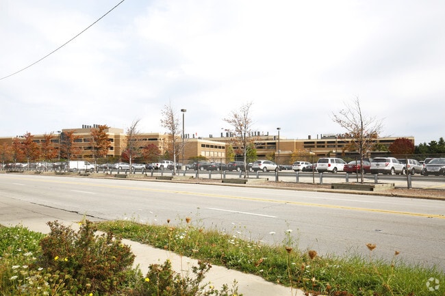
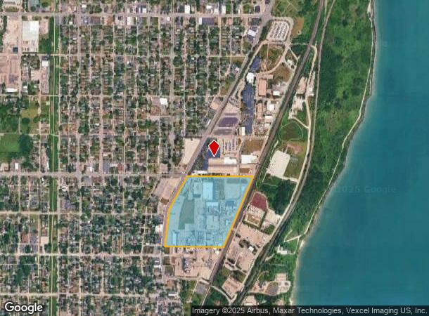
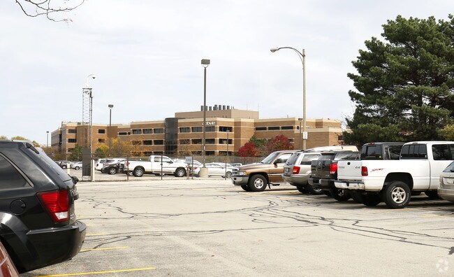
Property Record
1401 Sheridan Rd, North Chicago, IL 60064
NEARBY LISTINGS FOR SALE OR LEASE
Property Detail
1401 Sheridan Rd
Chicago-Naperville-Elgin, IL-IN-WI
Th Pt Lyg E Of E Ln Sheridan Rd & N Of N
08-33-300-028
TH PT LYG E OF E LN SHERIDAN RD & N OF N LN LENOX SUB & W OF C NW RY PT S1/2 SECTION 33 TOWNSHIP 45 RANGE 12
Industrialgeneral
Lake
X
Illinois
17097C0179L
29.84 AC
2023
North Lake County
2024
Chicago
862901
DEMOGRAPHICS near 1401 Sheridan Rd
1 Mile
3 Mile
5 Mile
2024 Total Population
11,081
67,072
129,584
2029 Population
10,659
65,536
127,287
Pop Growth 2024-2029
(3.81%)
(2.29%)
(1.77%)
Average Age
35
34
36
2024 Total Households
3,436
19,778
42,356
HH Growth 2024-2029
(3.84%)
(2.43%)
(1.85%)
Median Household Inc
$50,867
$49,024
$63,136
Avg Household Size
3.10
2.90
2.80
2024 Avg HH Vehicles
2.00
2.00
2.00
Median Home Value
$125,624
$141,246
$185,046
Median Year Built
1955
1961
1969
Nearby Places
Map Layers
Map Styles
 Street
 Aerial
- Restaurants
- Banks
- Shops
- Fitness
- Groceries
PUBLIC TRANSPORTATION
TRANSIT/SUBWAY
North Chicago Station (Union Pacific North Line - Northeast Illinois Regional Commuter Railroad (Metra))
DRIVE
WALK
Distance
North Chicago Station (Union Pacific North Line - Northeast Illinois Regional Commuter Railroad (Metra))
5 min
16 min
0.8 mi
COMMUTER RAIL
North Chicago Station (Union Pacific North Line - Northeast Illinois Regional Commuter Railroad (Metra))
DRIVE
WALK
Distance
North Chicago Station (Union Pacific North Line - Northeast Illinois Regional Commuter Railroad (Metra))
4 min
15 min
0.8 mi
Great Lakes Station (Union Pacific North Line - Northeast Illinois Regional Commuter Railroad (Metra))
DRIVE
WALK
Distance
Great Lakes Station (Union Pacific North Line - Northeast Illinois Regional Commuter Railroad (Metra))
5 min
2.4 mi
AIRPORT
Chicago O'Hare International
DRIVE
WALK
Distance
Chicago O'Hare International
45 min
31.5 mi
Freight Ports
Port Milwaukee
DRIVE
WALK
Distance
Port Milwaukee
68 min
53.1 mi
Nearby Properties
Address
Land Use
TOTAL SIZE
Lot Size
Zoning
Address
Land Use
TOTAL SIZE
Lot Size
Zoning
30,234 SF
55.40 AC
Address
Land Use
TOTAL SIZE
Lot Size
Zoning
4,116,168 SF
17.20 AC
Address
Land Use
TOTAL SIZE
Lot Size
Zoning
66.57 AC
Address
Land Use
TOTAL SIZE
Lot Size
Zoning
225,626 SF
4.11 AC
Address
Land Use
TOTAL SIZE
Lot Size
Zoning
91,058 SF
30.15 AC
Address
Land Use
TOTAL SIZE
Lot Size
Zoning
329,752 SF
15.60 AC
Address
Land Use
TOTAL SIZE
Lot Size
Zoning
14.49 AC
Address
Land Use
TOTAL SIZE
Lot Size
Zoning
1,082,769 SF
31.84 AC
Address
Land Use
TOTAL SIZE
Lot Size
Zoning
362,809 SF
21.48 AC
Address
Land Use
TOTAL SIZE
Lot Size
Zoning
2,939,829 SF
15.73 AC
Address
Land Use
TOTAL SIZE
Lot Size
Zoning
4,292,796 SF
16.39 AC
Address
Land Use
TOTAL SIZE
Lot Size
Zoning
19.86 AC
Address
Land Use
TOTAL SIZE
Lot Size
Zoning
21.48 AC
Address
Land Use
TOTAL SIZE
Lot Size
Zoning
177,219 SF
1.98 AC
Address
Land Use
TOTAL SIZE
Lot Size
Zoning
172,862 SF
8.98 AC
Address
Land Use
TOTAL SIZE
Lot Size
Zoning
100,070 SF
1.01 AC
Address
Land Use
TOTAL SIZE
Lot Size
Zoning
100,070 SF
0.70 AC
Address
Land Use
TOTAL SIZE
Lot Size
Zoning
8.18 AC
Address
Land Use
TOTAL SIZE
Lot Size
Zoning
1,504,944 SF
12.22 AC
Address
Land Use
TOTAL SIZE
Lot Size
Zoning
1,031,535 SF
9.58 AC
Address
Land Use
TOTAL SIZE
Lot Size
Zoning
237,180 SF
19.80 AC
Address
Land Use
TOTAL SIZE
Lot Size
Zoning
234,150 SF
13 AC
Address
Land Use
TOTAL SIZE
Lot Size
Zoning
175,942 SF
2.39 AC
Address
Land Use
TOTAL SIZE
Lot Size
Zoning
19.80 AC
Address
Land Use
TOTAL SIZE
Lot Size
Zoning
131.77 AC
Address
Land Use
TOTAL SIZE
Lot Size
Zoning
198,960 SF
11 AC
Address
Land Use
TOTAL SIZE
Lot Size
Zoning
146,211 SF
15.65 AC
Address
Land Use
TOTAL SIZE
Lot Size
Zoning
954,569 SF
4.74 AC
Address
Land Use
TOTAL SIZE
Lot Size
Zoning
167,384 SF
9.94 AC
The World's #1 Commercial Real Estate Marketplace
Connect with us
© 2026 CoStar Group
The information above has been obtained from sources believed reliable. While we do not doubt its accuracy we have not verified it and make no guarantee, warranty or representation about it. It is your responsibility to independently confirm its accuracy and completeness. Any projections, opinions, assumptions, or estimates used are for example only and do not represent the current or future performance of the property. The value of this transaction to you depends on tax and other factors which should be evaluated by your tax, financial, and legal advisors. You and your advisors should conduct a careful, independent investigation of the property to determine to your satisfaction the suitability of the property for your needs.