Property Record
1401 Tunnel Hill Varnell Rd Nw, Dalton, GA 30720
NEARBY LISTINGS FOR SALE OR LEASE
-
-
View all Dalton listings for sale on LoopNet.com
Property Detail
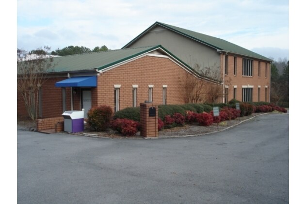
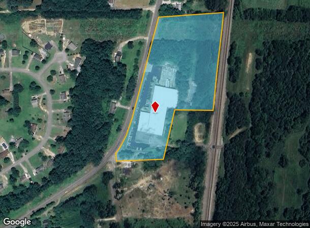
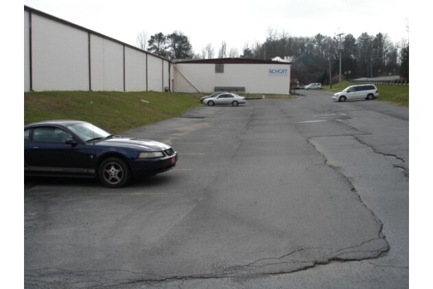
1401 Tunnel Hill Varnell Rd Nw
11-261-07-000
Comm Land (Rural)
Warehouse
7.29A LL261-11
X
Whitfield
13047C0100E
Georgia
2024
7.29 AC
2024
Georgia Northwest
000304
Other Market Areas
46,020 SF
Dalton, GA
DEMOGRAPHICS near 1401 Tunnel Hill Varnell Rd Nw
1 Mile
3 Mile
5 Mile
2024 Total Population
1,826
11,333
28,686
2029 Population
1,825
11,346
28,827
Pop Growth 2024-2029
(0.05%)
+ 0.11%
+ 0.49%
Average Age
38
39
39
2024 Total Households
632
3,935
10,126
HH Growth 2024-2029
0.00%
+ 0.13%
+ 0.52%
Median Household Inc
$78,699
$70,626
$64,552
Avg Household Size
2.80
2.80
2.80
2024 Avg HH Vehicles
3.00
2.00
2.00
Median Home Value
$198,629
$190,171
$179,132
Median Year Built
1998
1990
1989
Nearby Places
- Restaurants
- Banks
- Shops
- Fitness
- Groceries
PUBLIC TRANSPORTATION
AIRPORT
Lovell Field
DRIVE
WALK
Distance
Lovell Field
34 min
23.2 mi
Freight Ports
Georgia Ports - Savannah
DRIVE
WALK
Distance
Georgia Ports - Savannah
388 min
345.8 mi
Nearby Properties
Address
Land Use
TOTAL SIZE
Lot Size
Zoning
Address
Land Use
TOTAL SIZE
Lot Size
Zoning
346,476 SF
31.41 AC
Address
Land Use
TOTAL SIZE
Lot Size
Zoning
142,096 SF
60 AC
Address
Land Use
TOTAL SIZE
Lot Size
Zoning
202,360 SF
68.63 AC
Address
Land Use
TOTAL SIZE
Lot Size
Zoning
74,375 SF
61.76 AC
Address
Land Use
TOTAL SIZE
Lot Size
Zoning
211,512 SF
3.60 AC
M2
Address
Land Use
TOTAL SIZE
Lot Size
Zoning
48,171 SF
27.94 AC
Address
Land Use
TOTAL SIZE
Lot Size
Zoning
1,250 SF
109.30 AC
Address
Land Use
TOTAL SIZE
Lot Size
Zoning
77,604 SF
15.31 AC
Address
Land Use
TOTAL SIZE
Lot Size
Zoning
156,375 SF
16.67 AC
Address
Land Use
TOTAL SIZE
Lot Size
Zoning
2,128 SF
185.43 AC
CITY R1
Address
Land Use
TOTAL SIZE
Lot Size
Zoning
14.69 AC
C-2
Address
Land Use
TOTAL SIZE
Lot Size
Zoning
56,607 SF
27.74 AC
Address
Land Use
TOTAL SIZE
Lot Size
Zoning
1,184 SF
68.52 AC
C-2
Address
Land Use
TOTAL SIZE
Lot Size
Zoning
51,770 SF
6.63 AC
Address
Land Use
TOTAL SIZE
Lot Size
Zoning
33,668 SF
0.06 AC
M2
Address
Land Use
TOTAL SIZE
Lot Size
Zoning
32,550 SF
19.74 AC
COMMERICAL
Address
Land Use
TOTAL SIZE
Lot Size
Zoning
Address
Land Use
TOTAL SIZE
Lot Size
Zoning
42,500 SF
9.96 AC
Address
Land Use
TOTAL SIZE
Lot Size
Zoning
56,558 SF
15.83 AC
C-2
Address
Land Use
TOTAL SIZE
Lot Size
Zoning
32,000 SF
3.76 AC
Address
Land Use
TOTAL SIZE
Lot Size
Zoning
9,132 SF
12.05 AC
Address
Land Use
TOTAL SIZE
Lot Size
Zoning
45,000 SF
1.82 AC
M-2
Address
Land Use
TOTAL SIZE
Lot Size
Zoning
10,608 SF
3.03 AC
R-1
Address
Land Use
TOTAL SIZE
Lot Size
Zoning
2,800 SF
3.12 AC
Address
Land Use
TOTAL SIZE
Lot Size
Zoning
14,560 SF
8.26 AC
Address
Land Use
TOTAL SIZE
Lot Size
Zoning
4,650 SF
3.15 AC
Address
Land Use
TOTAL SIZE
Lot Size
Zoning
17,664 SF
1.54 AC
C2
Address
Land Use
TOTAL SIZE
Lot Size
Zoning
10,100 SF
10.89 AC
Address
Land Use
TOTAL SIZE
Lot Size
Zoning
1,111 SF
1.45 AC
The World's #1 Commercial Real Estate Marketplace
Connect with us
© 2025 CoStar Group
The information above has been obtained from sources believed reliable. While we do not doubt its accuracy we have not verified it and make no guarantee, warranty or representation about it. It is your responsibility to independently confirm its accuracy and completeness. Any projections, opinions, assumptions, or estimates used are for example only and do not represent the current or future performance of the property. The value of this transaction to you depends on tax and other factors which should be evaluated by your tax, financial, and legal advisors. You and your advisors should conduct a careful, independent investigation of the property to determine to your satisfaction the suitability of the property for your needs.