Property Record
1401 W Hebron Pky, Carrollton, TX 75010


Save to a Folder
{{folder.Name}}
{{folder.ListingIds.length}} Properties
{{folder.ListingIds.length}} Property
Create a New Folder
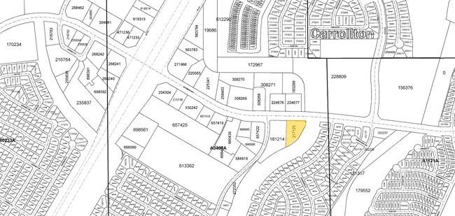
Property Detail
1401 W Hebron Pky
Dallas-Fort Worth-Arlington, TX
SPOTLESS ADDN(CARROLLTON) BLK 1 LOT 1
R217125
Denton
Commercialnec
Texas
2024
1
2025
1.21 AC
021649
Lewisville
6,175 SF
Dallas/Ft Worth
NEARBY LISTINGS FOR SALE OR LEASE
DEMOGRAPHICS near 1401 W Hebron Pky
1 mile
3 mile
5 mile
2025 Total Population
15,642
90,876
272,860
2030 Population
17,423
101,389
299,048
Pop Growth 2025-2030
+ 11.39%
+ 11.57%
+ 9.60%
Average Age
39
39
39
2025 Total Households
5,902
34,596
108,850
HH Growth 2025-2030
+ 11.71%
+ 11.80%
+ 9.99%
Median Household Inc
$116,349
$111,966
$95,796
Avg Household Size
2.60
2.60
2.50
2025 Avg HH Vehicles
2.00
2.00
2.00
Median Home Value
$485,574
$471,693
$427,718
Median Year Built
2001
1998
1993
Nearby Places
Map Layers
Map Styles
 Street
 Aerial
Layers
 Traffic
 Biking
Places
Listings with unknown addresses are not visible on the map
- Restaurants
- Banks
- Shops
- Fitness
- Groceries
PUBLIC TRANSPORTATION
COMMUTER RAIL
Hebron Station (A-train - Denton County Transportation Authority)
Drive
Walk
Distance
Hebron Station (A-train - Denton County Transportation Authority)
8 min
3.6 mi
Trinity Mills Station (Green Line - Dallas Area Rapid Transit (DART))
Drive
Walk
Distance
Trinity Mills Station (Green Line - Dallas Area Rapid Transit (DART))
9 min
4.5 mi
AIRPORT
Dallas-Fort Worth International
Drive
Walk
Distance
Dallas-Fort Worth International
18 min
14.0 mi
Dallas Love Field
Drive
Walk
Distance
Dallas Love Field
30 min
20.1 mi
Freight Ports
Port of Shreveport
Drive
Walk
Distance
Port of Shreveport
237 min
214.6 mi
Nearby Properties
Address
Land Use
TOTAL SIZE
Lot Size
Zoning
Address
Land Use
TOTAL SIZE
Lot Size
Zoning
578,457 SF
31.79 AC
Address
Land Use
TOTAL SIZE
Lot Size
Zoning
559,657 SF
30.49 AC
Address
Land Use
TOTAL SIZE
Lot Size
Zoning
660,180 SF
29.95 AC
Address
Land Use
TOTAL SIZE
Lot Size
Zoning
462,692 SF
30.77 AC
2G
Address
Land Use
TOTAL SIZE
Lot Size
Zoning
452,167 SF
5.80 AC
Address
Land Use
TOTAL SIZE
Lot Size
Zoning
434,639 SF
16.20 AC
Address
Land Use
TOTAL SIZE
Lot Size
Zoning
343,234 SF
32.41 AC
Address
Land Use
TOTAL SIZE
Lot Size
Zoning
354,546 SF
19.38 AC
3B
Address
Land Use
TOTAL SIZE
Lot Size
Zoning
424,064 SF
22.15 AC
2B
Address
Land Use
TOTAL SIZE
Lot Size
Zoning
364,000 SF
8.11 AC
Address
Land Use
TOTAL SIZE
Lot Size
Zoning
961,306 SF
44.52 AC
Address
Land Use
TOTAL SIZE
Lot Size
Zoning
97,750 SF
69.90 AC
Address
Land Use
TOTAL SIZE
Lot Size
Zoning
262,879 SF
11.97 AC
Address
Land Use
TOTAL SIZE
Lot Size
Zoning
725,972 SF
4 AC
Address
Land Use
TOTAL SIZE
Lot Size
Zoning
189,500 SF
53.90 AC
Address
Land Use
TOTAL SIZE
Lot Size
Zoning
392,646 SF
19.65 AC
3B
Address
Land Use
TOTAL SIZE
Lot Size
Zoning
298,991 SF
15.72 AC
Address
Land Use
TOTAL SIZE
Lot Size
Zoning
270,969 SF
13.03 AC
Address
Land Use
TOTAL SIZE
Lot Size
Zoning
337,409 SF
5.25 AC
Address
Land Use
TOTAL SIZE
Lot Size
Zoning
297,932 SF
14.05 AC
Address
Land Use
TOTAL SIZE
Lot Size
Zoning
397,889 SF
23.14 AC
2A
Address
Land Use
TOTAL SIZE
Lot Size
Zoning
659,218 SF
34.29 AC
Address
Land Use
TOTAL SIZE
Lot Size
Zoning
251,650 SF
14.22 AC
Address
Land Use
TOTAL SIZE
Lot Size
Zoning
318,477 SF
18.79 AC
Address
Land Use
TOTAL SIZE
Lot Size
Zoning
300,958 SF
16.61 AC
Address
Land Use
TOTAL SIZE
Lot Size
Zoning
711,360 SF
32.62 AC
Address
Land Use
TOTAL SIZE
Lot Size
Zoning
294,764 SF
18 AC
Address
Land Use
TOTAL SIZE
Lot Size
Zoning
599,800 SF
31.44 AC
Address
Land Use
TOTAL SIZE
Lot Size
Zoning
276,509 SF
16.67 AC
2G
Address
Land Use
TOTAL SIZE
Lot Size
Zoning
263,744 SF
4.42 AC
The World's #1 Commercial Real Estate Marketplace
Connect with us
© 2026 CoStar Group
The information above has been obtained from sources believed reliable. While we do not doubt its accuracy we have not verified it and make no guarantee, warranty or representation about it. It is your responsibility to independently confirm its accuracy and completeness. Any projections, opinions, assumptions, or estimates used are for example only and do not represent the current or future performance of the property. The value of this transaction to you depends on tax and other factors which should be evaluated by your tax, financial, and legal advisors. You and your advisors should conduct a careful, independent investigation of the property to determine to your satisfaction the suitability of the property for your needs.