Property Record
1401/09 Route 37 E, Toms River, NJ 08753


NEARBY LISTINGS FOR SALE OR LEASE
Property Detail
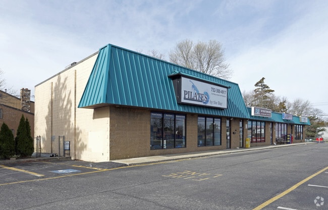
1401/09 Route 37 E
08-00722-0000-00108
240X117
Commercialnec
Ocean
X
New Jersey
34029C0308F
108
2024
0.65 AC
2025
Ocean County
722702
Northern New Jersey
4,988 SF
Lakewood-New Brunswick, NJ
DEMOGRAPHICS near 1401/09 Route 37 E
1 Mile
3 Mile
5 Mile
2024 Total Population
9,514
70,932
140,376
2029 Population
10,080
75,312
150,956
Pop Growth 2024-2029
+ 5.95%
+ 6.17%
+ 7.54%
Average Age
39
39
42
2024 Total Households
3,414
25,747
54,209
HH Growth 2024-2029
+ 5.62%
+ 5.71%
+ 7.44%
Median Household Inc
$80,210
$87,564
$83,586
Avg Household Size
2.70
2.60
2.50
2024 Avg HH Vehicles
2.00
2.00
2.00
Median Home Value
$334,259
$319,830
$333,593
Median Year Built
1967
1973
1975
Nearby Places
Map Layers
Map Styles
 Street
 Aerial
- Restaurants
- Banks
- Shops
- Fitness
- Groceries
PUBLIC TRANSPORTATION
AIRPORT
Trenton Mercer
DRIVE
WALK
Distance
Trenton Mercer
73 min
49.5 mi
Freight Ports
Port of Philadelphia
DRIVE
WALK
Distance
Port of Philadelphia
77 min
59.4 mi
SALE & LEASE HISTORY
LISTING DATE
SALE/LEASE

Mar 29, 2017
For Lease
Feb 04, 2020
For Lease
Aug 07, 2019
For Lease
Nearby Properties
Address
Land Use
TOTAL SIZE
Lot Size
Zoning
Address
Land Use
TOTAL SIZE
Lot Size
Zoning
70.33 AC
RC
Address
Land Use
TOTAL SIZE
Lot Size
Zoning
83.07 AC
R400
Address
Land Use
TOTAL SIZE
Lot Size
Zoning
22,175 SF
30.21 AC
RC
Address
Land Use
TOTAL SIZE
Lot Size
Zoning
44,584 SF
11.85 AC
VO
Address
Land Use
TOTAL SIZE
Lot Size
Zoning
8,512 SF
25.67 AC
RC
Address
Land Use
TOTAL SIZE
Lot Size
Zoning
165,024 SF
22.43 AC
HB
Address
Land Use
TOTAL SIZE
Lot Size
Zoning
8,118 SF
72.32 AC
R75
Address
Land Use
TOTAL SIZE
Lot Size
Zoning
8.21 AC
VO
Address
Land Use
TOTAL SIZE
Lot Size
Zoning
8,968 SF
26.36 AC
RMF
Address
Land Use
TOTAL SIZE
Lot Size
Zoning
41,100 SF
14.63 AC
RC
Address
Land Use
TOTAL SIZE
Lot Size
Zoning
31,302 SF
13.76 AC
EM18
Address
Land Use
TOTAL SIZE
Lot Size
Zoning
18,890 SF
24.59 AC
SPLT
Address
Land Use
TOTAL SIZE
Lot Size
Zoning
56,332 SF
8.85 AC
SPLT
Address
Land Use
TOTAL SIZE
Lot Size
Zoning
19,836 SF
13.03 AC
EM18
Address
Land Use
TOTAL SIZE
Lot Size
Zoning
7,436 SF
22.36 AC
MF8
Address
Land Use
TOTAL SIZE
Lot Size
Zoning
15.68 AC
MF8
Address
Land Use
TOTAL SIZE
Lot Size
Zoning
2,549 SF
16.02 AC
RC
Address
Land Use
TOTAL SIZE
Lot Size
Zoning
3,997 SF
11.09 AC
RC
Address
Land Use
TOTAL SIZE
Lot Size
Zoning
4,264 SF
189.71 AC
R400
Address
Land Use
TOTAL SIZE
Lot Size
Zoning
44,394 SF
7.66 AC
EM18
Address
Land Use
TOTAL SIZE
Lot Size
Zoning
71,285 SF
20.49 AC
HB
Address
Land Use
TOTAL SIZE
Lot Size
Zoning
9,874 SF
15.17 AC
RC
Address
Land Use
TOTAL SIZE
Lot Size
Zoning
1.98 AC
HB
Address
Land Use
TOTAL SIZE
Lot Size
Zoning
1,680 SF
14.33 AC
HB
Address
Land Use
TOTAL SIZE
Lot Size
Zoning
8.82 AC
O15
Address
Land Use
TOTAL SIZE
Lot Size
Zoning
9,343 SF
31.93 AC
SPLT
Address
Land Use
TOTAL SIZE
Lot Size
Zoning
103,750 SF
24.23 AC
R120
Address
Land Use
TOTAL SIZE
Lot Size
Zoning
33.59 AC
R90
Address
Land Use
TOTAL SIZE
Lot Size
Zoning
6,120 SF
12.83 AC
R400
Address
Land Use
TOTAL SIZE
Lot Size
Zoning
5,303 SF
2.14 AC
VO
The World's #1 Commercial Real Estate Marketplace
Connect with us
© 2026 CoStar Group
The information above has been obtained from sources believed reliable. While we do not doubt its accuracy we have not verified it and make no guarantee, warranty or representation about it. It is your responsibility to independently confirm its accuracy and completeness. Any projections, opinions, assumptions, or estimates used are for example only and do not represent the current or future performance of the property. The value of this transaction to you depends on tax and other factors which should be evaluated by your tax, financial, and legal advisors. You and your advisors should conduct a careful, independent investigation of the property to determine to your satisfaction the suitability of the property for your needs.