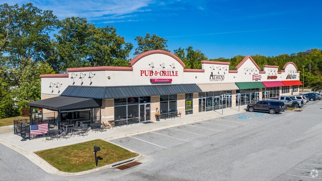
Property Record
1400 Handlir Dr, Bel Air, MD 21015


NEARBY LISTINGS FOR SALE OR LEASE
Property Detail
1400 Handlir Dr
Baltimore-Columbia-Towson, MD
West Prop 01
01-302744
LOT 5 4.10 AC 1400 HANDLIR DRIVE WEST PROPERTY PT 121/90
Communitycenter
Harford
X
Maryland
24025C0257E
5
2025
4.10 AC
2025
Aberdeen
301704
Baltimore
12,160 SF
DEMOGRAPHICS near 1400 Handlir Dr
1 Mile
3 Mile
5 Mile
2024 Total Population
7,199
34,804
96,499
2029 Population
7,437
35,987
99,325
Pop Growth 2024-2029
+ 3.31%
+ 3.40%
+ 2.93%
Average Age
37
39
40
2024 Total Households
2,772
12,950
36,264
HH Growth 2024-2029
+ 3.28%
+ 3.39%
+ 2.96%
Median Household Inc
$87,049
$98,371
$95,330
Avg Household Size
2.50
2.60
2.60
2024 Avg HH Vehicles
2.00
2.00
2.00
Median Home Value
$249,895
$315,524
$293,462
Median Year Built
1992
1994
1990
Nearby Places
Map Layers
Map Styles
 Street
 Aerial
- Restaurants
- Banks
- Shops
- Fitness
- Groceries
PUBLIC TRANSPORTATION
COMMUTER RAIL
Edgewood (PENN - WASHINGTON - Maryland Area Regional Commuter Trains (The MARC), Penn Line - Maryland Area Regional Commuter Trains (The MARC))
DRIVE
WALK
Distance
Edgewood (PENN - WASHINGTON - Maryland Area Regional Commuter Trains (The MARC), Penn Line - Maryland Area Regional Commuter Trains (The MARC))
13 min
6.3 mi
Aberdeen (PENN - WASHINGTON - Maryland Area Regional Commuter Trains (The MARC), Penn Line - Maryland Area Regional Commuter Trains (The MARC))
DRIVE
WALK
Distance
Aberdeen (PENN - WASHINGTON - Maryland Area Regional Commuter Trains (The MARC), Penn Line - Maryland Area Regional Commuter Trains (The MARC))
10 min
6.4 mi
Freight Ports
Port of Baltimore
DRIVE
WALK
Distance
Port of Baltimore
38 min
27.6 mi
SALE & LEASE HISTORY
LISTING DATE
SALE/LEASE

Sep 25, 2016
For Lease
Nov 01, 2017
For Lease
Mar 09, 2020
For Sale
Jun 01, 2017
For Lease
Nearby Properties
Address
Land Use
TOTAL SIZE
Lot Size
Zoning
Address
Land Use
TOTAL SIZE
Lot Size
Zoning
407,868 SF
10.39 AC
MO
Address
Land Use
TOTAL SIZE
Lot Size
Zoning
800,000 SF
44.65 AC
GI
Address
Land Use
TOTAL SIZE
Lot Size
Zoning
15,250 SF
17.86 AC
CI
Address
Land Use
TOTAL SIZE
Lot Size
Zoning
945,700 SF
50.08 AC
GI
Address
Land Use
TOTAL SIZE
Lot Size
Zoning
33,120 SF
174.61 AC
CI
Address
Land Use
TOTAL SIZE
Lot Size
Zoning
7,535 SF
22.26 AC
R3COS
Address
Land Use
TOTAL SIZE
Lot Size
Zoning
233,820 SF
35.84 AC
R3
Address
Land Use
TOTAL SIZE
Lot Size
Zoning
190,544 SF
9.47 AC
GI
Address
Land Use
TOTAL SIZE
Lot Size
Zoning
59,724 SF
20.79 AC
C1
Address
Land Use
TOTAL SIZE
Lot Size
Zoning
171,869 SF
160 AC
R4
Address
Land Use
TOTAL SIZE
Lot Size
Zoning
308,078 SF
15.10 AC
GI
Address
Land Use
TOTAL SIZE
Lot Size
Zoning
240,938 SF
14.90 AC
GI
Address
Land Use
TOTAL SIZE
Lot Size
Zoning
144,867 SF
128 AC
R4
Address
Land Use
TOTAL SIZE
Lot Size
Zoning
44,464 SF
3.11 AC
R4
Address
Land Use
TOTAL SIZE
Lot Size
Zoning
369,600 SF
43.28 AC
G1
Address
Land Use
TOTAL SIZE
Lot Size
Zoning
300,304 SF
21.08 AC
CI
Address
Land Use
TOTAL SIZE
Lot Size
Zoning
300,546 SF
15.19 AC
CI
Address
Land Use
TOTAL SIZE
Lot Size
Zoning
171,171 SF
8.09 AC
GI
Address
Land Use
TOTAL SIZE
Lot Size
Zoning
205,142 SF
12.56 AC
GI
Address
Land Use
TOTAL SIZE
Lot Size
Zoning
97,985 SF
12.12 AC
CI
Address
Land Use
TOTAL SIZE
Lot Size
Zoning
180,654 SF
20.03 AC
GI
Address
Land Use
TOTAL SIZE
Lot Size
Zoning
256,450 SF
20.88 AC
GI
Address
Land Use
TOTAL SIZE
Lot Size
Zoning
75,875 SF
4.65 AC
CI
Address
Land Use
TOTAL SIZE
Lot Size
Zoning
35,400 SF
28.02 AC
R1
Address
Land Use
TOTAL SIZE
Lot Size
Zoning
27,640 SF
10.43 AC
GI
Address
Land Use
TOTAL SIZE
Lot Size
Zoning
49,131 SF
14.39 AC
CI
Address
Land Use
TOTAL SIZE
Lot Size
Zoning
51,480 SF
10.23 AC
B3
Address
Land Use
TOTAL SIZE
Lot Size
Zoning
178,100 SF
10.18 AC
GI
Address
Land Use
TOTAL SIZE
Lot Size
Zoning
51.35 AC
AG
Address
Land Use
TOTAL SIZE
Lot Size
Zoning
170,544 SF
184 AC
R3
The World's #1 Commercial Real Estate Marketplace
Connect with us
© 2025 CoStar Group
The information above has been obtained from sources believed reliable. While we do not doubt its accuracy we have not verified it and make no guarantee, warranty or representation about it. It is your responsibility to independently confirm its accuracy and completeness. Any projections, opinions, assumptions, or estimates used are for example only and do not represent the current or future performance of the property. The value of this transaction to you depends on tax and other factors which should be evaluated by your tax, financial, and legal advisors. You and your advisors should conduct a careful, independent investigation of the property to determine to your satisfaction the suitability of the property for your needs.