Property Record
1402 N Highway 84, Slaton, TX 79364
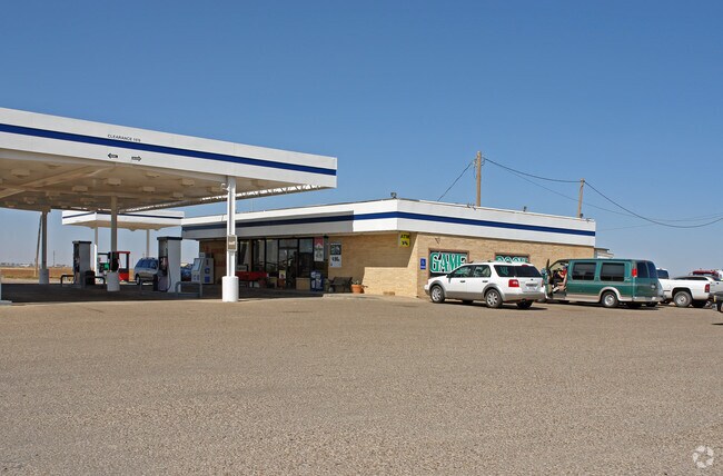


Property Detail
1402 N Highway 84
Lubbock, TX
BLK S SEC 48 AB 462 TR 14 SE/4 AC: 5.202
R103127
LUBBOCK
Commercialnec
Texas
B and X Area of moderate flood hazard, usually the area between the limits of the 100-year and 500-year floods.
9400
2024
5.20 AC
2025
Outlying Lubbock County
010601
Lubbock
5,712 SF
NEARBY LISTINGS FOR SALE OR LEASE
-
-
View all Slaton listings for sale on LoopNet.com
DEMOGRAPHICS near 1402 N Highway 84
1 mile
3 mile
5 mile
2025 Total Population
1,628
7,067
7,541
2030 Population
1,718
7,504
8,006
Pop Growth 2025-2030
+ 5.53%
+ 6.18%
+ 6.17%
Average Age
40
39
39
2025 Total Households
651
2,695
2,887
HH Growth 2025-2030
+ 5.68%
+ 6.42%
+ 6.37%
Median Household Inc
$46,103
$52,208
$52,556
Avg Household Size
2.50
2.60
2.60
2025 Avg HH Vehicles
2.00
2.00
2.00
Median Home Value
$165,217
$88,336
$92,204
Median Year Built
1976
1970
1970
Nearby Places
Map Layers
Map Styles
 Street
 Aerial
Transit
 Traffic
 Biking
Places
Listings with unknown addresses are not visible on the map
- Restaurants
- Banks
- Shops
- Fitness
- Groceries
PUBLIC TRANSPORTATION
AIRPORT
Lubbock Preston Smith International
Drive
Walk
Distance
Lubbock Preston Smith International
39 min
26.6 mi
Freight Ports
Tulsa Port Of Catoosa
Drive
Walk
Distance
Tulsa Port Of Catoosa
516 min
478.6 mi
SALE & LEASE HISTORY
LISTING DATE
SALE/LEASE

Nov 04, 2022
For Sale
Mar 01, 2017
For Sale
Nearby Properties
Address
Land Use
TOTAL SIZE
Lot Size
Zoning
Address
Land Use
TOTAL SIZE
Lot Size
Zoning
22,450 SF
310.38 AC
Address
Land Use
TOTAL SIZE
Lot Size
Zoning
91,579 SF
7.20 AC
Address
Land Use
TOTAL SIZE
Lot Size
Zoning
36,088 SF
7.10 AC
Address
Land Use
TOTAL SIZE
Lot Size
Zoning
18,010 SF
10.92 AC
Address
Land Use
TOTAL SIZE
Lot Size
Zoning
9,808 SF
1 AC
Address
Land Use
TOTAL SIZE
Lot Size
Zoning
17,200 SF
4.14 AC
Address
Land Use
TOTAL SIZE
Lot Size
Zoning
25,532 SF
0.88 AC
Address
Land Use
TOTAL SIZE
Lot Size
Zoning
14,640 SF
102.08 AC
Address
Land Use
TOTAL SIZE
Lot Size
Zoning
21,253 SF
8 AC
Address
Land Use
TOTAL SIZE
Lot Size
Zoning
34,472 SF
2 AC
Address
Land Use
TOTAL SIZE
Lot Size
Zoning
25,375 SF
1.14 AC
Address
Land Use
TOTAL SIZE
Lot Size
Zoning
311.58 AC
Address
Land Use
TOTAL SIZE
Lot Size
Zoning
67,913 SF
5 AC
Address
Land Use
TOTAL SIZE
Lot Size
Zoning
14,021 SF
4.29 AC
Address
Land Use
TOTAL SIZE
Lot Size
Zoning
26,255 SF
0.72 AC
Address
Land Use
TOTAL SIZE
Lot Size
Zoning
25,037 SF
18.01 AC
Address
Land Use
TOTAL SIZE
Lot Size
Zoning
26,801 SF
10.17 AC
Address
Land Use
TOTAL SIZE
Lot Size
Zoning
13,950 SF
2.76 AC
Address
Land Use
TOTAL SIZE
Lot Size
Zoning
3,950 SF
0.99 AC
Address
Land Use
TOTAL SIZE
Lot Size
Zoning
18,281 SF
2.60 AC
Address
Land Use
TOTAL SIZE
Lot Size
Zoning
3,944 SF
1.17 AC
Address
Land Use
TOTAL SIZE
Lot Size
Zoning
20,630 SF
6 AC
Address
Land Use
TOTAL SIZE
Lot Size
Zoning
18,967 SF
4 AC
Address
Land Use
TOTAL SIZE
Lot Size
Zoning
30,650 SF
6.81 AC
Address
Land Use
TOTAL SIZE
Lot Size
Zoning
19,005 SF
4.82 AC
Address
Land Use
TOTAL SIZE
Lot Size
Zoning
4,905 SF
0.55 AC
Address
Land Use
TOTAL SIZE
Lot Size
Zoning
3,325 SF
1.19 AC
Address
Land Use
TOTAL SIZE
Lot Size
Zoning
7,310 SF
81.03 AC
Address
Land Use
TOTAL SIZE
Lot Size
Zoning
6,000 SF
1 AC
The World's #1 Commercial Real Estate Marketplace
Connect with us
© 2026 CoStar Group
The information above has been obtained from sources believed reliable. While we do not doubt its accuracy we have not verified it and make no guarantee, warranty or representation about it. It is your responsibility to independently confirm its accuracy and completeness. Any projections, opinions, assumptions, or estimates used are for example only and do not represent the current or future performance of the property. The value of this transaction to you depends on tax and other factors which should be evaluated by your tax, financial, and legal advisors. You and your advisors should conduct a careful, independent investigation of the property to determine to your satisfaction the suitability of the property for your needs.