Property Record
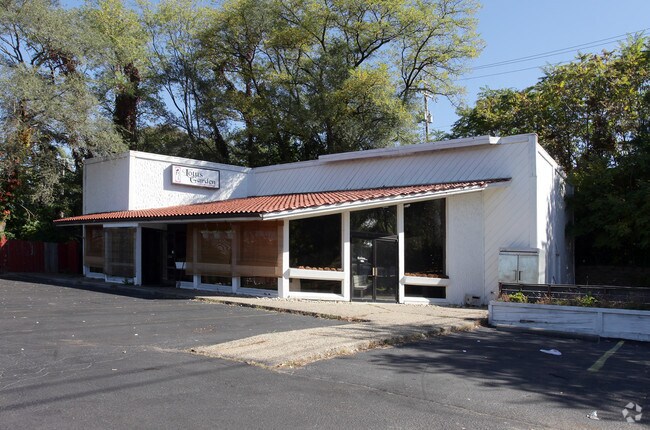
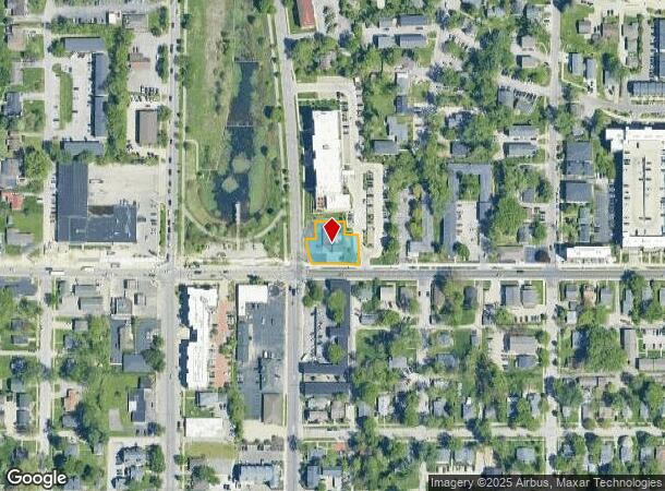
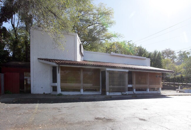
1402 N Walnut St, Bloomington, IN 47404
NEARBY LISTINGS FOR SALE OR LEASE
Property Detail
1402 N Walnut St
53-05-28-300-063.000-005
013-20470-00 PT SW 28-9-1W .317A PLAT 139
Restaurantbuilding
Monroe
X
Indiana
18105C0141D
0.32 AC
2024
Downtown Bloomington IN
2024
Other Market Areas
001600
Bloomington, IN
2,650 SF
DEMOGRAPHICS near 1402 N Walnut St
1 Mile
3 Mile
5 Mile
2024 Total Population
15,593
67,327
106,255
2029 Population
15,577
67,306
105,893
Pop Growth 2024-2029
(0.10%)
(0.03%)
(0.34%)
Average Age
29
32
35
2024 Total Households
6,884
28,347
44,908
HH Growth 2024-2029
(0.23%)
(0.03%)
(0.38%)
Median Household Inc
$21,390
$34,539
$46,159
Avg Household Size
2.00
2.00
2.10
2024 Avg HH Vehicles
2.00
2.00
2.00
Median Home Value
$171,161
$233,630
$243,519
Median Year Built
1982
1984
1987
Nearby Places
Map Layers
Map Styles
 Street
 Aerial
- Restaurants
- Banks
- Shops
- Fitness
- Groceries
Nearby Properties
Address
Land Use
TOTAL SIZE
Lot Size
Zoning
Address
Land Use
TOTAL SIZE
Lot Size
Zoning
442,250 SF
37.15 AC
Address
Land Use
TOTAL SIZE
Lot Size
Zoning
7,804 SF
7.22 AC
Address
Land Use
TOTAL SIZE
Lot Size
Zoning
496,556 SF
1.73 AC
Address
Land Use
TOTAL SIZE
Lot Size
Zoning
8,107 SF
12.37 AC
Address
Land Use
TOTAL SIZE
Lot Size
Zoning
13,910 SF
3.86 AC
Address
Land Use
TOTAL SIZE
Lot Size
Zoning
Address
Land Use
TOTAL SIZE
Lot Size
Zoning
Address
Land Use
TOTAL SIZE
Lot Size
Zoning
261,278 SF
4.62 AC
Address
Land Use
TOTAL SIZE
Lot Size
Zoning
10,573 SF
3.28 AC
Address
Land Use
TOTAL SIZE
Lot Size
Zoning
8,064 SF
1.29 AC
Address
Land Use
TOTAL SIZE
Lot Size
Zoning
14,964 SF
12.34 AC
Address
Land Use
TOTAL SIZE
Lot Size
Zoning
19,128 SF
24.44 AC
Address
Land Use
TOTAL SIZE
Lot Size
Zoning
404,051 SF
36.54 AC
Address
Land Use
TOTAL SIZE
Lot Size
Zoning
4,895 SF
16.61 AC
Address
Land Use
TOTAL SIZE
Lot Size
Zoning
60,434 SF
29.85 AC
IG
Address
Land Use
TOTAL SIZE
Lot Size
Zoning
169,170 SF
0.72 AC
Address
Land Use
TOTAL SIZE
Lot Size
Zoning
8,190 SF
4.22 AC
Address
Land Use
TOTAL SIZE
Lot Size
Zoning
5,908 SF
19.52 AC
Address
Land Use
TOTAL SIZE
Lot Size
Zoning
134,566 SF
0.60 AC
Address
Land Use
TOTAL SIZE
Lot Size
Zoning
7,500 SF
0.40 AC
Address
Land Use
TOTAL SIZE
Lot Size
Zoning
181,798 SF
0.80 AC
Address
Land Use
TOTAL SIZE
Lot Size
Zoning
32,737 SF
0.93 AC
Address
Land Use
TOTAL SIZE
Lot Size
Zoning
18,772 SF
2.69 AC
Address
Land Use
TOTAL SIZE
Lot Size
Zoning
53,005 SF
10.03 AC
PUD
Address
Land Use
TOTAL SIZE
Lot Size
Zoning
404,051 SF
25.72 AC
Address
Land Use
TOTAL SIZE
Lot Size
Zoning
17,312 SF
31.90 AC
Address
Land Use
TOTAL SIZE
Lot Size
Zoning
14,376 SF
11.03 AC
Address
Land Use
TOTAL SIZE
Lot Size
Zoning
38,208 SF
8.03 AC
Address
Land Use
TOTAL SIZE
Lot Size
Zoning
1,120 SF
11.95 AC
Address
Land Use
TOTAL SIZE
Lot Size
Zoning
6,480 SF
10.73 AC
The World's #1 Commercial Real Estate Marketplace
Connect with us
© 2025 CoStar Group
The information above has been obtained from sources believed reliable. While we do not doubt its accuracy we have not verified it and make no guarantee, warranty or representation about it. It is your responsibility to independently confirm its accuracy and completeness. Any projections, opinions, assumptions, or estimates used are for example only and do not represent the current or future performance of the property. The value of this transaction to you depends on tax and other factors which should be evaluated by your tax, financial, and legal advisors. You and your advisors should conduct a careful, independent investigation of the property to determine to your satisfaction the suitability of the property for your needs.