Property Record
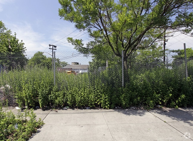
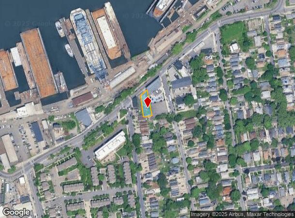
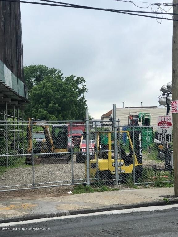
1402 Richmond Ter, Staten Island, NY 10310
NEARBY LISTINGS FOR SALE OR LEASE
-
-
-
-
-
-
No Photo
-
-
View all Staten Island listings for sale on LoopNet.com
Property Detail
1402 Richmond Ter
00158-0003
Staten Island
Miscellaneous
New York
X
3
3604970188F
0.17 AC
2024
Staten Island
2025
Long Island (New York)
009700
New York-Jersey City-White Plains, NY-NJ
DEMOGRAPHICS near 1402 Richmond Ter
1 Mile
3 Mile
5 Mile
2024 Total Population
30,707
259,561
545,600
2029 Population
30,031
254,329
528,379
Pop Growth 2024-2029
(2.20%)
(2.02%)
(3.16%)
Average Age
39
39
40
2024 Total Households
10,549
90,737
195,431
HH Growth 2024-2029
(2.36%)
(2.18%)
(3.43%)
Median Household Inc
$73,266
$74,653
$74,744
Avg Household Size
2.80
2.70
2.70
2024 Avg HH Vehicles
1.00
1.00
1.00
Median Home Value
$579,701
$531,290
$574,572
Median Year Built
1952
1960
1962
Nearby Places
- Restaurants
- Banks
- Shops
- Fitness
- Groceries
PUBLIC TRANSPORTATION
COMMUTER RAIL
St George (Staten Island Railway - New York MTA Subway (The Subway))
DRIVE
WALK
Distance
St George (Staten Island Railway - New York MTA Subway (The Subway))
8 min
2.8 mi
Tompkinsville (Staten Island Railway - New York MTA Subway (The Subway))
DRIVE
WALK
Distance
Tompkinsville (Staten Island Railway - New York MTA Subway (The Subway))
8 min
2.9 mi
AIRPORT
Newark Liberty International
DRIVE
WALK
Distance
Newark Liberty International
22 min
12.6 mi
LaGuardia
DRIVE
WALK
Distance
LaGuardia
43 min
23.6 mi
John F Kennedy International
DRIVE
WALK
Distance
John F Kennedy International
46 min
26.0 mi
Freight Ports
New York Container Terminal
DRIVE
WALK
Distance
New York Container Terminal
11 min
4.3 mi
SALE & LEASE HISTORY
LISTING DATE
SALE/LEASE

Jul 03, 2019
For Sale
Nearby Properties
Address
Land Use
TOTAL SIZE
Lot Size
Zoning
Address
Land Use
TOTAL SIZE
Lot Size
Zoning
Address
Land Use
TOTAL SIZE
Lot Size
Zoning
4,450,000 SF
95.24 AC
Address
Land Use
TOTAL SIZE
Lot Size
Zoning
22.49 AC
HC
Address
Land Use
TOTAL SIZE
Lot Size
Zoning
1.01 AC
Address
Land Use
TOTAL SIZE
Lot Size
Zoning
30.92 AC
Address
Land Use
TOTAL SIZE
Lot Size
Zoning
3.27 AC
Address
Land Use
TOTAL SIZE
Lot Size
Zoning
17.60 AC
Address
Land Use
TOTAL SIZE
Lot Size
Zoning
28.47 AC
I-H
Address
Land Use
TOTAL SIZE
Lot Size
Zoning
114.66 AC
BMHO
Address
Land Use
TOTAL SIZE
Lot Size
Zoning
89.40 AC
R1
Address
Land Use
TOTAL SIZE
Lot Size
Zoning
115.33 AC
IH
Address
Land Use
TOTAL SIZE
Lot Size
Zoning
74.35 AC
TDD
Address
Land Use
TOTAL SIZE
Lot Size
Zoning
30.70 AC
Address
Land Use
TOTAL SIZE
Lot Size
Zoning
Address
Land Use
TOTAL SIZE
Lot Size
Zoning
10.86 AC
R-2
Address
Land Use
TOTAL SIZE
Lot Size
Zoning
1,502 SF
0.69 AC
C-1
Address
Land Use
TOTAL SIZE
Lot Size
Zoning
Address
Land Use
TOTAL SIZE
Lot Size
Zoning
73.86 AC
IH
Address
Land Use
TOTAL SIZE
Lot Size
Zoning
5.77 AC
BMHO
Address
Land Use
TOTAL SIZE
Lot Size
Zoning
2.77 AC
Address
Land Use
TOTAL SIZE
Lot Size
Zoning
23.77 AC
Address
Land Use
TOTAL SIZE
Lot Size
Zoning
538,240 SF
12.08 AC
R2
Address
Land Use
TOTAL SIZE
Lot Size
Zoning
25.67 AC
Address
Land Use
TOTAL SIZE
Lot Size
Zoning
521,405 SF
52.79 AC
R3-1
Address
Land Use
TOTAL SIZE
Lot Size
Zoning
816 SF
1.57 AC
Address
Land Use
TOTAL SIZE
Lot Size
Zoning
20.20 AC
Address
Land Use
TOTAL SIZE
Lot Size
Zoning
111,000 SF
186.03 AC
PARK
Address
Land Use
TOTAL SIZE
Lot Size
Zoning
Address
Land Use
TOTAL SIZE
Lot Size
Zoning
48.68 AC
IH
Address
Land Use
TOTAL SIZE
Lot Size
Zoning
147.32 AC
W
The World's #1 Commercial Real Estate Marketplace
Connect with us
© 2025 CoStar Group
The information above has been obtained from sources believed reliable. While we do not doubt its accuracy we have not verified it and make no guarantee, warranty or representation about it. It is your responsibility to independently confirm its accuracy and completeness. Any projections, opinions, assumptions, or estimates used are for example only and do not represent the current or future performance of the property. The value of this transaction to you depends on tax and other factors which should be evaluated by your tax, financial, and legal advisors. You and your advisors should conduct a careful, independent investigation of the property to determine to your satisfaction the suitability of the property for your needs.