Property Record
14026 Manchester Rd, Ballwin, MO 63011

NEARBY LISTINGS FOR SALE OR LEASE
Property Detail
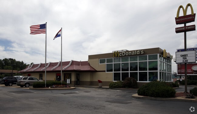
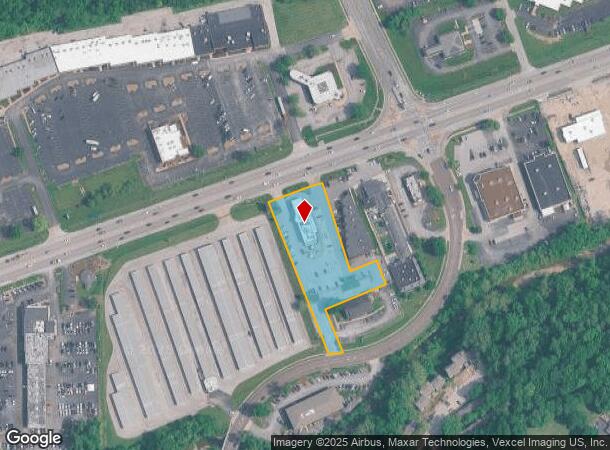
14026 Manchester Rd
St. Louis, MO-IL
Mcdonalds Commercial Center
22Q-32-0162
MCDONALDS COMMERCIAL CENTER LOT 1 22Q320126 10 27 86
Restaurantbuilding
St. Louis
X
Missouri
29099C0050F
1
2024
1.74 AC
2025
West County
218016
St. Louis
5,422 SF
DEMOGRAPHICS near 14026 Manchester Rd
1 Mile
3 Mile
5 Mile
2024 Total Population
7,193
67,706
159,489
2029 Population
7,044
66,051
155,812
Pop Growth 2024-2029
(2.07%)
(2.44%)
(2.31%)
Average Age
39
42
43
2024 Total Households
2,883
26,981
62,556
HH Growth 2024-2029
(2.19%)
(2.52%)
(2.35%)
Median Household Inc
$93,456
$103,126
$112,987
Avg Household Size
2.40
2.40
2.50
2024 Avg HH Vehicles
2.00
2.00
2.00
Median Home Value
$337,357
$333,739
$369,492
Median Year Built
1976
1977
1977
Nearby Places
Map Layers
Map Styles
 Street
 Aerial
- Restaurants
- Banks
- Shops
- Fitness
- Groceries
PUBLIC TRANSPORTATION
COMMUTER RAIL
DRIVE
WALK
Distance
13 min
6.2 mi
Maplewood-Manchester (Shrewsbury-Lansdowne I-44 Emerson Park - St. Louis MetroLink (MetroLink))
DRIVE
WALK
Distance
Maplewood-Manchester (Shrewsbury-Lansdowne I-44 Emerson Park - St. Louis MetroLink (MetroLink))
21 min
9.4 mi
AIRPORT
St Louis Lambert International
DRIVE
WALK
Distance
St Louis Lambert International
32 min
21.1 mi
Nearby Properties
Address
Land Use
TOTAL SIZE
Lot Size
Zoning
Address
Land Use
TOTAL SIZE
Lot Size
Zoning
670,149 SF
24.95 AC
17C-2
Address
Land Use
TOTAL SIZE
Lot Size
Zoning
96.62 AC
R3
Address
Land Use
TOTAL SIZE
Lot Size
Zoning
495,011 SF
33.43 AC
Address
Land Use
TOTAL SIZE
Lot Size
Zoning
100,291 SF
569.29 AC
PS
Address
Land Use
TOTAL SIZE
Lot Size
Zoning
600,516 SF
4.27 AC
17C-3
Address
Land Use
TOTAL SIZE
Lot Size
Zoning
46,849 SF
311.57 AC
NU
Address
Land Use
TOTAL SIZE
Lot Size
Zoning
228,889 SF
43.21 AC
A
Address
Land Use
TOTAL SIZE
Lot Size
Zoning
65.15 AC
105NU
Address
Land Use
TOTAL SIZE
Lot Size
Zoning
1,635 SF
68.83 AC
83E
Address
Land Use
TOTAL SIZE
Lot Size
Zoning
302,449 SF
11.44 AC
NU
Address
Land Use
TOTAL SIZE
Lot Size
Zoning
223,541 SF
6.52 AC
17C-3
Address
Land Use
TOTAL SIZE
Lot Size
Zoning
415,744 SF
62.46 AC
M3
Address
Land Use
TOTAL SIZE
Lot Size
Zoning
233,381 SF
4.45 AC
C-8
Address
Land Use
TOTAL SIZE
Lot Size
Zoning
204,349 SF
19.07 AC
83POP
Address
Land Use
TOTAL SIZE
Lot Size
Zoning
142,603 SF
1.37 AC
C-8
Address
Land Use
TOTAL SIZE
Lot Size
Zoning
183,445 SF
6.82 AC
NU
Address
Land Use
TOTAL SIZE
Lot Size
Zoning
284,400 SF
10.72 AC
55RSING
Address
Land Use
TOTAL SIZE
Lot Size
Zoning
403,166 SF
23.17 AC
R4
Address
Land Use
TOTAL SIZE
Lot Size
Zoning
144,773 SF
10.99 AC
17C-5
Address
Land Use
TOTAL SIZE
Lot Size
Zoning
68,441 SF
26.01 AC
58PDC
Address
Land Use
TOTAL SIZE
Lot Size
Zoning
19.25 AC
55INSTU
Address
Land Use
TOTAL SIZE
Lot Size
Zoning
201,837 SF
27.89 AC
83C
Address
Land Use
TOTAL SIZE
Lot Size
Zoning
206,018 SF
18.78 AC
R1
Address
Land Use
TOTAL SIZE
Lot Size
Zoning
137,873 SF
10.99 AC
PCD
Address
Land Use
TOTAL SIZE
Lot Size
Zoning
7.32 AC
83C
Address
Land Use
TOTAL SIZE
Lot Size
Zoning
137,362 SF
3.47 AC
NU
Address
Land Use
TOTAL SIZE
Lot Size
Zoning
180,808 SF
18.30 AC
83SM
Address
Land Use
TOTAL SIZE
Lot Size
Zoning
153,489 SF
13.01 AC
93C-1
Address
Land Use
TOTAL SIZE
Lot Size
Zoning
246,426 SF
8.87 AC
94R-6
Address
Land Use
TOTAL SIZE
Lot Size
Zoning
69,910 SF
8.62 AC
M3
The World's #1 Commercial Real Estate Marketplace
Connect with us
© 2026 CoStar Group
The information above has been obtained from sources believed reliable. While we do not doubt its accuracy we have not verified it and make no guarantee, warranty or representation about it. It is your responsibility to independently confirm its accuracy and completeness. Any projections, opinions, assumptions, or estimates used are for example only and do not represent the current or future performance of the property. The value of this transaction to you depends on tax and other factors which should be evaluated by your tax, financial, and legal advisors. You and your advisors should conduct a careful, independent investigation of the property to determine to your satisfaction the suitability of the property for your needs.